MyTopo
Classic USGS Meyer Mountain Montana 7.5'x7.5' Topo Map
Couldn't load pickup availability
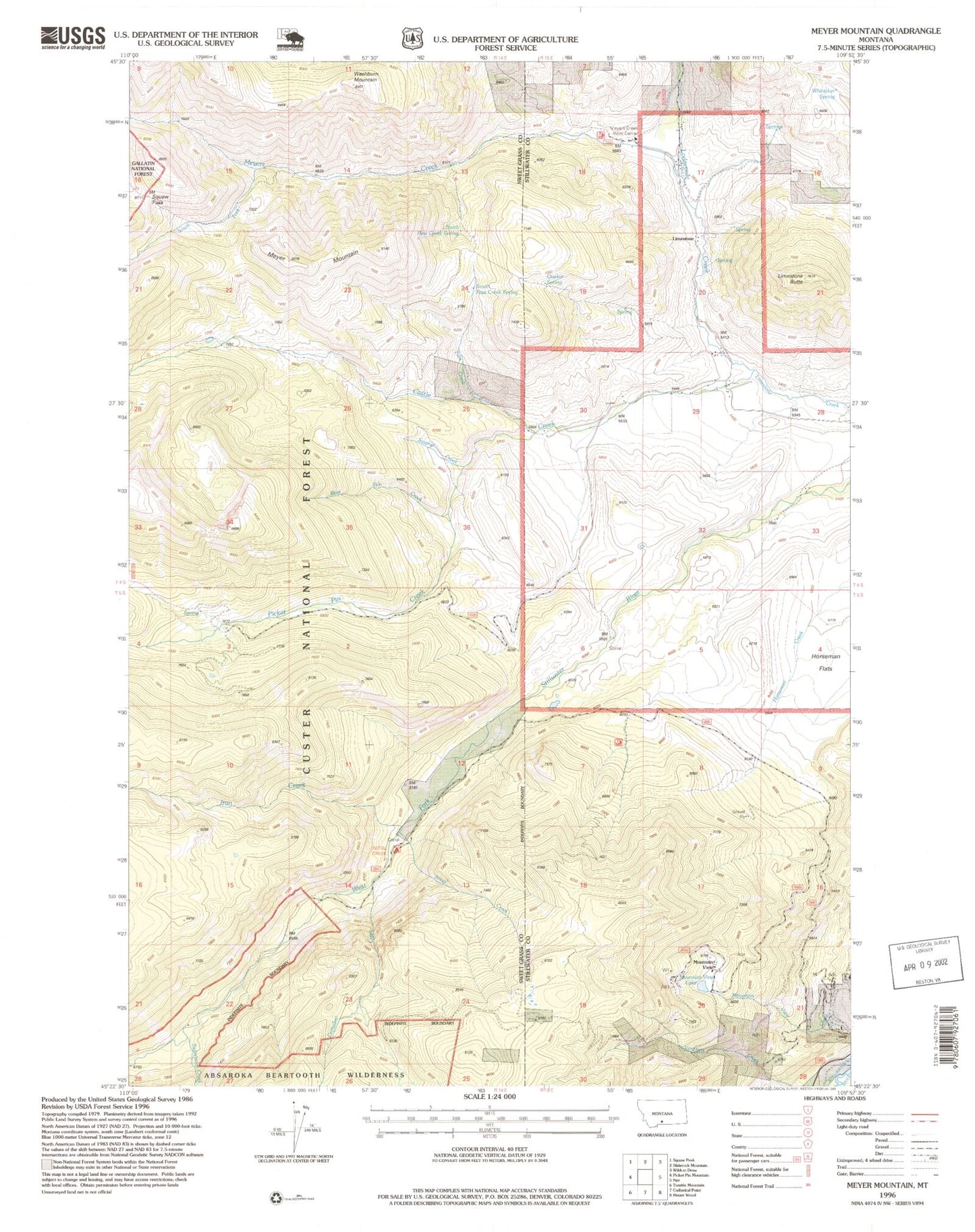
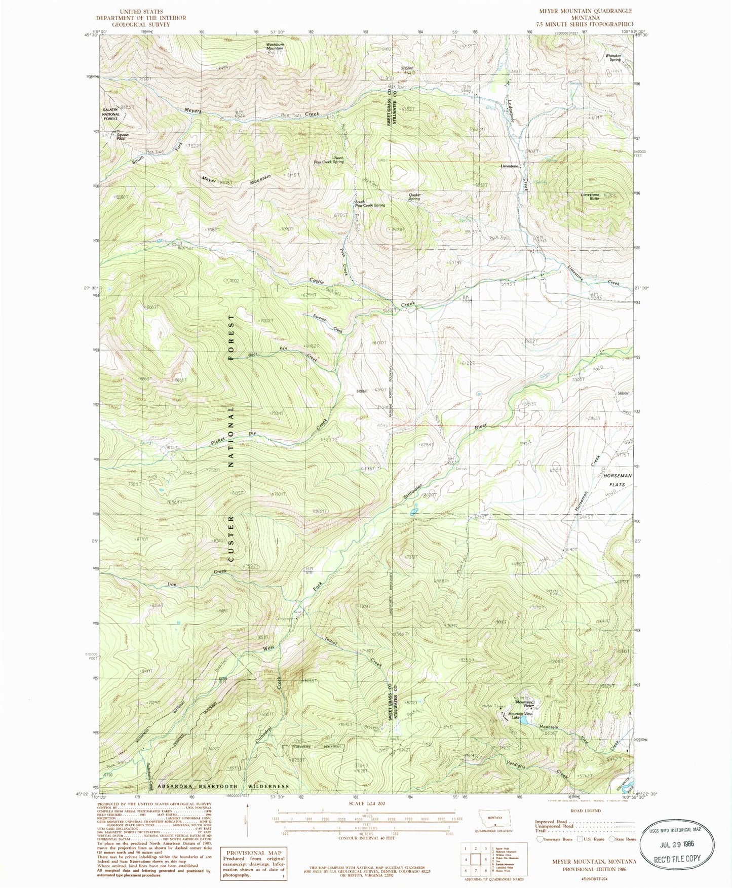
Historical USGS topographic quad map of Meyer Mountain in the state of Montana. Map scale may vary for some years, but is generally around 1:24,000. Print size is approximately 24" x 27"
This quadrangle is in the following counties: Stillwater, Sweet Grass.
The map contains contour lines, roads, rivers, towns, and lakes. Printed on high-quality waterproof paper with UV fade-resistant inks, and shipped rolled.
Contains the following named places: 04S15E20ABBA01 Spring, 04S15E20ABCD01 Spring, 04S15E28AACC01 Spring, 04S15E28ACAD01 Spring, 04S15E28DBAB01 Spring, 04S15E29ACDA01 Well, 04S15E33ABDB01 Spring, 04S15E33BDBB01 Spring, 05S15E08CAAA01 Spring, 05S15E08DBBB01 Spring, 05S15E21AACA01 Well, Bear Pen Creek, Castle Creek, Cathedral Creek, Horseman Flats, Initial Creek, Iron Creek, Limestone, Limestone Butte, Limestone Post Office, Limestone School, Lodgepole Creek, Meyer Creek Work Center, Meyer Mountain, Meyers Creek, Meyers Creek Pass, Mouat Mine, Mount Mine, Mountain View, Mountain View Creek, Mountain View Lake, Moval Mill, North Pass Creek Spring, Pass Creek, Picket Pin Creek, Quaker Spring, Saderbalm Creek, South Fork Meyers Creek, South Pass Creek Spring, Swamp Creek, Verdigris Creek, Washburn Mountain, Whittaker Spring