
MyTopo
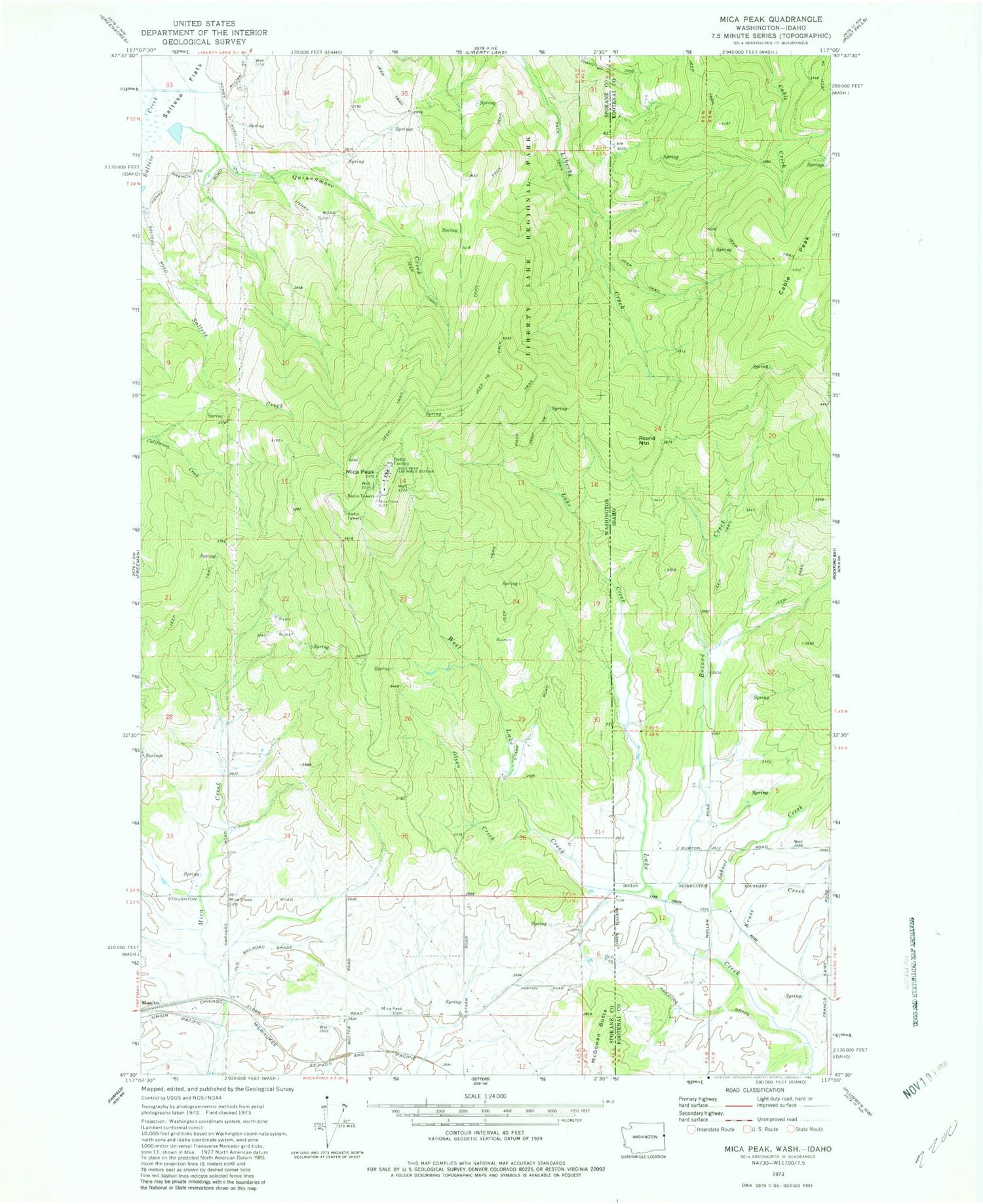
Classic USGS Mica Peak Washington 7.5'x7.5' Topo Map
Couldn't load pickup availability
Historical USGS topographic quad map of Mica Peak in the states of Washington, Idaho. Typical map scale is 1:24,000, but may vary for certain years, if available. Print size: 24" x 27"
This quadrangle is in the following counties: Kootenai, Spokane.
The map contains contour lines, roads, rivers, towns, and lakes. Printed on high-quality waterproof paper with UV fade-resistant inks, and shipped rolled.
Contains the following named places: Liberty Lake Regional Park, Mica Creek Cemetery, Mica Peak, Mica Peak Cemetery, Olson Creek, Quinnamose Creek, Dosser Reservoir Dam, Dosser Reservoir, KKPL-FM (Opportunity), KMBI-FM (Spokane), KPBX-FM (Spokane), KDRK-FM (Spokane), Mica Peak Air Force Station (historical), Bozard Creek, Cable Peak, Kruse Creek, School Creek, West Lake Creek, Round Mountain


