MyTopo
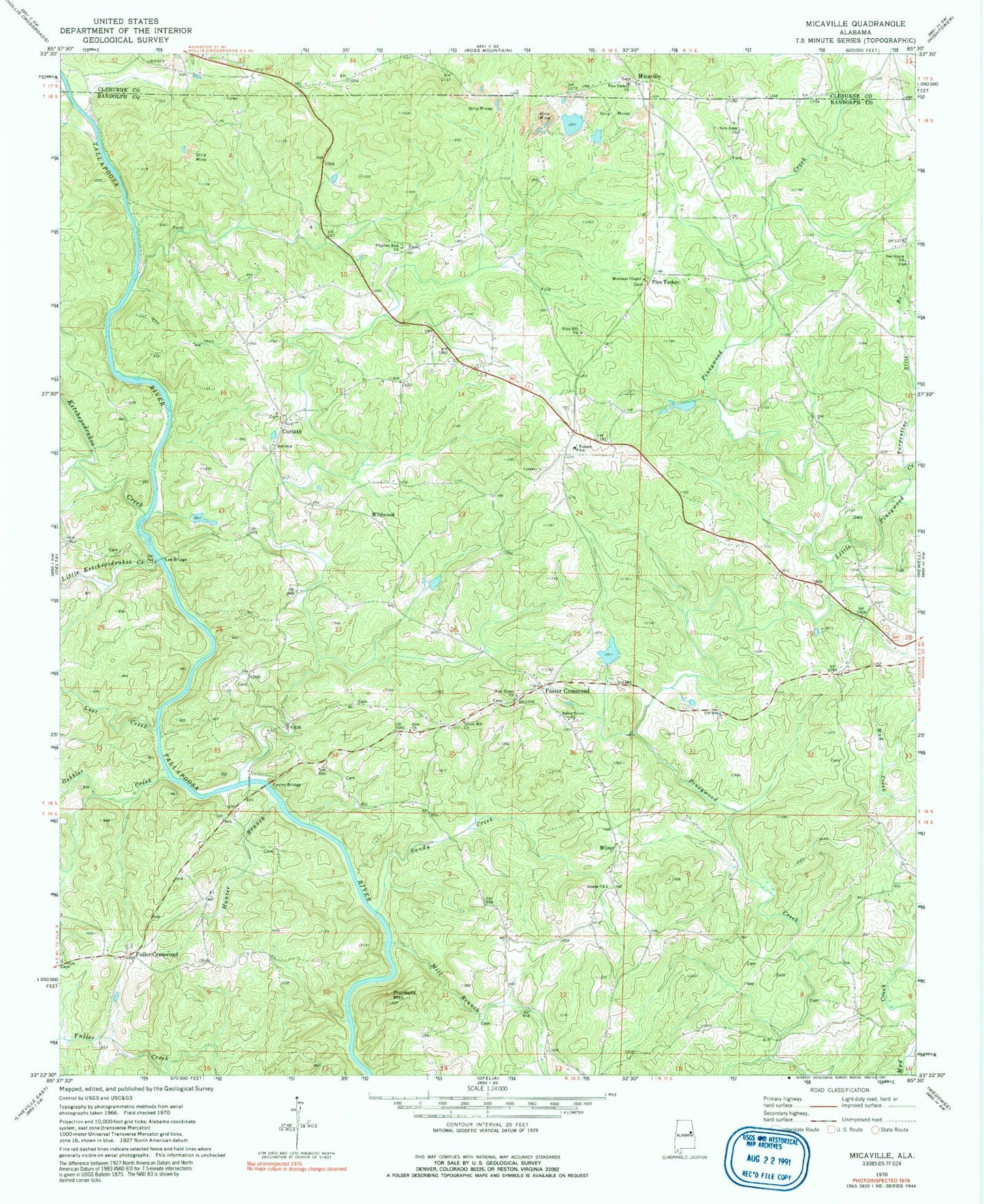
Classic USGS Micaville Alabama 7.5'x7.5' Topo Map
Couldn't load pickup availability
Historical USGS topographic quad map of Micaville in the state of Alabama. Map scale may vary for some years, but is generally around 1:24,000. Print size is approximately 24" x 27"
This quadrangle is in the following counties: Cleburne, Randolph.
The map contains contour lines, roads, rivers, towns, and lakes. Printed on high-quality waterproof paper with UV fade-resistant inks, and shipped rolled.
Contains the following named places: Alexandria Mine, Arnold Prospect, Arnott Mine, Bagley Mine, Boyd Dam, Boyd Lake, Brady Lake, Brady Lake Dam, Buckhannon Creek, Campbell Mine, Cedron, Consolidated Number Five Mine, Consolidated Number Four Mine, Consolidated Number One Mine, Consolidated Number Ten Mine, Consolidated Number Three Mine, Corinth, Corinth Cemetery, Corinth Church, Crews Mine, Crystal Clear Mine, Flint Hill Church, Folsom, Folsom Division, Folsom Elementary School, Foote Prospect, Foster Bridge, Foster Crossroad, Foster Ford, Foster Mine, Fosters Crossroads Volunteer Fire Department, Fowler Cemetery, Friendshiip Number One Mine, Friendship Number Two Mine, Fuller Crossroad, Gobbler Creek, Gray Dam, Grays Lake, Great Southern Number Four Mine, Great Southern Number One Mine, Great Southern Number Three Mine, Great Southern Number Two Mine, Haynes Number One Mine, Haynes Number Two Mine, Heaven Bound Church, Holmes Prospect, Hunter Branch, Iduma Congregational Methodist Church, Jack Rice Mine, Jones Number One Mine, Jones Prospect, Jordan Mine, Ketchepedrakee Creek, Kitchen Prospect, Knopf Prospects, Lee Bridge, Liberty Mine, Little Ketchepedrakee Creek, Little Pineywood Creek, Lost Creek, McAdoo Mine, Micaville, Micaville Church, Micaville Volunteer Fire Department, Mill Branch, Miller Mines, Milner, Morrison Chapel, Morrison Mine, New Area Church, New Home Church, New Number One Mine, New Number Two Mine, Nixon Ford, Oak Grove Church, Old Anicent Mine, Owen Ford, Pilgrims Rest Church, Pine Tuckey, Pine Tuckey Church, Pinetucky Mine, Pinetucky Number One Mine, Pineywoods Church, Plunkett Mountain, Rice Mill, Sandy Creek, Schefner Mine, Silver Leaf Prospect, Spring Hill Number One Mine, Spring Hill Number Three Mine, Spring Hill Number Two Mine, Stone Hill, Tennant Prospect, Turpentine Still Branch, Union Hill Church, Valley Grove Church, Valley Grove Primitive Baptist Church Cemetery, Vickers Number Four Mine, Vickers Number One Mine, Wallace Number One Mine, Wallace Number Two Mine, Weeks Mine, Wesley Chapel Church, Whitehead Prospects, Wildwood, York Prospect, Zeesman Pit, Zion Church