MyTopo
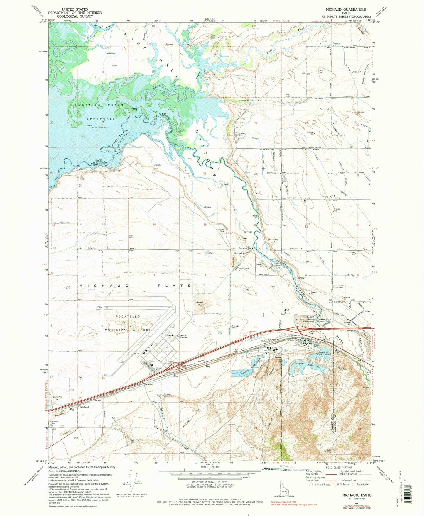
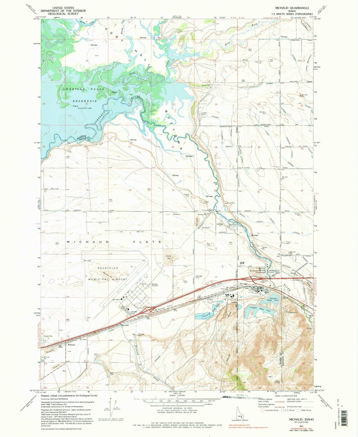
Classic USGS Michaud Idaho 7.5'x7.5' Topo Map
Couldn't load pickup availability
Historical USGS topographic quad map of Michaud in the state of Idaho. Map scale may vary for some years, but is generally around 1:24,000. Print size is approximately 24" x 27"
This quadrangle is in the following counties: Bannock, Power.
The map contains contour lines, roads, rivers, towns, and lakes. Printed on high-quality waterproof paper with UV fade-resistant inks, and shipped rolled.
Contains the following named places: Arbon Valley Census Designated Place, Batiste Springs, Church Lateral, Clear Creek, Don, Havenor Lateral, Havenor Siphon, Hayes Lateral, Hooker Lateral, Indian Cemetery, Kinney Creek, KRCD-AM (Chubbuck), Martin Lateral, Michaud, Michaud Creek, Michaud Flats, Pocatello Army Air Field, Pocatello Fire Department Station 4, Pocatello Regional Airport, Ross Fork, Spraker Lateral, Taghee Canal, Tyhee Lateral