MyTopo
Classic USGS Michie Tennessee 7.5'x7.5' Topo Map
Couldn't load pickup availability
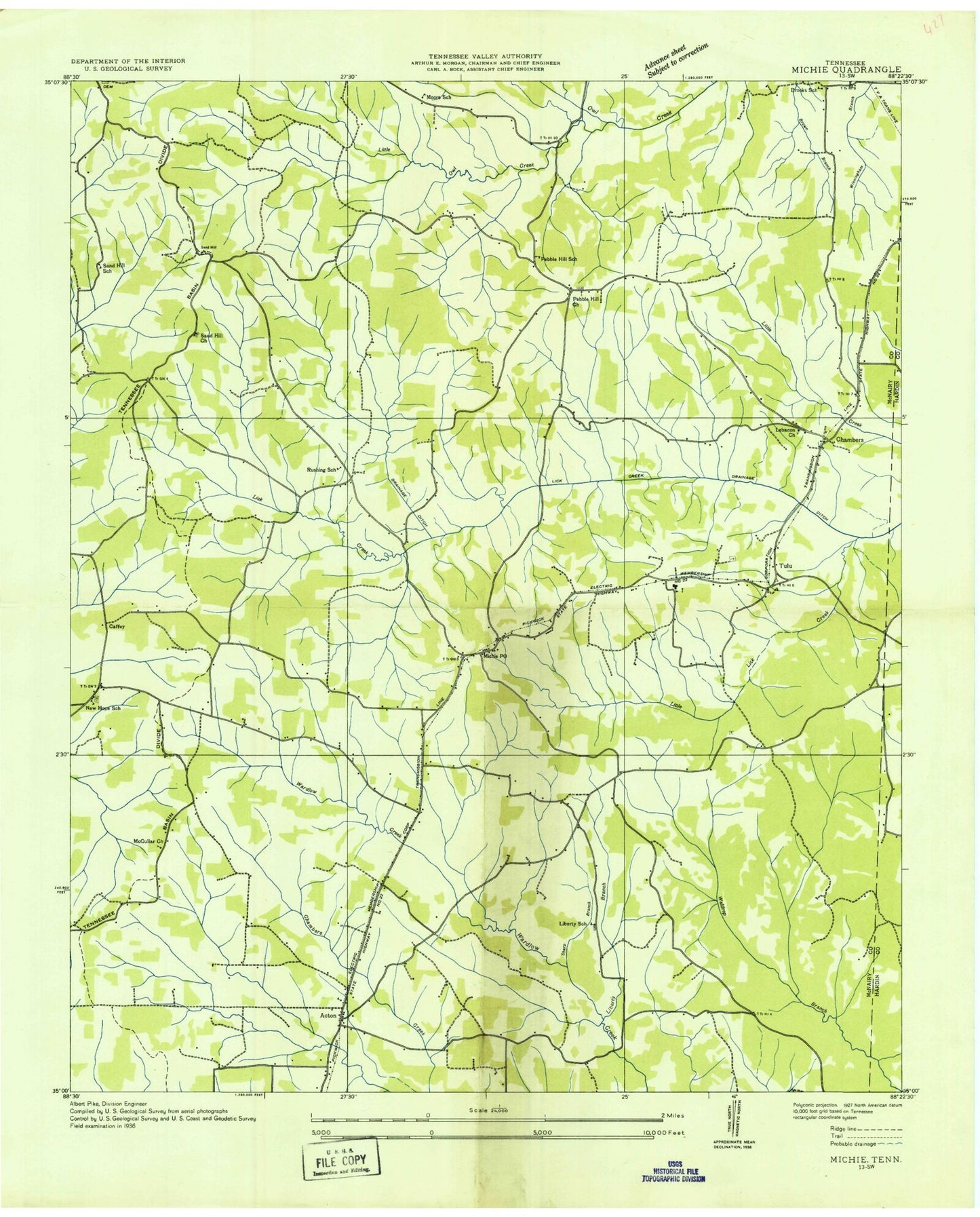
Historical USGS topographic quad map of Michie in the state of Tennessee. Map scale may vary for some years, but is generally around 1:24,000. Print size is approximately 24" x 27"
This quadrangle is in the following counties: Hardin, McNairy.
The map contains contour lines, roads, rivers, towns, and lakes. Printed on high-quality waterproof paper with UV fade-resistant inks, and shipped rolled.
Contains the following named places: Acton, Acton Church of Christ, Atkins Mill, Brooks School, Caffey, Carter Cemetery, Chambers, Chambers Cemetery, Church of God of Prophecy, Commissioner District 7, Donald Springs, Donald Springs Branch, Lebanon Cemetery, Lebanon Church, Liberty, Liberty Branch, Liberty Cemetery, Liberty Church, Liberty School, Little Lick Creek, Little Owl Creek, McCullar Church, Michie, Michie Division, Michie Elementary School, Michie First Baptist Church, Michie Post Office, Michie Volunteer Fire and Rescue Department, Moore School, Mount Olive Cemetery, Mount Olivet Church, Needmore, New Hope, New Hope Cemetery, New Hope Church, New Hope School, Pebble Hill, Pebble Hill Cemetery, Pebble Hill Church, Pebble Hill School, Rushing School, Sand Hill Cemetery, Sand Hill Church, Sand Hill School, Sanders Cemetery, Sharp Branch, Singleton Creek, Spring Branch, Town of Michie, Tulu, Wyatt Branch, ZIP Code: 38357