MyTopo
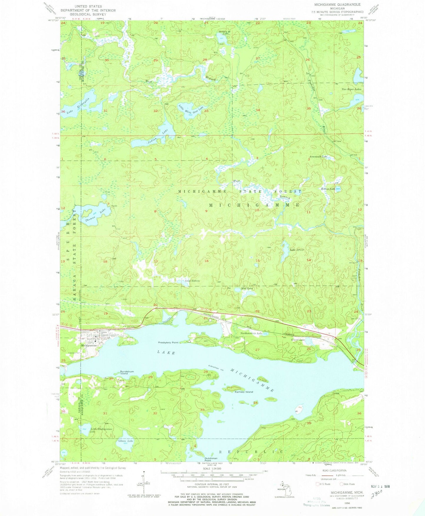
Classic USGS Michigamme Michigan 7.5'x7.5' Topo Map
Couldn't load pickup availability
Historical USGS topographic quad map of Michigamme in the state of Michigan. Typical map scale is 1:24,000, but may vary for certain years, if available. Print size: 24" x 27"
This quadrangle is in the following counties: Baraga, Marquette.
The map contains contour lines, roads, rivers, towns, and lakes. Printed on high-quality waterproof paper with UV fade-resistant inks, and shipped rolled.
Contains the following named places: Arsenault Lake, Lake Arvid, Dutchman Point, Gibson Lake, Gravel Lake, Hilltop Lake, Indian Lake, Lake Keewaydin, Lakeview Cemetery, Little Michigamme Lake, Little White Goat Lake, Michigamme, Lake Michigamme, Mud Lake, Northwestern Lake, Peshekee River, Presbytery Point, Ramsay Island, Section Twenty-eight Lake, Lake Sixteen, Sundstrum Island, Thomas Lake, West Branch Peshekee River, Dee Lundeen Falls, Church in the Wildwood, Michigamme - Spurr Township Volunteer Fire Department, Michigamme Historical Museum, Michigamme Post Office, Michigamme Station, Michigamme Shores Campground, Sam Cohodas Lodge Historical Marker, Sam Cohodas Historical Marker, Michigamme Census Designated Place