MyTopo
Classic USGS Mid Hills California 7.5'x7.5' Topo Map
Regular price
$16.95
Regular price
Sale price
$16.95
Unit price
per
Couldn't load pickup availability
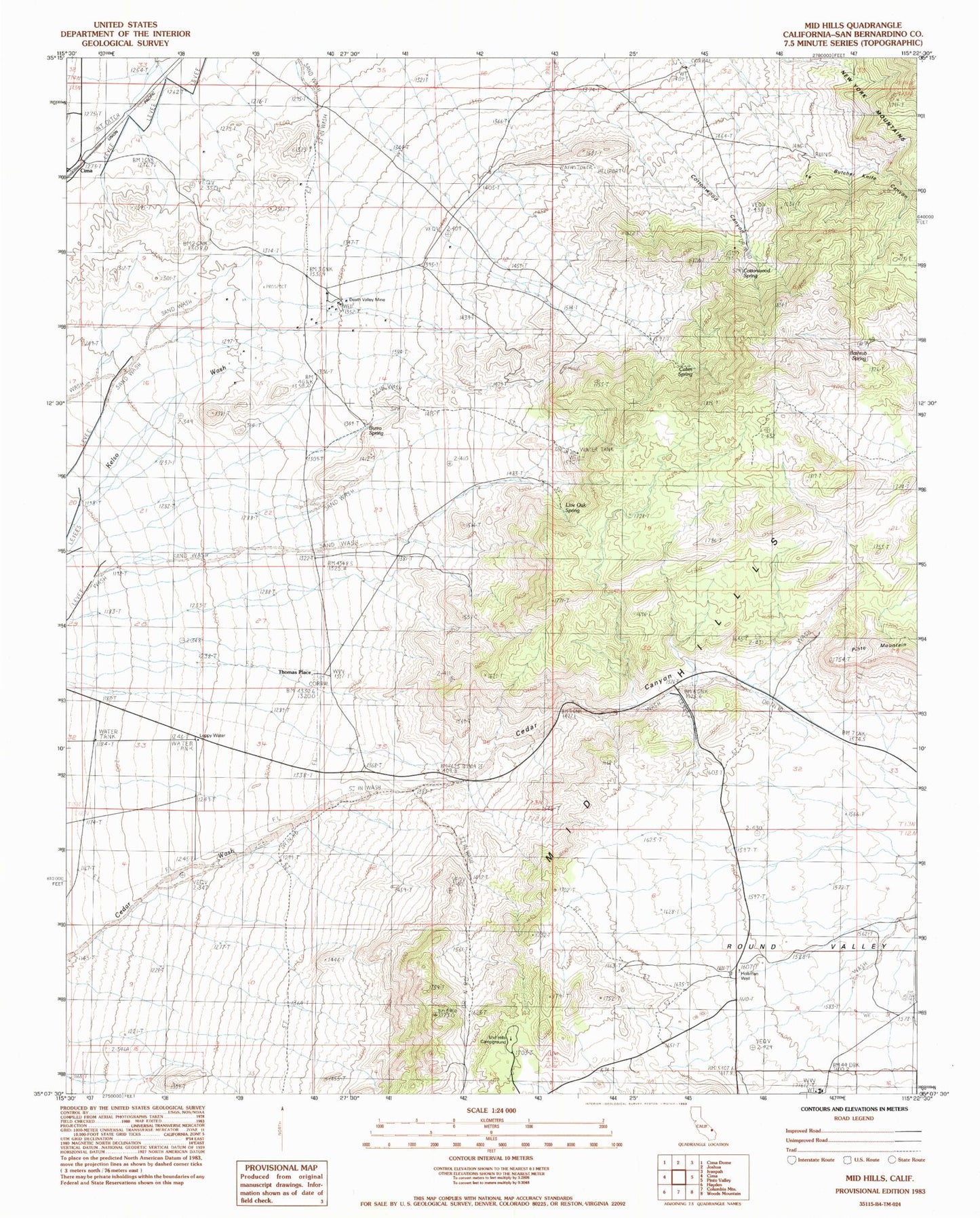
Historical USGS topographic quad map of Mid Hills in the state of California. Map scale may vary for some years, but is generally around 1:24,000. Print size is approximately 24" x 27"
This quadrangle is in the following counties: San Bernardino.
The map contains contour lines, roads, rivers, towns, and lakes. Printed on high-quality waterproof paper with UV fade-resistant inks, and shipped rolled.
Contains the following named places: Bathtub Spring, Burro Spring, Butcher Knife Canyon, Cabin Spring, Cedar Canyon, Cima, Cottonwood Canyon, Cottonwood Spring, Death Valley Mine, Holliman Well, Leppy Water Tank, Live Oak Spring, Mid Hills, Mid Hills Campground, Thomas Place