MyTopo
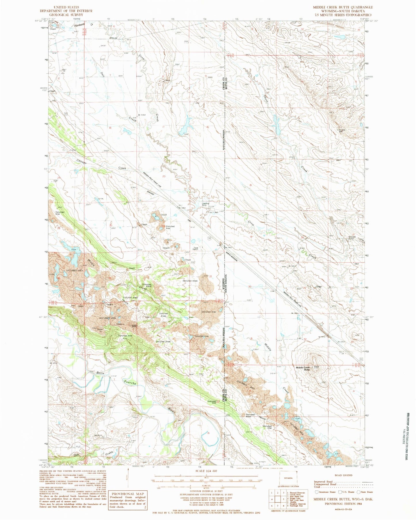
Classic USGS Middle Creek Butte South Dakota 7.5'x7.5' Topo Map
Couldn't load pickup availability
Historical USGS topographic quad map of Middle Creek Butte in the states of South Dakota, Wyoming. Map scale may vary for some years, but is generally around 1:24,000. Print size is approximately 24" x 27"
This quadrangle is in the following counties: Butte, Crook.
The map contains contour lines, roads, rivers, towns, and lakes. Printed on high-quality waterproof paper with UV fade-resistant inks, and shipped rolled.
Contains the following named places: Belle Fourche River Number Three Mine, Chicago Creek, Daly Creek, Dennis Dam, Dennis Reservoir, Ghost Creek, Havens Dam, Havens Reservoir, Humboldt Creek, McLeod Ranch, Middle Creek Butte, Middle Creek Number One Mine, Middle Creek Number Two Mine, Oak Creek, Oak Creek Reservoir, Tope Ranch, VVV Ranch