MyTopo
Classic USGS Middlebury Indiana 7.5'x7.5' Topo Map
Couldn't load pickup availability
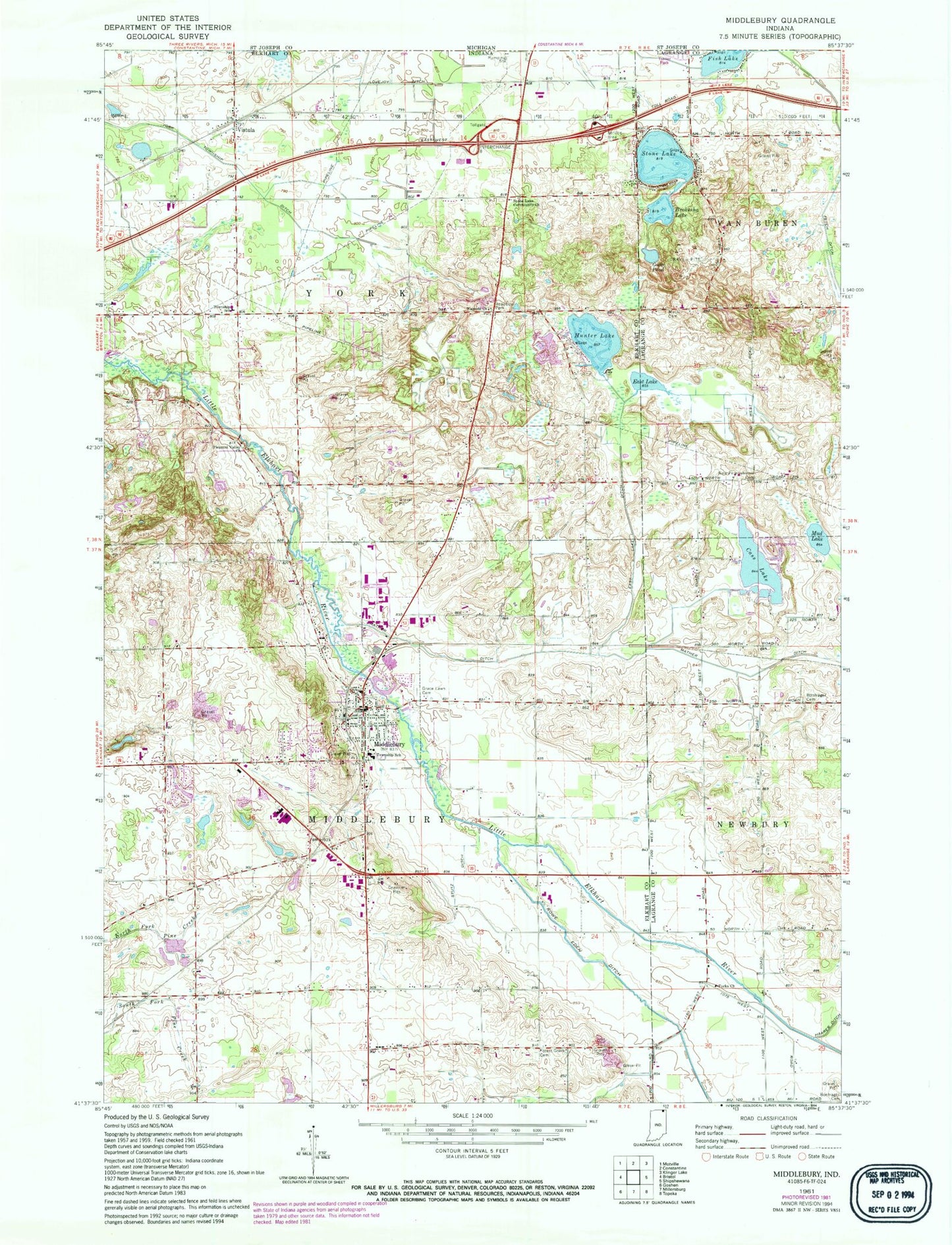
Historical USGS topographic quad map of Middlebury in the state of Indiana. Map scale may vary for some years, but is generally around 1:24,000. Print size is approximately 24" x 27"
This quadrangle is in the following counties: Elkhart, LaGrange.
The map contains contour lines, roads, rivers, towns, and lakes. Printed on high-quality waterproof paper with UV fade-resistant inks, and shipped rolled.
Contains the following named places: Bontrager Cemetery, Bontrager North Cemetery, Brokesha Lake, Cass Lake, Crystal Bend Farm, Crystal Valley Dairy Farm, Culver Duck Farms, Dogwood Hills Tree Farm, East Lake, East Lake Ditch, Faith Baptist Church, First Mennonite Church, First United Methodist Church of Middlebury, Forest Grove Cemetery, Forest Grove Dairy, Goose Pond, Grace Lawn Cemetery, Griner Mennonite Church, Heritage Intermediate School, Hunter Lake, Mack Cemetery, Mather Ditch, Mather Lateral, Mid River Farms, Middlebury, Middlebury Church of the Brethren, Middlebury Community Public Library, Middlebury Elementary School, Middlebury Police Department, Middlebury Post Office, Middlebury Township Fire and EMS Department, Mud Lake, My Brook Farm, New Pennsylvania Cemetery, Northridge High School, Pleasant Valley Church of the Brethren, Raber Farms, Roselawn Conservative Mennonite Church, Smeltzer Farms, Stone Lake, Stone Lake Community Church, Stoney - M Farm, Stutz Ditch, Sunny Brook Farms, Town of Middlebury, Township of Middlebury, Township of York, Vistula, Wayside Church, Yoder Farm, ZIP Code: 46540