MyTopo
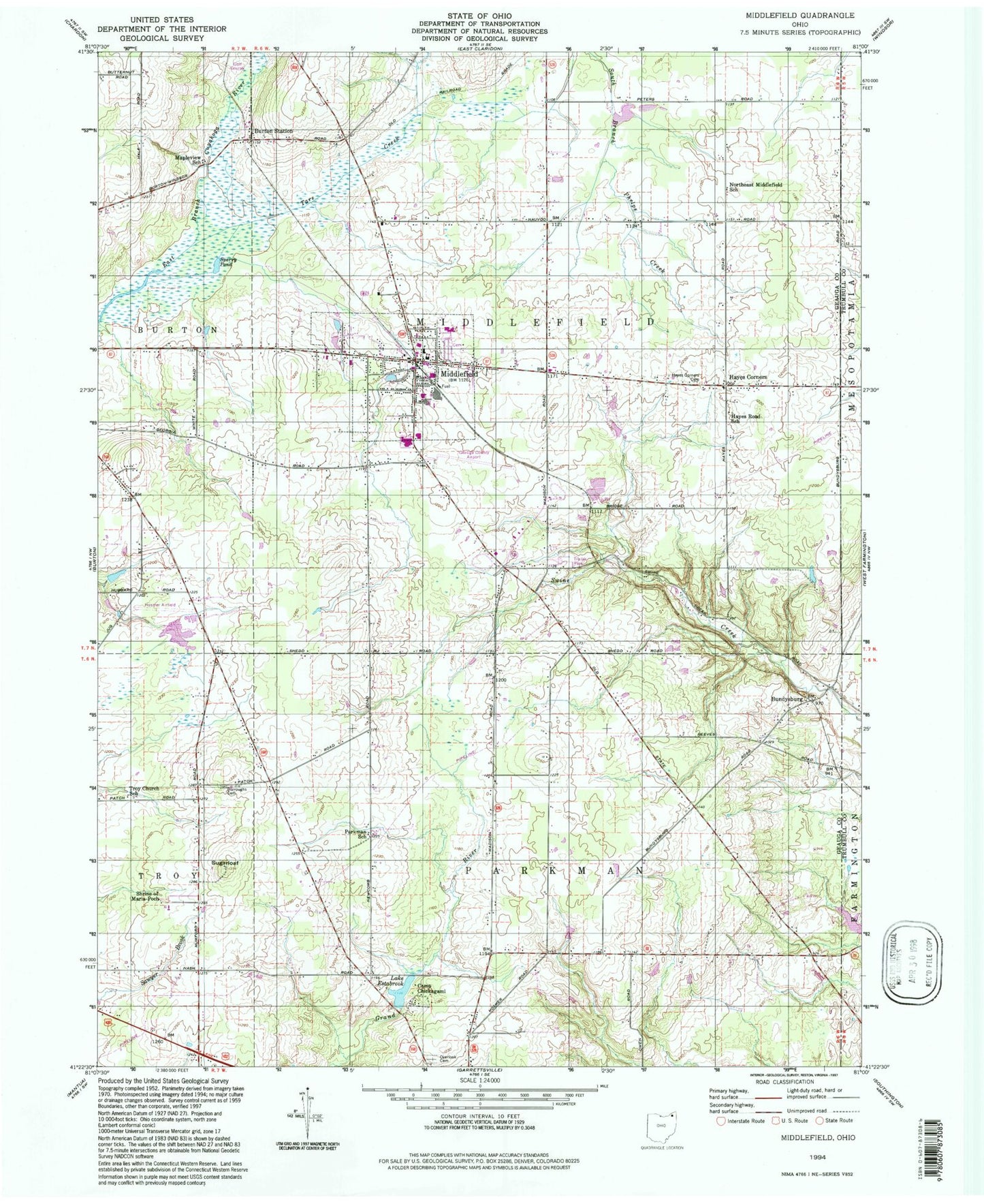
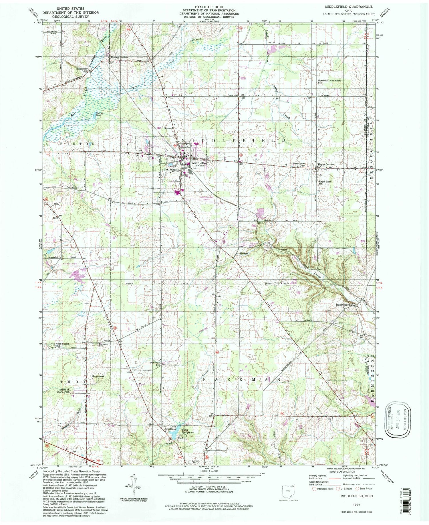
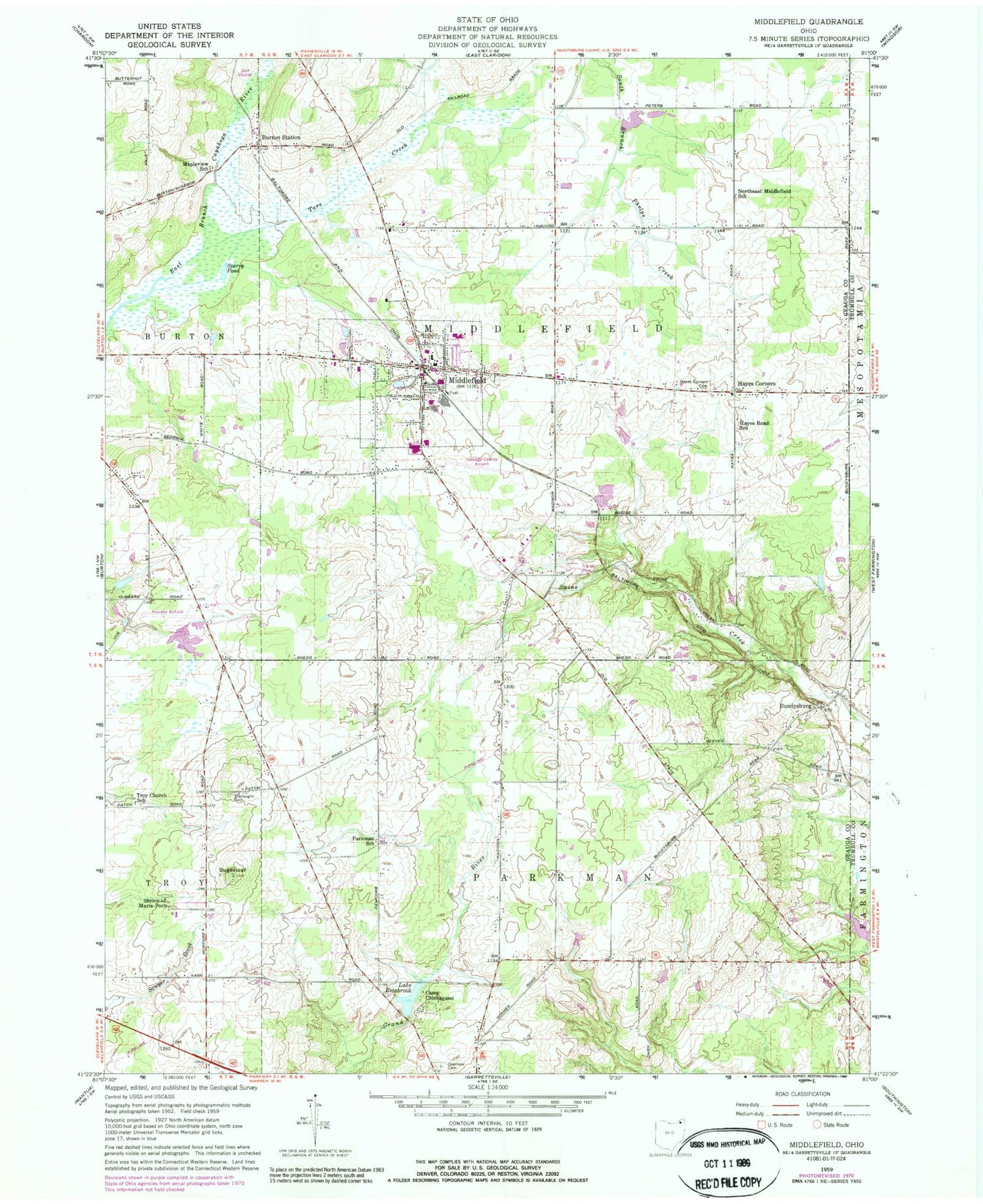
Classic USGS Middlefield Ohio 7.5'x7.5' Topo Map
Couldn't load pickup availability
Historical USGS topographic quad map of Middlefield in the state of Ohio. Typical map scale is 1:24,000, but may vary for certain years, if available. Print size: 24" x 27"
This quadrangle is in the following counties: Geauga, Trumbull.
The map contains contour lines, roads, rivers, towns, and lakes. Printed on high-quality waterproof paper with UV fade-resistant inks, and shipped rolled.
Contains the following named places: Burroughs Cemetery, Camp Chickagami, Lake Estabrook, Hayes Corners Cemetery, Hayes Road School, Mapleview School, Northeast Middlefield School, Overlook Cemetery, Parkman School, Troy Church School, Hayes Corners, Burton Station, Cardinal High School, Cardinal Middle School, A J Jordak Elementary School, Sperry Pond, Bundysburg, Middlefield, Maple Grove, Sugarloaf, Tare Creek, Hosmer Airfield (historical), Larry Peairs Memorial Lake Dam, Larry Peairs Memorial Lake, Shrine of Maria-Poch, Airwolf Heliport, Geauga County Airport, Harrington Square Heliport, Pauls Airport (historical), Township of Middlefield, Township of Parkman, Middlefield Center Cemetery, Yoder Cemetery, Bundysburg Post Office (historical), Burton Station Post Office (historical), Welshfield Post Office (historical), Middlefield Post Office, Middlefield Post Office, Village of Middlefield, Berkshire Industrial Park, Burton Industrial Park, Bonner Industrial Park, Geauga Industrial Park, Zaylor Farm, Moss Farm, Middlefield Fire Department Station 1, Cornerstone Bible Church, John's Country Nursery, Middlefield Police Department, Wilkum Creek