MyTopo
Classic USGS Middletown California 7.5'x7.5' Topo Map
Couldn't load pickup availability
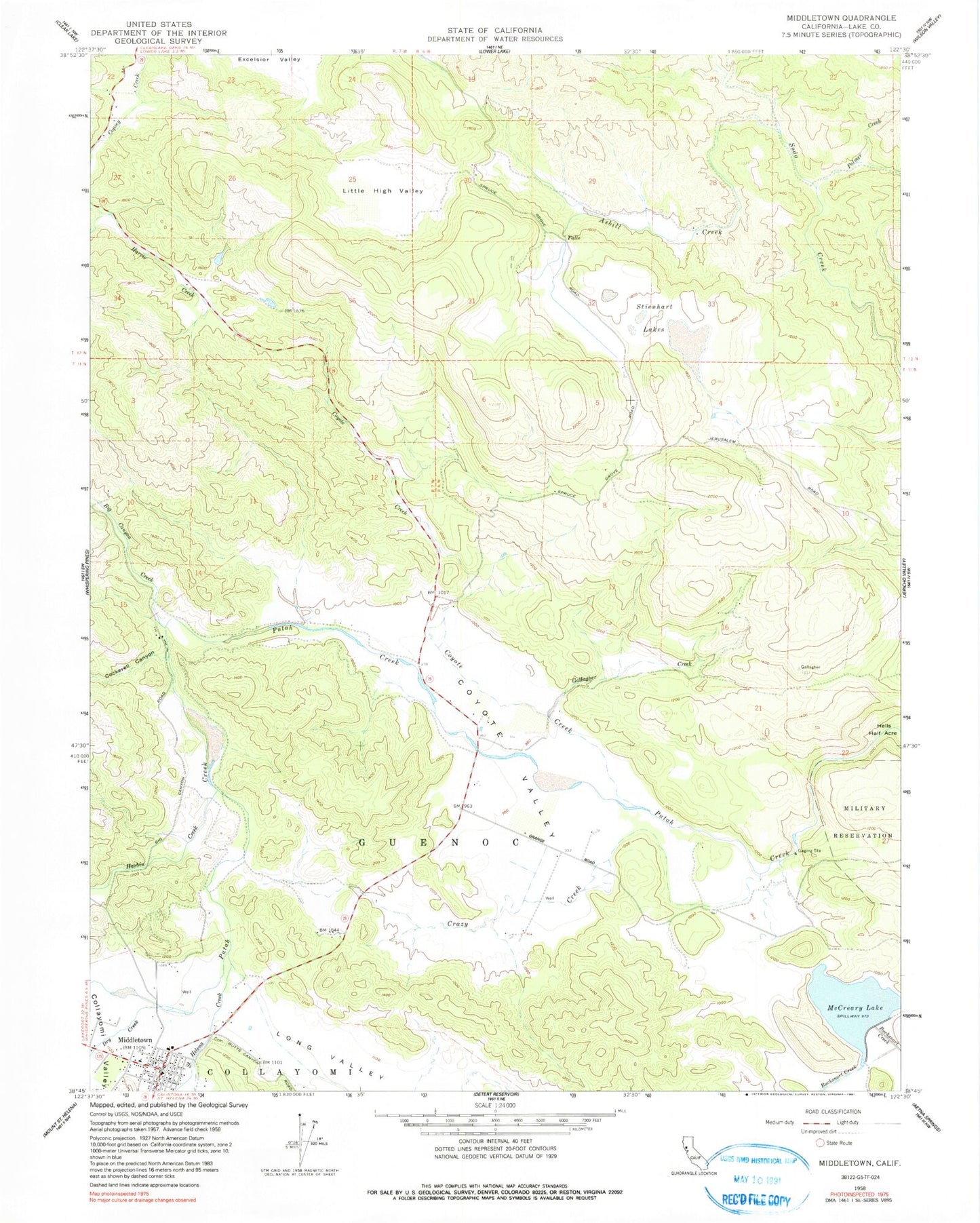
Historical USGS topographic quad map of Middletown in the state of California. Map scale may vary for some years, but is generally around 1:24,000. Print size is approximately 24" x 27"
This quadrangle is in the following counties: Lake.
The map contains contour lines, roads, rivers, towns, and lakes. Printed on high-quality waterproof paper with UV fade-resistant inks, and shipped rolled.
Contains the following named places: Asbill Creek, Big Canyon Creek, Channing Rudd Cellars, Cockerell Canyon, Collayomi, Coyote Creek, Coyote Creek 397 Dam, Coyote Valley, Coyote Valley Elementary School, Crazy Creek, Department of Forestry and Fire Protection South Lake County Fire Protection District Station 63, Dry Creek, Gallagher Creek, Guenoc, Harbin Creek, Hidden Valley Lake, Hidden Valley Lake Census Designated Place, Hidden Valley Lake Golf Course, Lake Burgundy, Lake County Sheriff's Department Substation, Little High Valley, Loconoma Valley Continuation High School, Lower Lake-Middletown Division, McCreary 392-002 Dam, McCreary Lake, Middletown, Middletown Branch Lake County Library, Middletown Cemetery, Middletown Census Designated Place, Middletown Community Day School, Middletown Division, Middletown Elem Community Day School, Middletown High School, Middletown Middle School, Middletown Post Office, Minnie Cannon Elementary School, Palmer Creek, Saint Helena Creek, South Lake County Fire Protection District Station 60, Stienhart Lakes, ZIP Codes: 95461, 95467