MyTopo
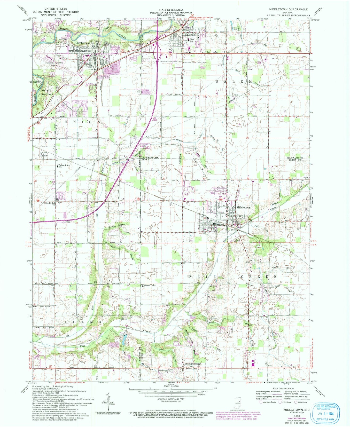
Classic USGS Middletown Indiana 7.5'x7.5' Topo Map
Couldn't load pickup availability
Historical USGS topographic quad map of Middletown in the state of Indiana. Map scale may vary for some years, but is generally around 1:24,000. Print size is approximately 24" x 27"
This quadrangle is in the following counties: Delaware, Henry, Madison.
The map contains contour lines, roads, rivers, towns, and lakes. Printed on high-quality waterproof paper with UV fade-resistant inks, and shipped rolled.
Contains the following named places: Allen-Bethel Church, Anderson Municipal Airport-Darlington Field, Brandon Ditch, Bronnenberg Cemetery, Bronnenberg Ditch, Burk Personal Use Airport, Candy Brook, Capp Tucker Cemetery, Chesterfield, Chesterfield - Union Township Fire Department, Chesterfield Branch, Chesterfield Pit, Chesterfield Police Department, Chesterfield Post Office, Clem Cemetery, Cooper Ditch, County Brook, Daleville, Daleville Elementary School, Daleville High School, Daleville Police Department, Deer Creek, Fair Brook, Fattic Cemetery, Honey Creek, Keesling Cemetery, Keesling Run, Little Creek, Mechanicsburg, Mechanicsburg Cemetery, Mechanicsburg Drain, Middletown, Middletown Drain, Middletown Elementary School, Middletown Fire Department and Emergency Medical Service, Middletown Police Department, Middletown Post Office, Mounds State Park, Mud Creek, Painter Cemetery, Painter Run, PHI Dove Flight Air Medical Transport, Pleasant Valley Church, Road Run, Roc Mar Ton Lake, Roc Mar Ton Lake Dam, Salem Township Fire Department, Saunders Cemetery, Shallow Run, Shoemaker Ditch, Short Run, Sly Fork, Small Branch, Sugar Creek, Sweet Brook, Town of Chesterfield, Town of Daleville, Town of Middletown, Township of Fall Creek, Township of Salem, Township of Union, Turkey Creek, Valley Branch, Valley Grove Elementary School, ZIP Codes: 46017, 47334, 47356