MyTopo
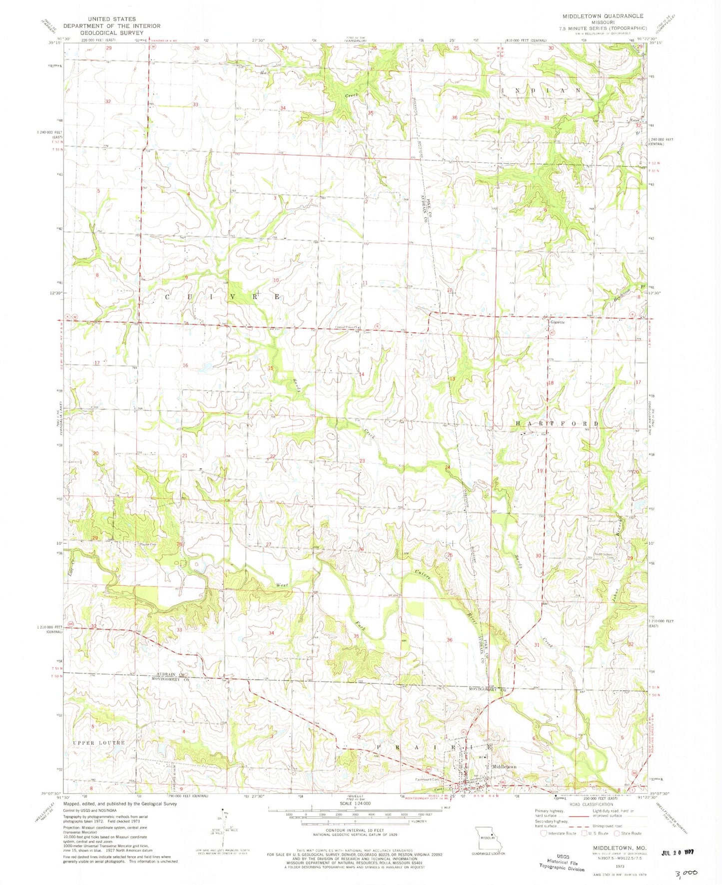
Classic USGS Middletown Missouri 7.5'x7.5' Topo Map
Couldn't load pickup availability
Historical USGS topographic quad map of Middletown in the state of Missouri. Map scale may vary for some years, but is generally around 1:24,000. Print size is approximately 24" x 27"
This quadrangle is in the following counties: Audrain, Montgomery, Pike.
The map contains contour lines, roads, rivers, towns, and lakes. Printed on high-quality waterproof paper with UV fade-resistant inks, and shipped rolled.
Contains the following named places: Allison Lake Dam, Barber Lake Dam, Bruce Crysdale Dam, Camerer Dam, Camerer Lake, Central Union Church, Clithero Lake, Clithero Lake Dam, Crow School, Culwell School, Drysdale Lake, Ehrlick Dam South, Ehrlick Lake, Ehrlick Lake Dam, Estes, Estes School, Fairmount Cemetery, Gazette, Hall School, Heim Lake Dam, Johns Branch, Lost Creek, Middletown, Middletown Fire Protection District, Middletown Post Office, Mount Carmel, Mount Carmel Post Office, Payne Cemetery, Ray Lake Dam, Rudd School, Rudd School Cemetery, Sandy Creek, Town of Middletown, Trower School, Wendell L Heim Lake, Wendells Lake, Wendells Lake Dam, Whiteside School