MyTopo
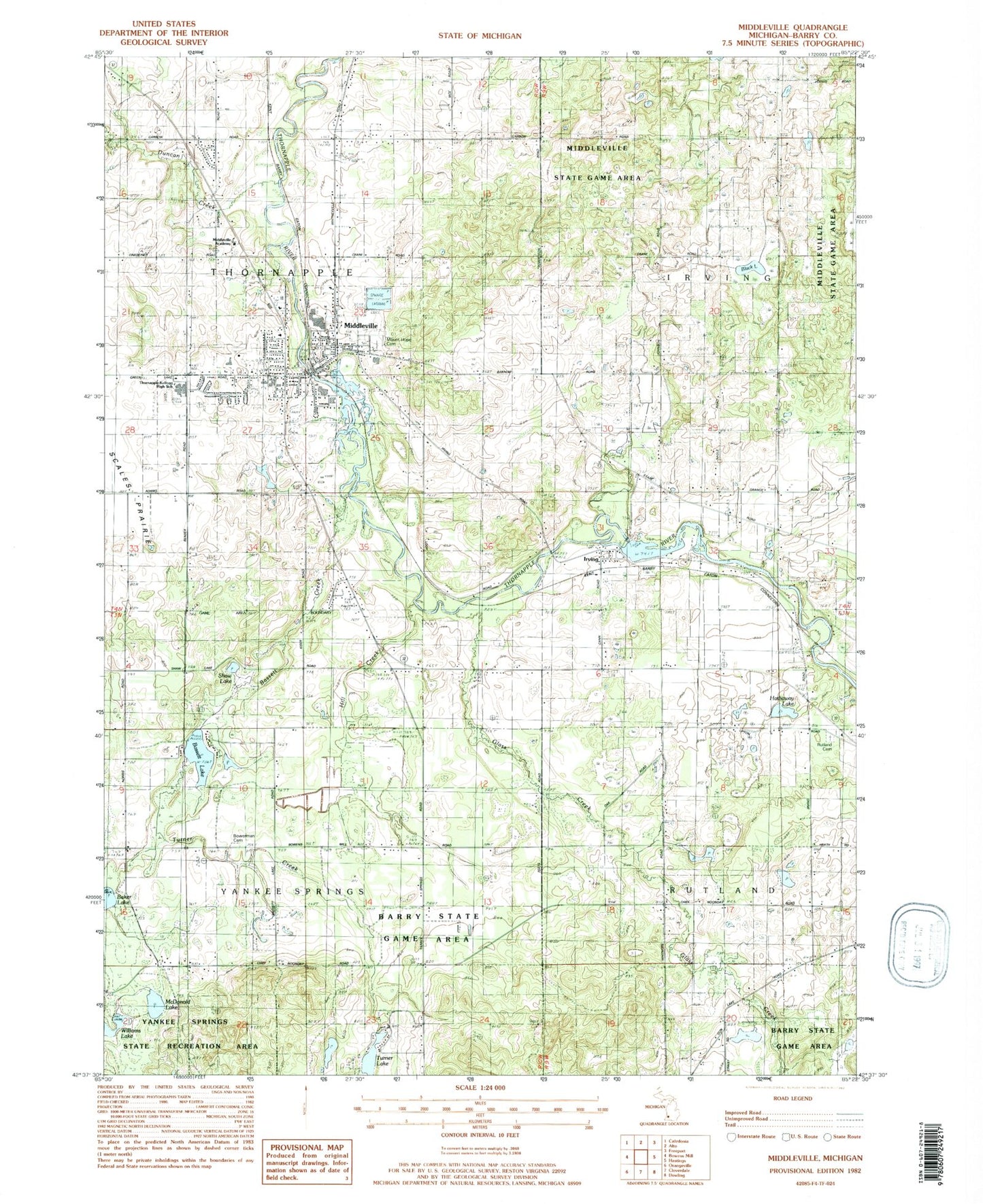
Classic USGS Middleville Michigan 7.5'x7.5' Topo Map
Couldn't load pickup availability
Historical USGS topographic quad map of Middleville in the state of Michigan. Typical map scale is 1:24,000, but may vary for certain years, if available. Print size: 24" x 27"
This quadrangle is in the following counties: Barry.
The map contains contour lines, roads, rivers, towns, and lakes. Printed on high-quality waterproof paper with UV fade-resistant inks, and shipped rolled.
Contains the following named places: Bassett Creek, Bassett Lake, Black Lake, Bowerman Cemetery, Duncan Creek, Glass Creek, Hathaway Lake, Hill Creek, Irving, McDonald Lake, Middleville, Rutland Cemetery, Shaw Lake, Turner Creek, Turner Lake, Williams Lake, Township of Thornapple, Township of Yankee Springs, Mount Hope Cemetery, Thornapple-Kellogg High School, Middleville Academy, Village of Middleville, John Carveth House Historical Marker, Scale's Prairie Historical Marker, Mount Hope Cemetery, Hill Cemetery, Irving Post Office (historical), Irving Station (historical), Whispering Waters Campground, Middleville Wesleyan Church, Cornerstone Wesleyan Church, First Baptist Church, Most Holy Rosary Church, United Methodist Church, Middleville Christian Reformed Church, Good Shepherd Lutheran Church, Middleville Station (historical), Middleville Village Hall, Middleville Post Office, Thornapple Kellogg Middle School, Page Elementary School, McFall Elementary School, Lee Elementary School, Cherry Valley Family Physicians, Sharp Park Campground, Thornapple Township Fire and Emergency Services, Michigan Department of Natural Resources Yankee Springs Field Office, Barry County Sheriff's Office Middleville Unit, Barry County Waterfowl Production Area