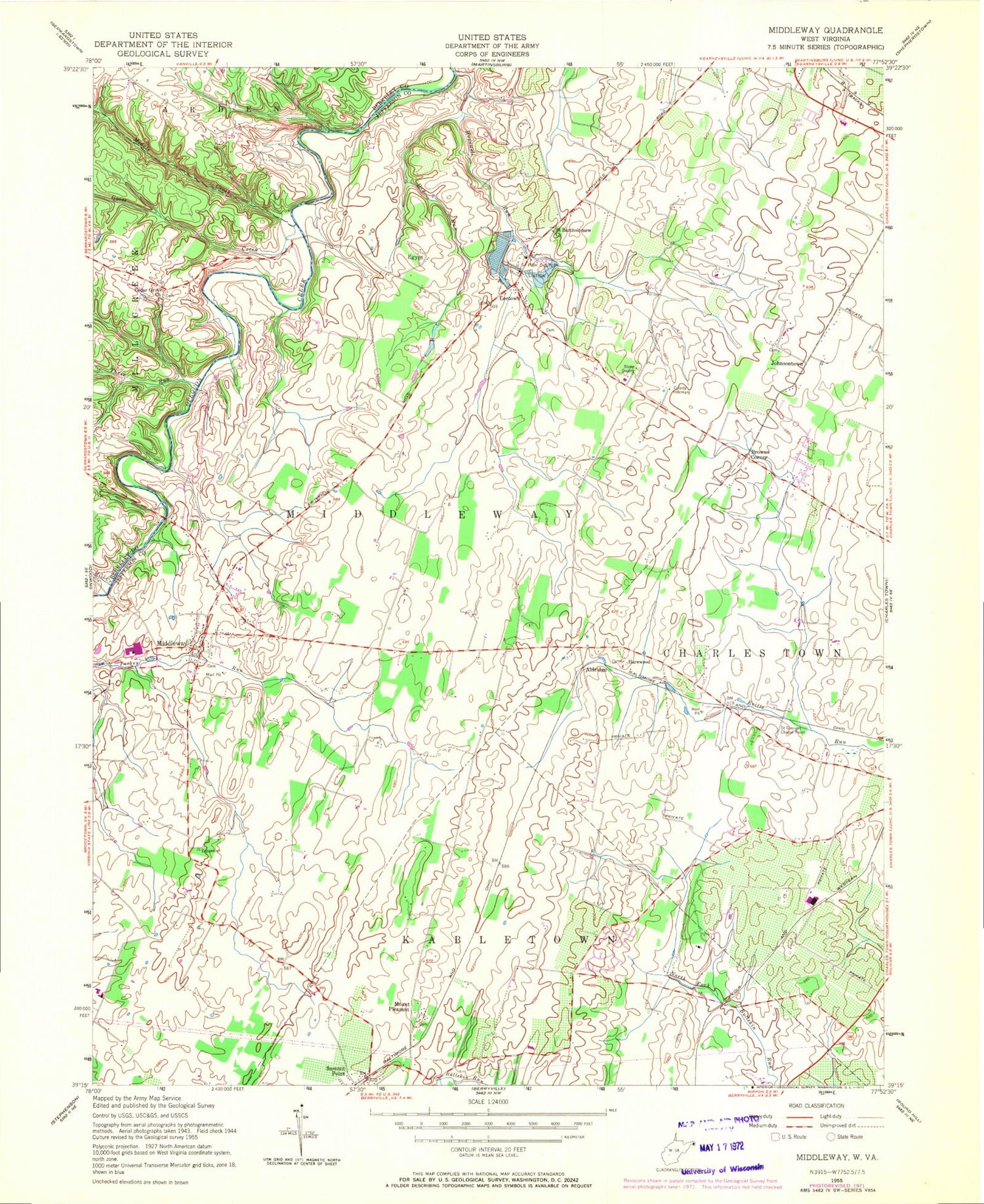
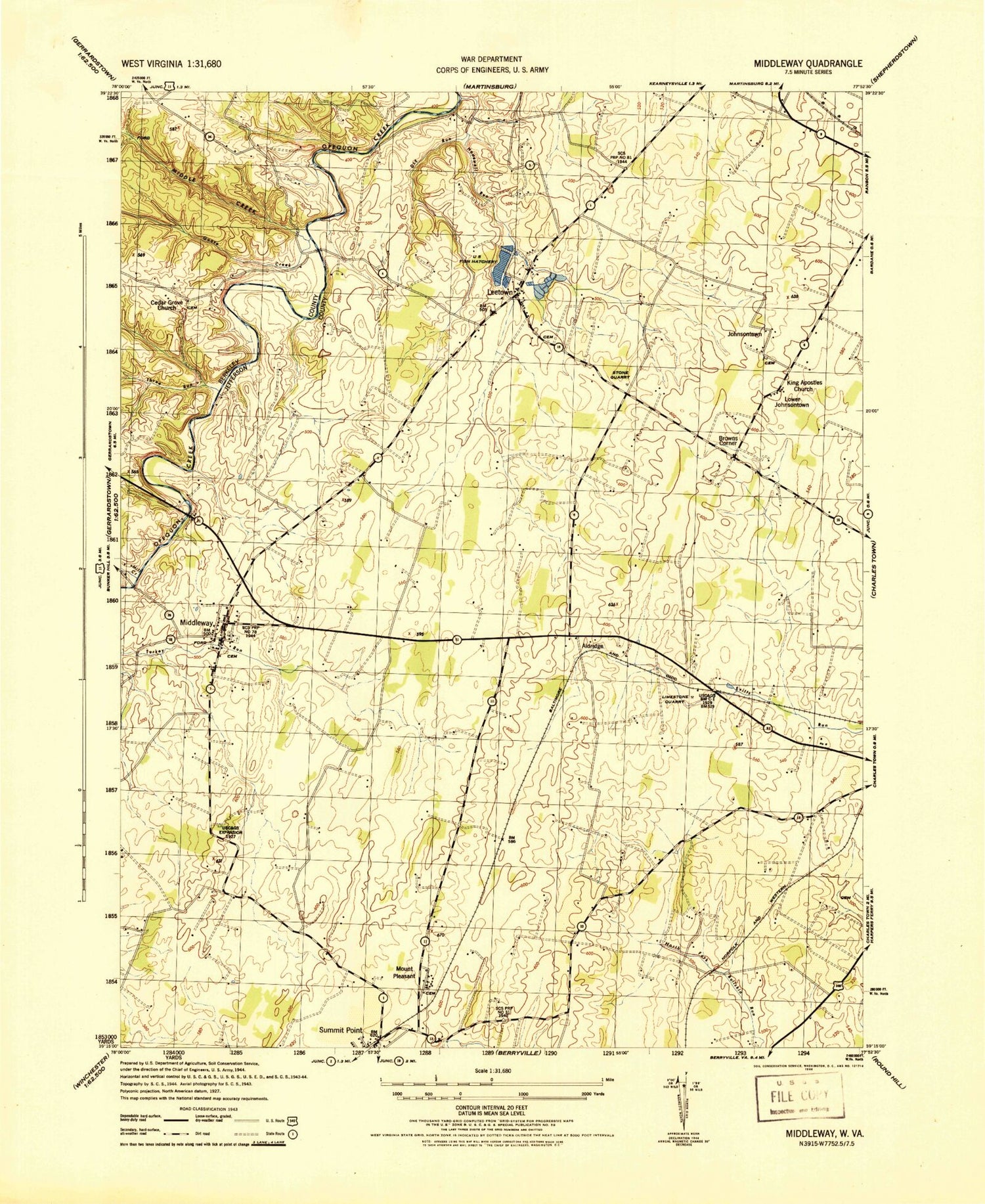
MyTopo
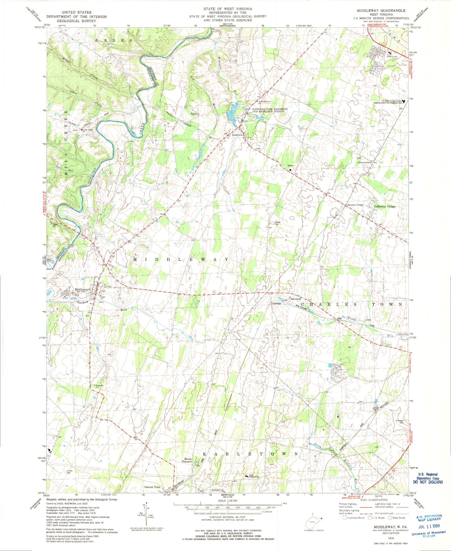
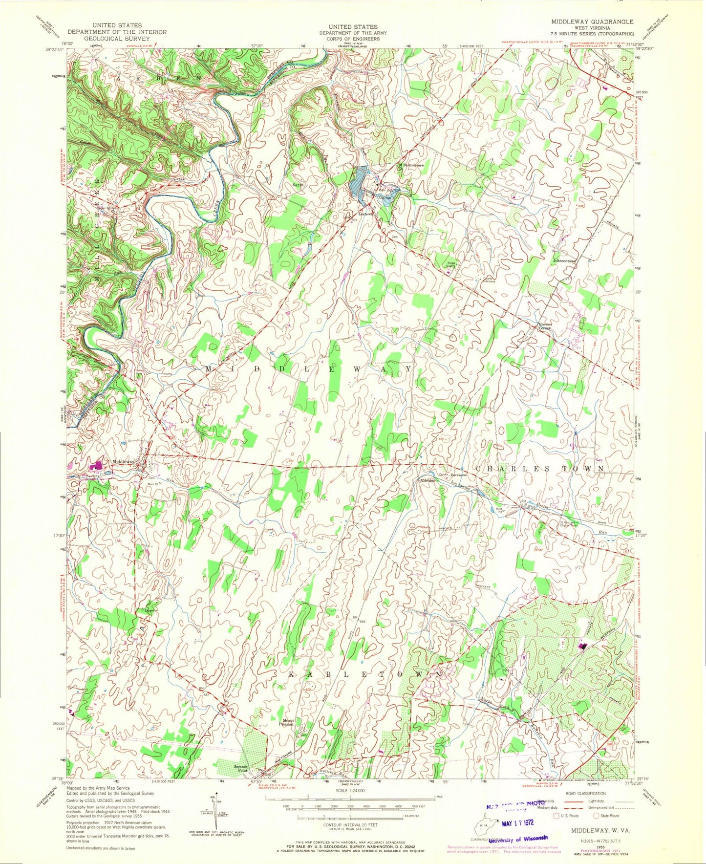
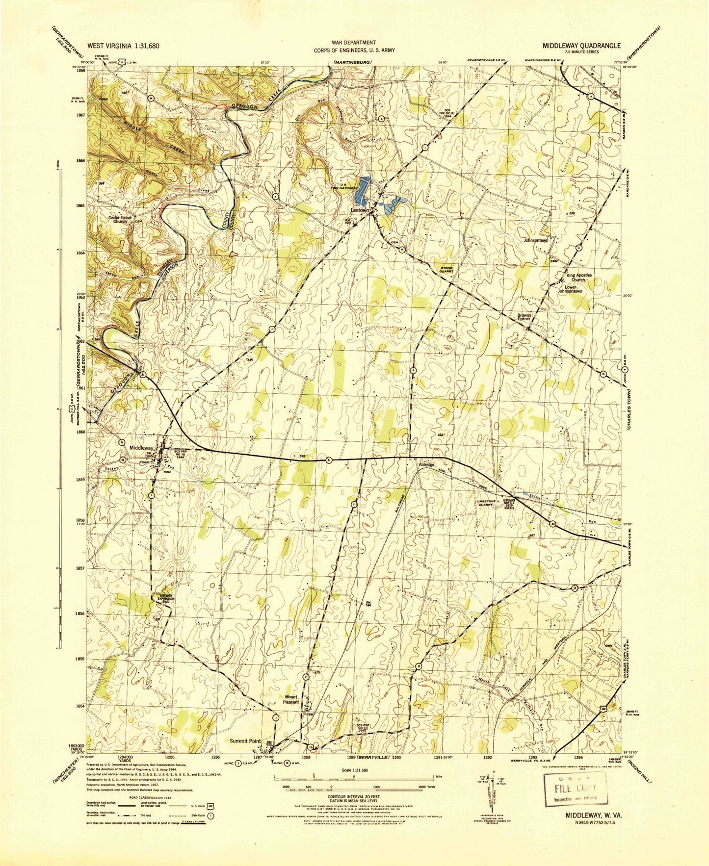
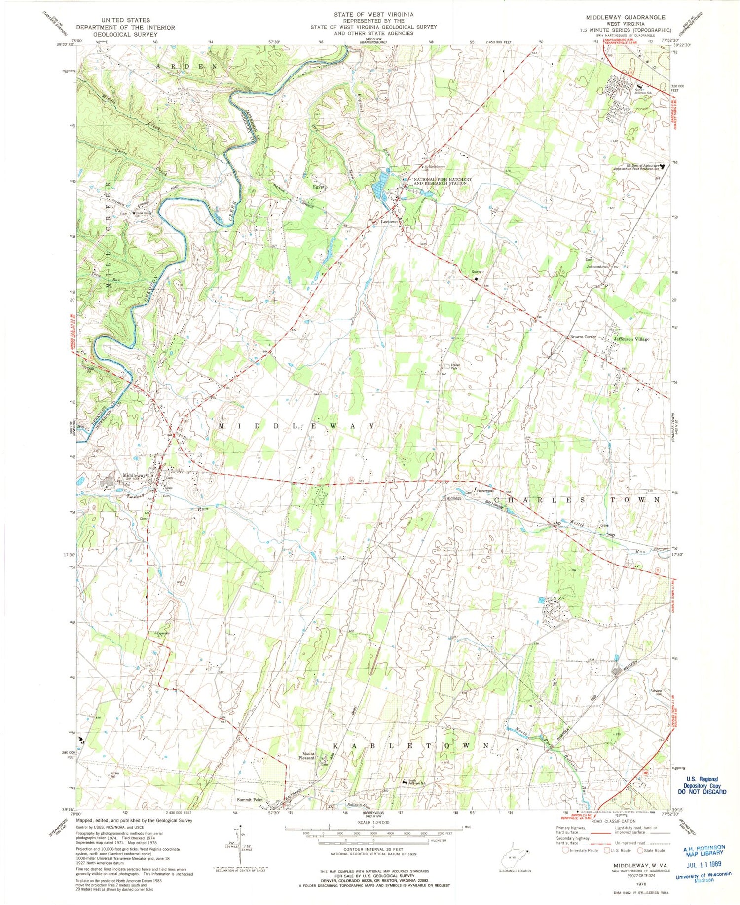
Classic USGS Middleway West Virginia 7.5'x7.5' Topo Map
Couldn't load pickup availability
Historical USGS topographic quad map of Middleway in the state of West Virginia. Map scale may vary for some years, but is generally around 1:24,000. Print size is approximately 24" x 27"
This quadrangle is in the following counties: Berkeley, Jefferson.
The map contains contour lines, roads, rivers, towns, and lakes. Printed on high-quality waterproof paper with UV fade-resistant inks, and shipped rolled.
Contains the following named places: Aldridge, Aldridge Spring, Balch Spring, Browns Corner, Byrd Spring, Capper Farm Spring, Cedar Grove Cemetery, Cedar Grove Church, Claymont Court Spring, Claymont Paige Spring, Claymont Springs, Cool Spring, Country Day School, Dandridges Ford, Dry Run, Egypt, Engle Spring, Fairview Cemetery, Goose Creek, Grace Church, Grey Spring, Harewood, Hopewell Run, Jefferson County Sheriff's Office, Jefferson Village, Johnsontown, Johnsontown Cemetery, Leetown, Locust Hill Golf Course, Middle Creek, Middleway, Middleway Census Designated Place, Middleway District, Middleway Historic District, Middleway Volunteer Fire Department, Mill Creek, Mount Pleasant, North Jefferson Elementary School, Owens Farm Spring, Piedmont Farm Spring, Saint Bartholomew Church, Schlack Farm Spring, South Jefferson Elementary School, Springdale Farm Spring, Swimley School, Three Run, Turkey Run Spring, United States Department of Agriculture Appalachian Fruit Research Station, Washington Burial Ground, Washington High School, Washington Spring, Wee Disciples Christian Academy, White Hill, White House Spring, Whitmores Ford, Wiltshire School, Wysong Spring, ZIP Code: 25430