MyTopo
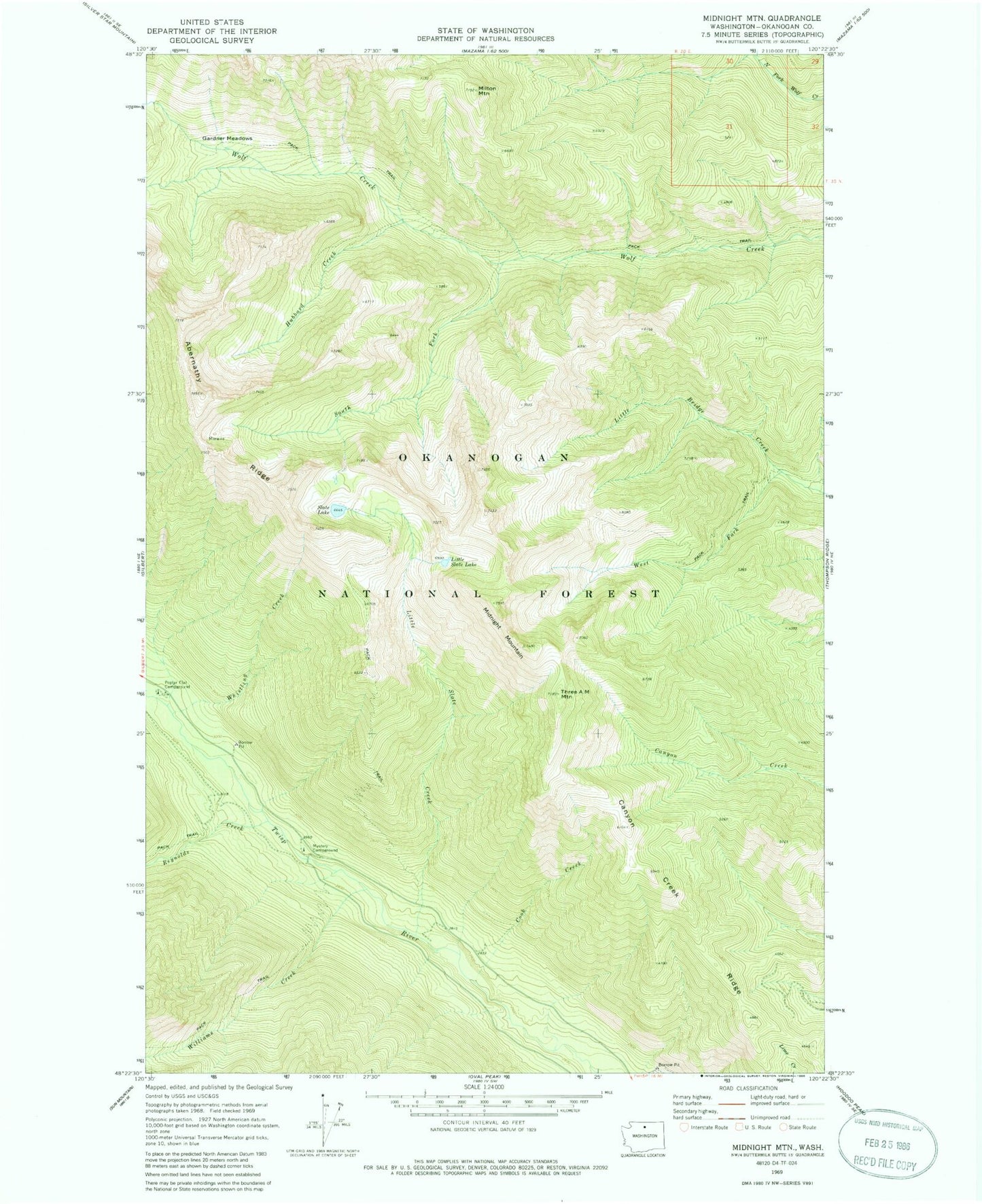
Classic USGS Midnight Mountain Washington 7.5'x7.5' Topo Map
Couldn't load pickup availability
Historical USGS topographic quad map of Midnight Mountain in the state of Washington. Typical map scale is 1:24,000, but may vary for certain years, if available. Print size: 24" x 27"
This quadrangle is in the following counties: Okanogan.
The map contains contour lines, roads, rivers, towns, and lakes. Printed on high-quality waterproof paper with UV fade-resistant inks, and shipped rolled.
Contains the following named places: Canyon Creek Ridge, Cook Creek, Gardner Meadows, Hubbard Creek, Little Slate Creek, Little Slate Lake, Midnight Mountain, Milton Mountain, Mystery Campground, Poplar Flat Campground, Reynolds Creek, Slate Lake, South Fork Wolf Creek, Three A M Mountain, West Fork Little Bridge Creek, Whistling Creek, Williams Creek, Poplar Flats