MyTopo
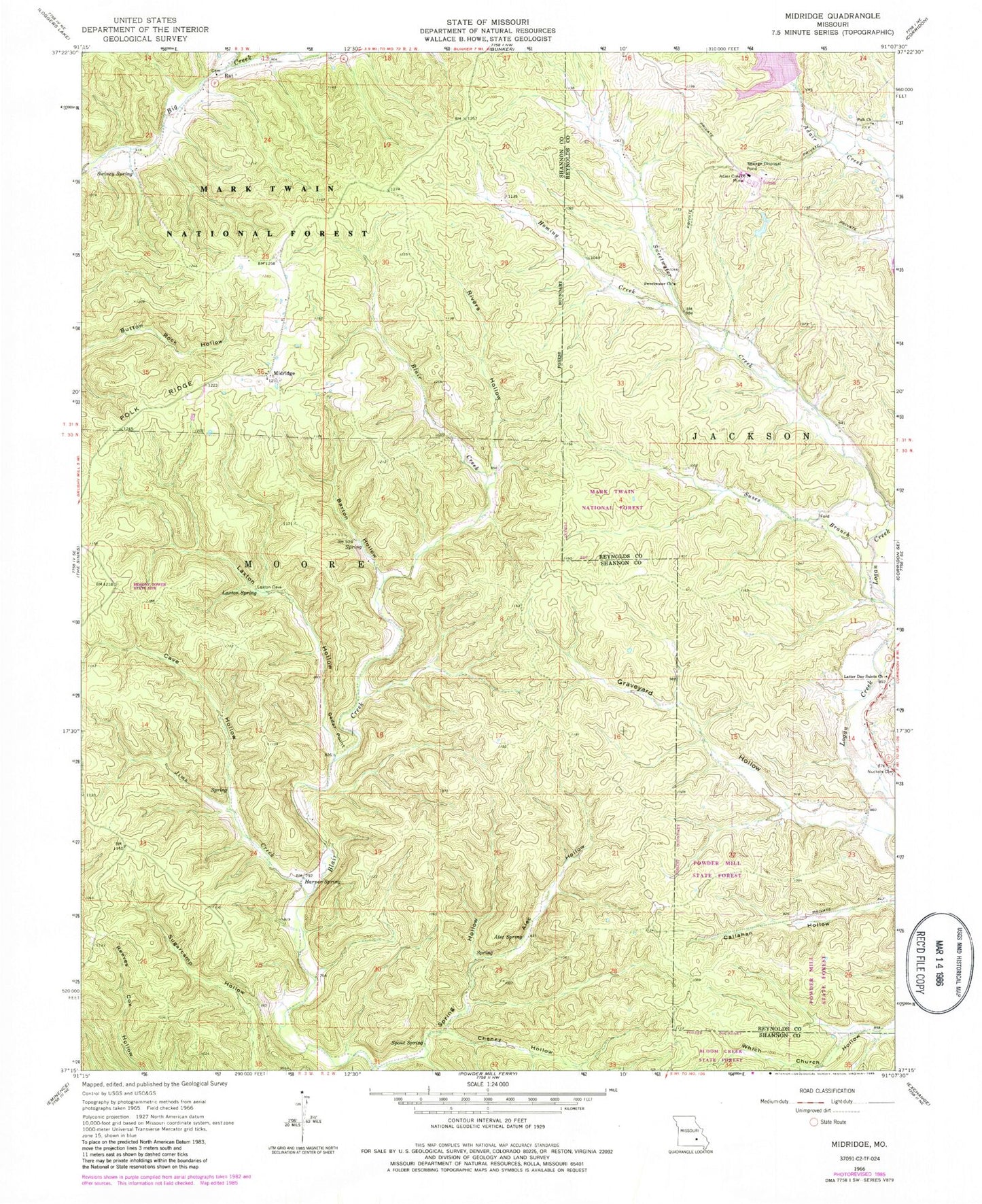
Classic USGS Midridge Missouri 7.5'x7.5' Topo Map
Couldn't load pickup availability
Historical USGS topographic quad map of Midridge in the state of Missouri. Typical map scale is 1:24,000, but may vary for certain years, if available. Print size: 24" x 27"
This quadrangle is in the following counties: Reynolds, Shannon.
The map contains contour lines, roads, rivers, towns, and lakes. Printed on high-quality waterproof paper with UV fade-resistant inks, and shipped rolled.
Contains the following named places: Rivers Hollow, Himont (historical), Cedar Point School (historical), Adair Creek Mine, Alec Hollow, Alec Spring, Barton Hollow, Bounds Branch, Cave Hollow, Cedar Point, Cheney Hollow, Graveyard Hollow, McIntire Spring, Homing Creek, Jims Creek, Latter Day Saints Church, Laxton Hollow, Laxton Spring, Midridge, Polk Church, Polk Ridge, Rat, Spout Spring, Spring Hollow, Suses Branch, Sweetwater Church, Swiney Spring, Woods Hollow, Himont Lookout Tower, Ozark Lead Tailings Dam, Township of Moore, McIntire Spring Branch, McIntire Spring House (historical)