MyTopo
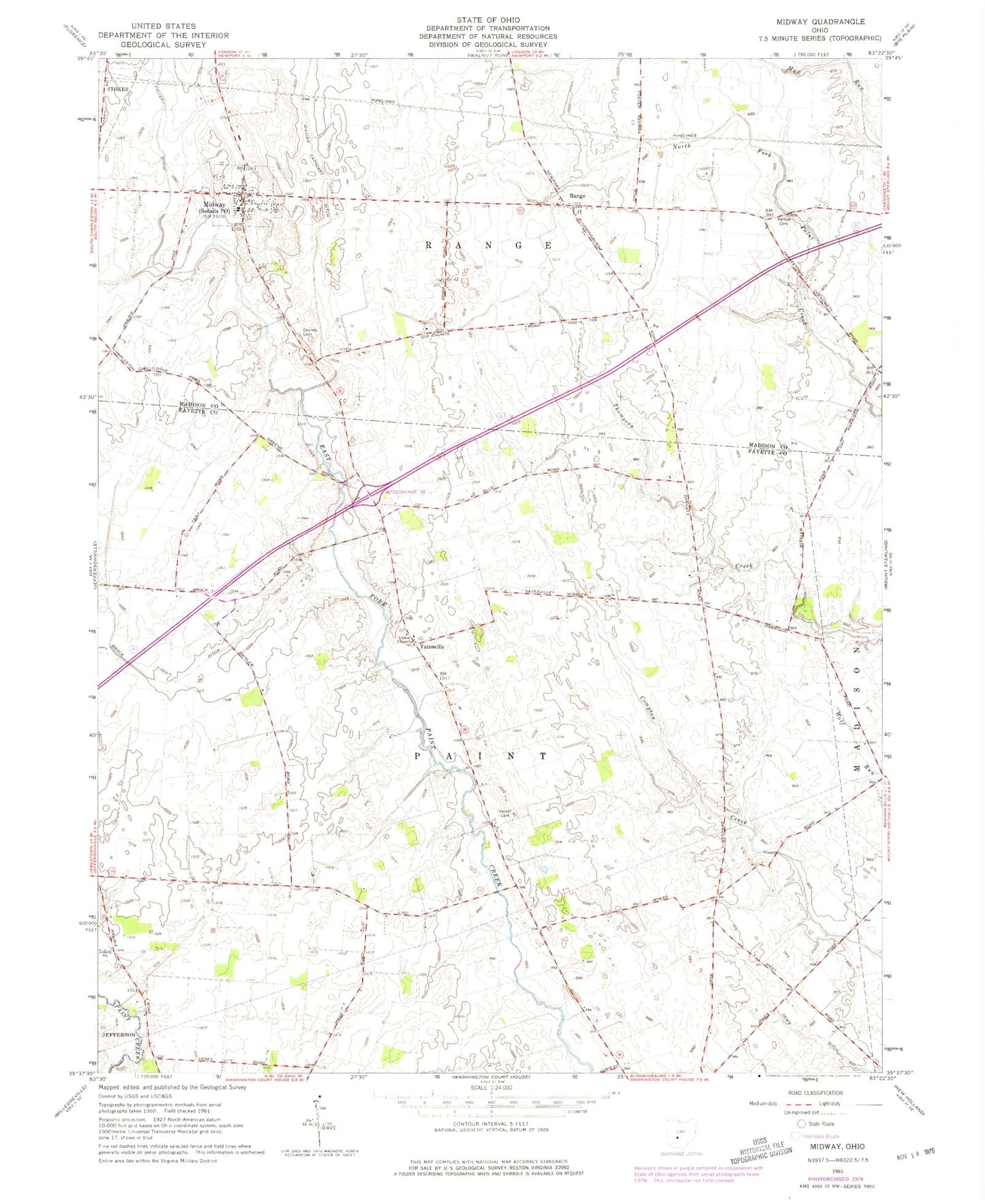
Classic USGS Midway Ohio 7.5'x7.5' Topo Map
Couldn't load pickup availability
Historical USGS topographic quad map of Midway in the state of Ohio. Map scale may vary for some years, but is generally around 1:24,000. Print size is approximately 24" x 27"
This quadrangle is in the following counties: Fayette, Madison.
The map contains contour lines, roads, rivers, towns, and lakes. Printed on high-quality waterproof paper with UV fade-resistant inks, and shipped rolled.
Contains the following named places: Bethel, Bethel Cemetery, Bethel Methodist Episcopal Church, Bock Farms, Brock Ditch, Counts Cemetery, Dews Ditch, Midway, Midway Elementary School, Range, Range Cemetery, Range Post Office, Range Township Fire Department, Sedalia Post Office, Stardust Dairy, Township of Paint, Township of Range, Union Chapel Cemetery, Union Chapel Methodist Church, Vallery Ditch, Vesey Cemetery, Village of Midway, William Cathcart Ditch, Yatesville, Yatesville Post Office, ZIP Codes: 43106, 43151