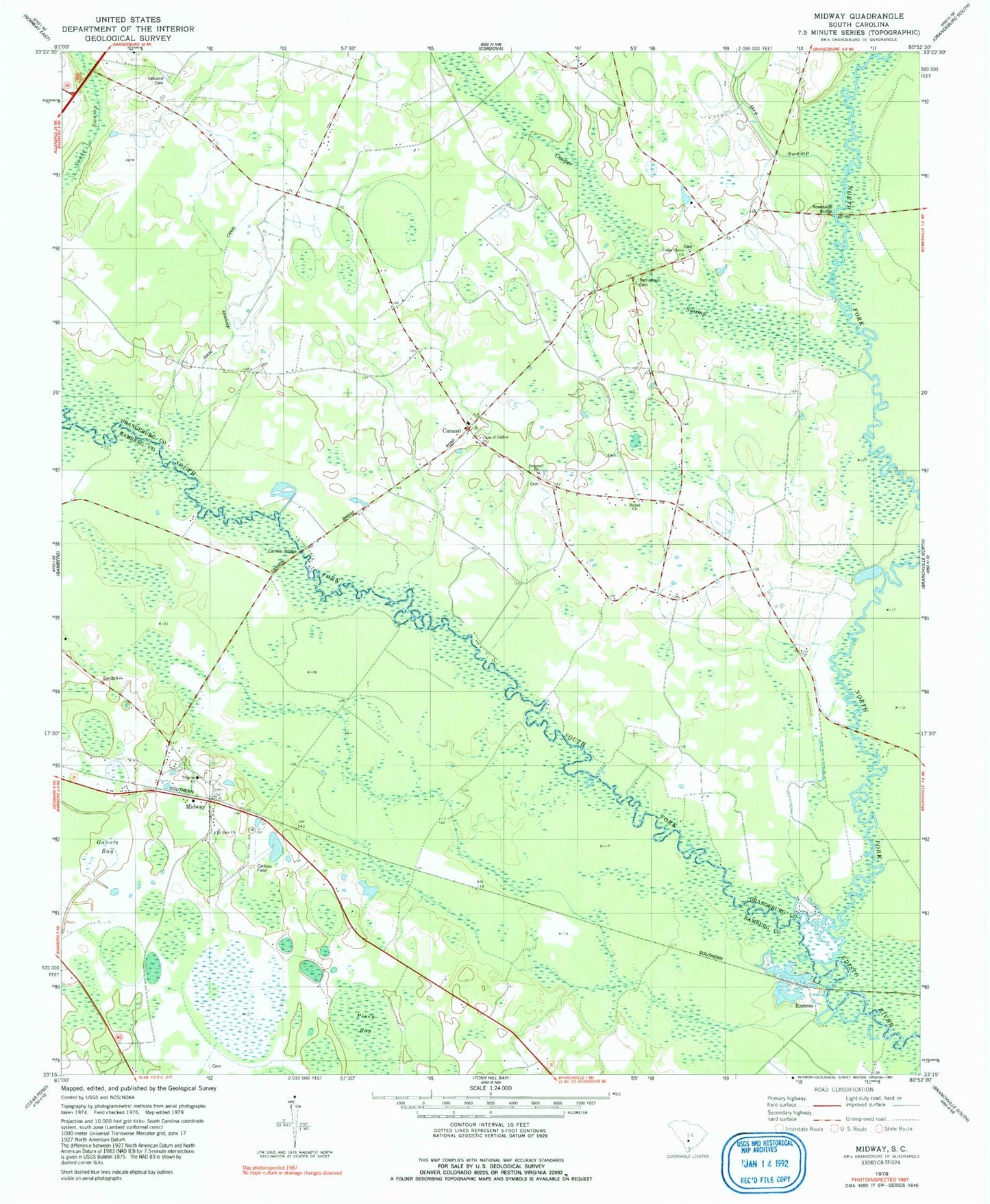
MyTopo
Classic USGS Midway South Carolina 7.5'x7.5' Topo Map
Couldn't load pickup availability
Historical USGS topographic quad map of Midway in the state of South Carolina. Map scale may vary for some years, but is generally around 1:24,000. Print size is approximately 24" x 27"
This quadrangle is in the following counties: Bamberg, Orangeburg.
The map contains contour lines, roads, rivers, towns, and lakes. Printed on high-quality waterproof paper with UV fade-resistant inks, and shipped rolled.
Contains the following named places: Bethel Church, Bethlehem Cemetery, Bethlehem Church, Cana of Galilee Church, Canaan, Canaan Cemetery, Canaan Church, Canaan Fire Department Station 1, Canaan Fire Department Station 2, Canaan School, Cannon Bridge, Cedar Grove Church, Cedar Grove School, Cooper Swamp, Cope Division, Corner School, Dry Swamp, Edisto School, Emanuel Cemetery, Emanuel Church, Emanuel School, Embree, Fork Bridges, Gannts Bay, Isaac Jennings Canal, McMillan School, Midway, Mount Pisgah Church, Mount Pisgah School, Mount Zion Church, North Fork Edisto River, Oakland Cemetery, Pilgrim Baptist Church, Rowesville Bridge, South Fork Edisto River, Tatums Pond Dam D-2823, ZIP Code: 29038