MyTopo
Classic USGS Midwest Wyoming 7.5'x7.5' Topo Map
Couldn't load pickup availability
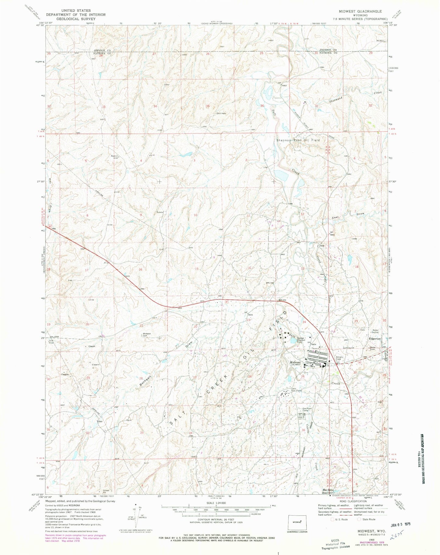
Historical USGS topographic quad map of Midwest in the state of Wyoming. Map scale may vary for some years, but is generally around 1:24,000. Print size is approximately 24" x 27"
This quadrangle is in the following counties: Johnson, Natrona.
The map contains contour lines, roads, rivers, towns, and lakes. Printed on high-quality waterproof paper with UV fade-resistant inks, and shipped rolled.
Contains the following named places: Bothwell Draw, Castle Creek, Coal Draw, Edgerton Cemetery, Gas Plant Camp, Lower Salt Creek Dam, Lower Salt Creek Reservoir, Mac Reas Reservoir, Midwest, Midwest Cemetery, Midwest High School, Midwest Junior High School, Midwest Number 23 Dam, Midwest Number 23 Reservoir, Midwest Police Department, Midwest Post Office, Midwest School, Salt Creek Emergency Services Midwest Station, Salt Creek Oil Field, Shannon Pool Oil Field, Sherwood Creek, Steele Formation Mine, Town of Midwest, Wyoming Associated Number 17 Dam, Wyoming Associated Reservoir Number 17, ZIP Code: 82643