MyTopo
Classic USGS Miesville Minnesota 7.5'x7.5' Topo Map
Couldn't load pickup availability
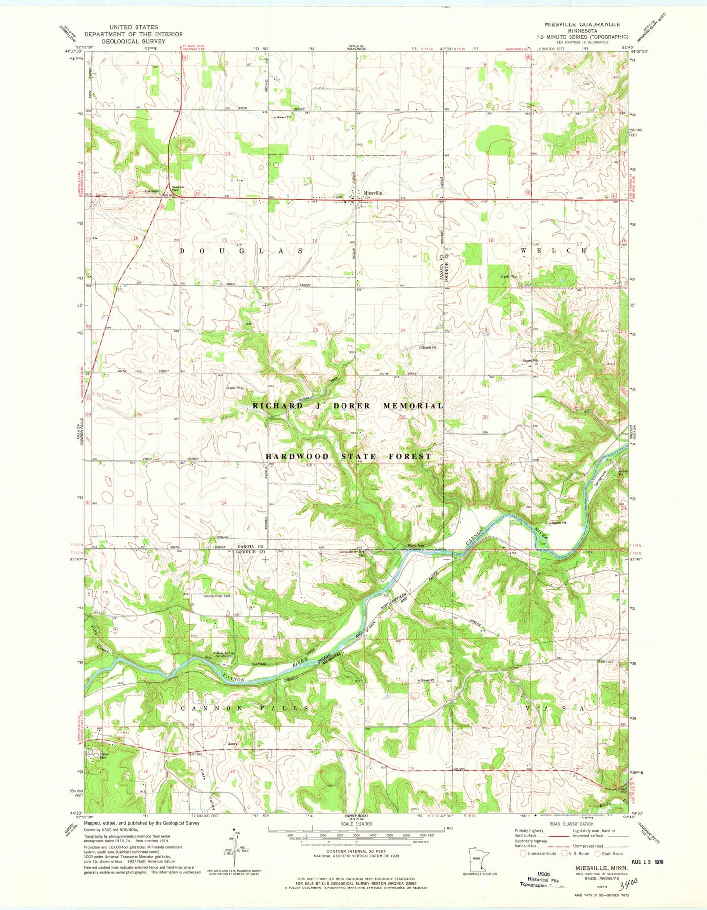
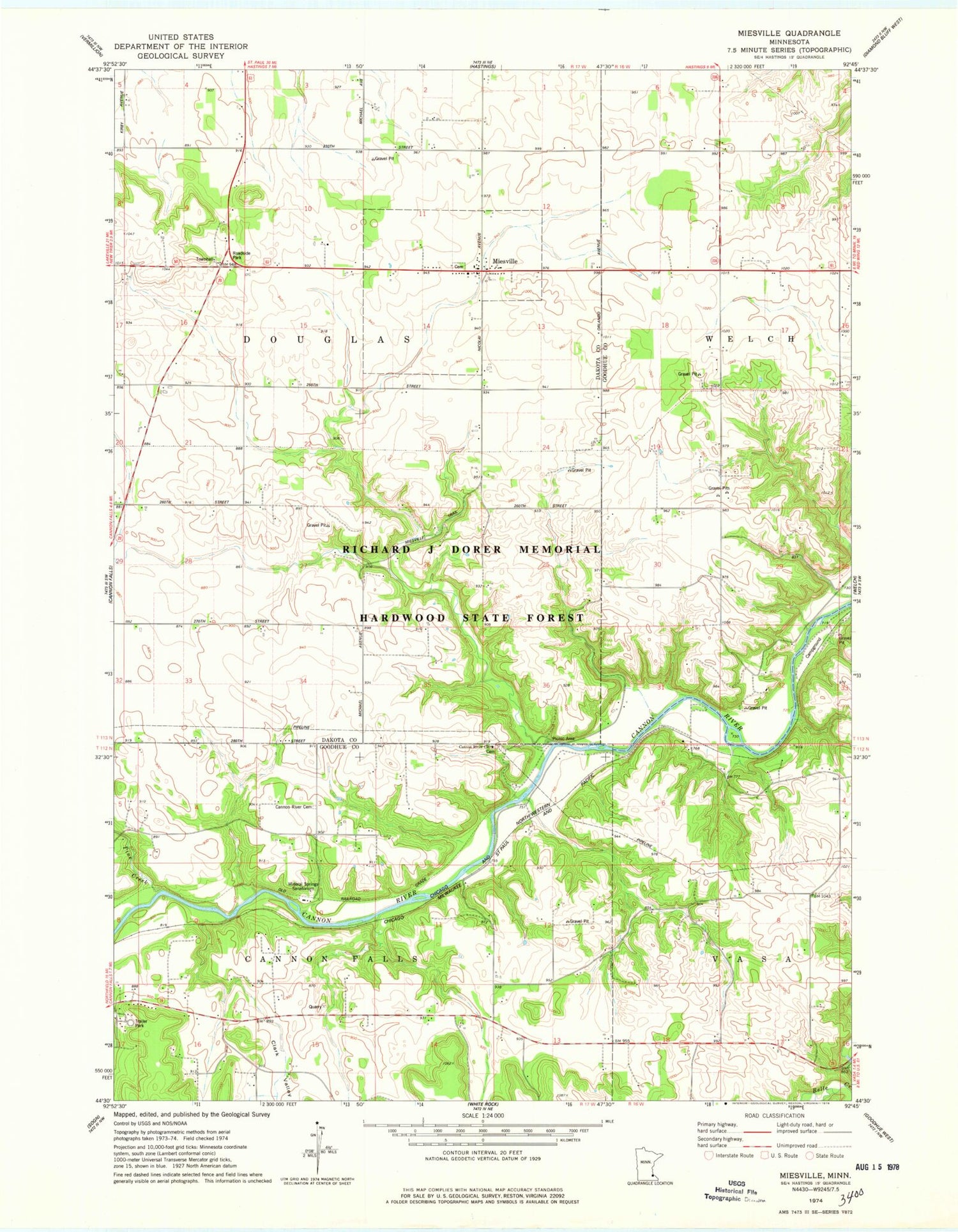
Historical USGS topographic quad map of Miesville in the state of Minnesota. Map scale may vary for some years, but is generally around 1:24,000. Print size is approximately 24" x 27"
This quadrangle is in the following counties: Dakota, Goodhue.
The map contains contour lines, roads, rivers, towns, and lakes. Printed on high-quality waterproof paper with UV fade-resistant inks, and shipped rolled.
Contains the following named places: Cannon Falls Campground, Cannon River Cemetery, Cannon River Church, Cannon River Lutheran Church Cemetery, City of Miesville, Clark Valley, Elmdale Hills Golf Course, Hidden Valley Campgrounds, Miesville, Miesville Post Office, Miesville Volunteer Fire Department, Mineral Springs Sanatorium, Pine Creek, River Ridge Ranch Airport, Saint Joseph Catholic Cemetery, Saint Joseph Catholic Church, Township of Douglas