MyTopo
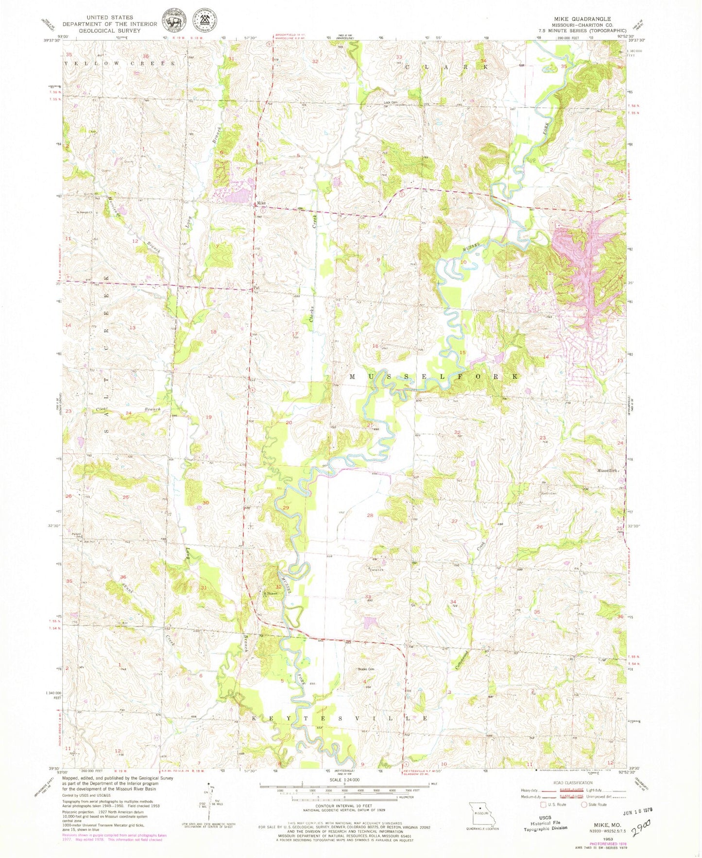
Classic USGS Mike Missouri 7.5'x7.5' Topo Map
Couldn't load pickup availability
Historical USGS topographic quad map of Mike in the state of Missouri. Map scale may vary for some years, but is generally around 1:24,000. Print size is approximately 24" x 27"
This quadrangle is in the following counties: Chariton.
The map contains contour lines, roads, rivers, towns, and lakes. Printed on high-quality waterproof paper with UV fade-resistant inks, and shipped rolled.
Contains the following named places: Bills School, Brooks Cemetery, Bynumville Fire Department Station 3, Chariton County, Chraneville, Chraneville Post Office, Clarks Creek, Clear Branch, Cook School, Corinth Church, Crossroads School, East Indian Grove School, Grubbs School, Guthridge, Holland School, Hurricane Branch, Hurricane Branch School, Lake Nehai Tonayea, Liberty School, Locke Cemetery, Lowery School, Mike, Moser Lake, Moser Lake Dam, Mount Pleasant Cemetery, Mount Pleasant Church, Musselfork, Nehai Tonkayea Lake Dam, Oldham School, Pleasure Hills Estates Lake, Pleasure Hills Estates Lake Dam, Pollard School, Prather School, Saint Joseph Church, Skunk Creek, Township of Musselfork, Trade, Welch Cemetery, White Oak School, Wright Lake, Wright Lake Dam