MyTopo
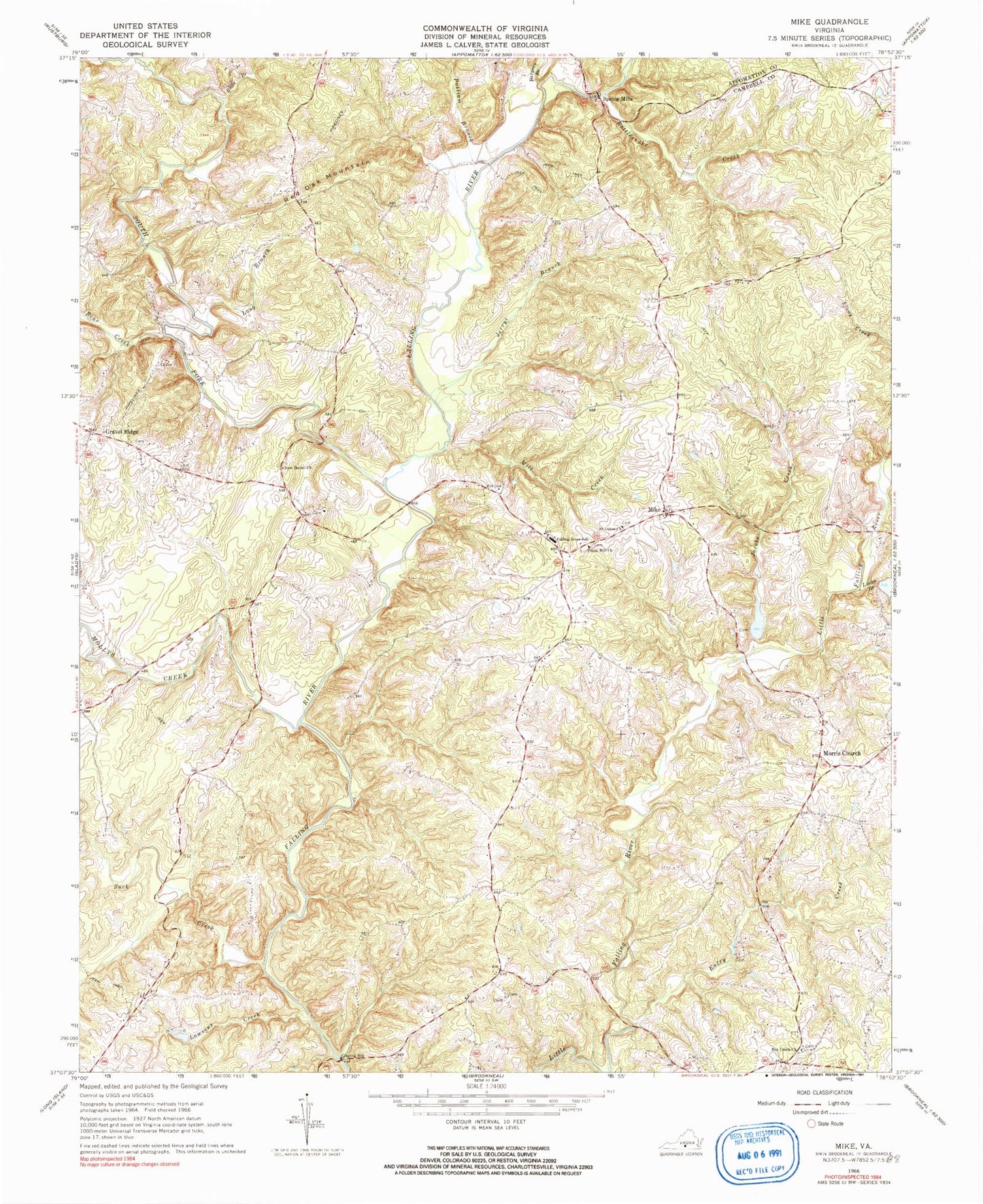
Classic USGS Mike Virginia 7.5'x7.5' Topo Map
Couldn't load pickup availability
Historical USGS topographic quad map of Mike in the state of Virginia. Map scale may vary for some years, but is generally around 1:24,000. Print size is approximately 24" x 27"
This quadrangle is in the following counties: Appomattox, Campbell.
The map contains contour lines, roads, rivers, towns, and lakes. Printed on high-quality waterproof paper with UV fade-resistant inks, and shipped rolled.
Contains the following named places: Bargers Branch, Bear Creek, Bull Branch, Entry Creek, Falling River School, Gravel Ridge, Hat Creek Church, Hat Creek School, Jacobs Creek, Jerrys Branch, Jones Dam, Jones Pond, Lawsons Creek, Little Falling River Number Three Dam, Little Falling River Number Two Dam, Long Branch, Lucks Branch, Mike, Mill Creek, Mollys Creek, Morris Church, New Bethel Church, Pulliam Branch, Rattlesnake Creek, Red Oak Mountain, Saint Lukes Church, South Fork Falling River, Spring Mills, Suck Creek, Union Hill Church