MyTopo
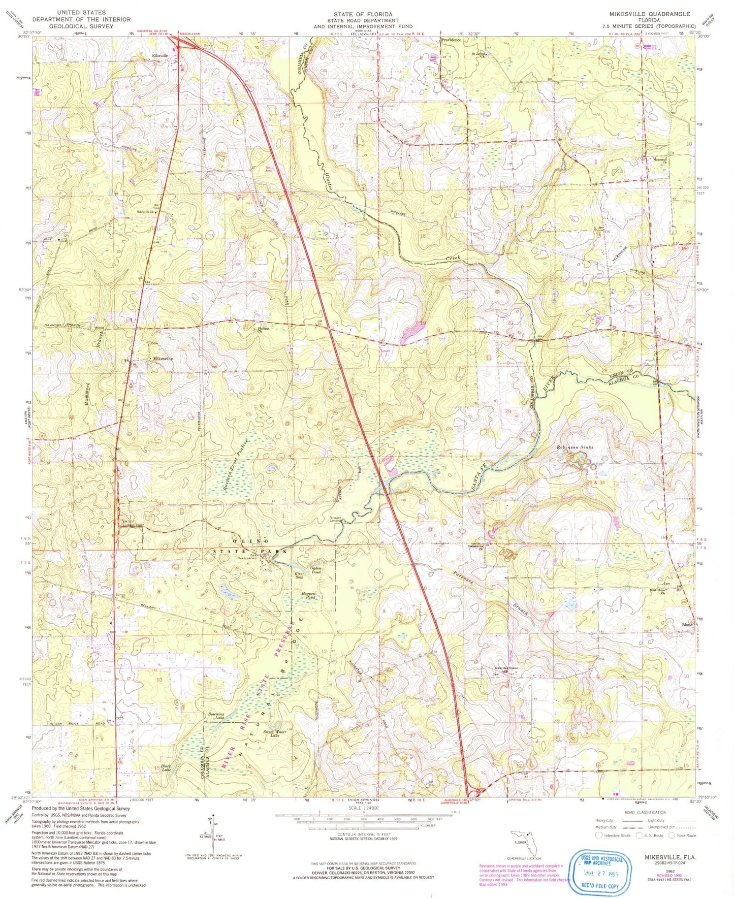
Classic USGS Mikesville Florida 7.5'x7.5' Topo Map
Couldn't load pickup availability
Historical USGS topographic quad map of Mikesville in the state of Florida. Typical map scale is 1:24,000, but may vary for certain years, if available. Print size: 24" x 27"
This quadrangle is in the following counties: Alachua, Columbia, Union.
The map contains contour lines, roads, rivers, towns, and lakes. Printed on high-quality waterproof paper with UV fade-resistant inks, and shipped rolled.
Contains the following named places: Black Lake, Buzzard Roost Prairie, Damascus Church (historical), Downing Lake, Hammock Branch, Hogpen Pond, Full Gospel of Jesus Christ, Mikesville Church, Natural Bridge, Greater New Hope Missionary Baptist Church, New Oak Grove Baptist Church, Ogden Pond, Pareners Branch, Philippi Church, Robinson Sinks, Saint John Missionary Baptist Church, O'Leno State Park, San Francisco Potano (historical), Mikesville, Vinzant Landing, Francis R Sanchez Grant, River Sink, Olustee Creek, Sweet Water Lake, Greater New Hope Baptist Church, Damascus Cemetery, New Oak Grove Cemetery, New Hope Cemetery, Clay Electric Cooperative Bland Substation, Hopewell Church of God by Faith, Sarah Community Park, Saint John Cemetery