MyTopo
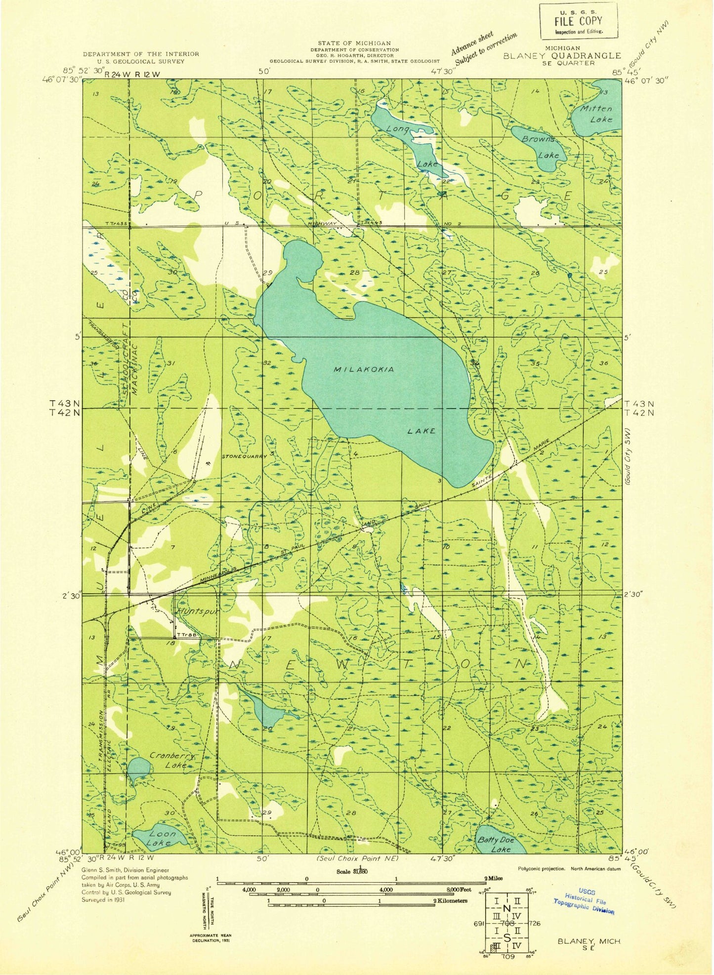
Classic USGS Milakokia Lake Michigan 7.5'x7.5' Topo Map
Couldn't load pickup availability
Historical USGS topographic quad map of Milakokia Lake in the state of Michigan. Map scale may vary for some years, but is generally around 1:24,000. Print size is approximately 24" x 27"
This quadrangle is in the following counties: Mackinac, Schoolcraft.
The map contains contour lines, roads, rivers, towns, and lakes. Printed on high-quality waterproof paper with UV fade-resistant inks, and shipped rolled.
Contains the following named places: Batty Doe Lake, Beaver Bay, Browns Lake, Cranberry Lake, Heinz Lake, Huntspur, Huntspur Post Office, Huntspur Station, Inland, Long Lake, Loon Lake, Milakokia Lake, Milakokia Lake Campground, Mitten Lake, North Branch Milakokia River, Pike Lake Post Office, Pike Lake Station, Rose Lake, Rubys Bay, Toms Creek