MyTopo
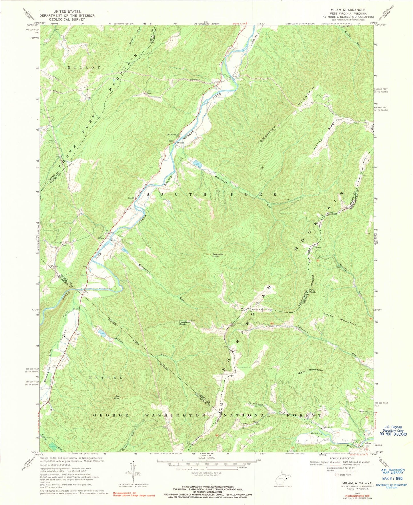
Classic USGS Milam West Virginia 7.5'x7.5' Topo Map
Couldn't load pickup availability
Historical USGS topographic quad map of Milam in the states of West Virginia, Virginia. Typical map scale is 1:24,000, but may vary for certain years, if available. Print size: 24" x 27"
This quadrangle is in the following counties: Grant, Hardy, Pendleton, Rockingham.
The map contains contour lines, roads, rivers, towns, and lakes. Printed on high-quality waterproof paper with UV fade-resistant inks, and shipped rolled.
Contains the following named places: Ant Knob, Foremost Mountain, Haystack Knob, Hunting Ridge, Kettle Creek, Milam, Mount Olive Church, Peru, Reynolds Knob, Rodabaugh Run, Rohrbaugh Run, South Fork Mountain, Sweedlin Valley, Wilson Run, Zion Church, Criders School (historical), Hinkle School (historical), Wine Spring School (historical), Bergdoll School (historical), Deep Spring School (historical), South Fork Structure Four Dam, South Fork Structure Five Dam, South Fork Structure Six Dam, South Fork Structure 37 Dam, Mount Hope School (historical), Sweedlin Valley School (historical), Nettie Davis Spring, Milam Post Office, Trumbo Ford Bridge, Criders Church, Damascus Church, Mays Mountain, Persimmon Run, Shenandoah Mountain, Valley View Church, Criders, Pine Knob, Smith Mountain, Smith School (historical), Criders School (historical), Hupp School (historical), Mount Pleasant School (historical), Clover Hill Volunteer Fire Company and Rescue 17, Criders Post Office