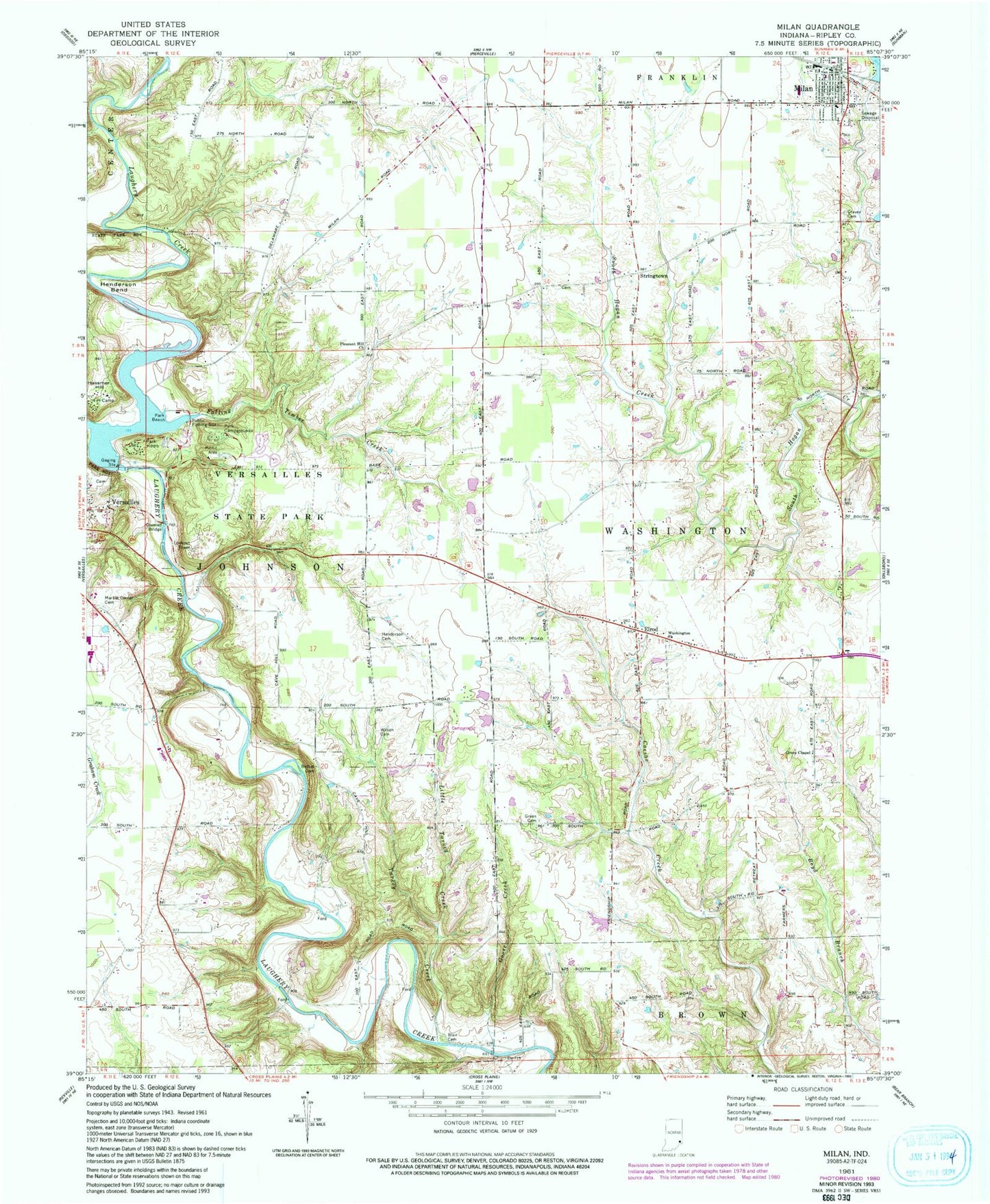
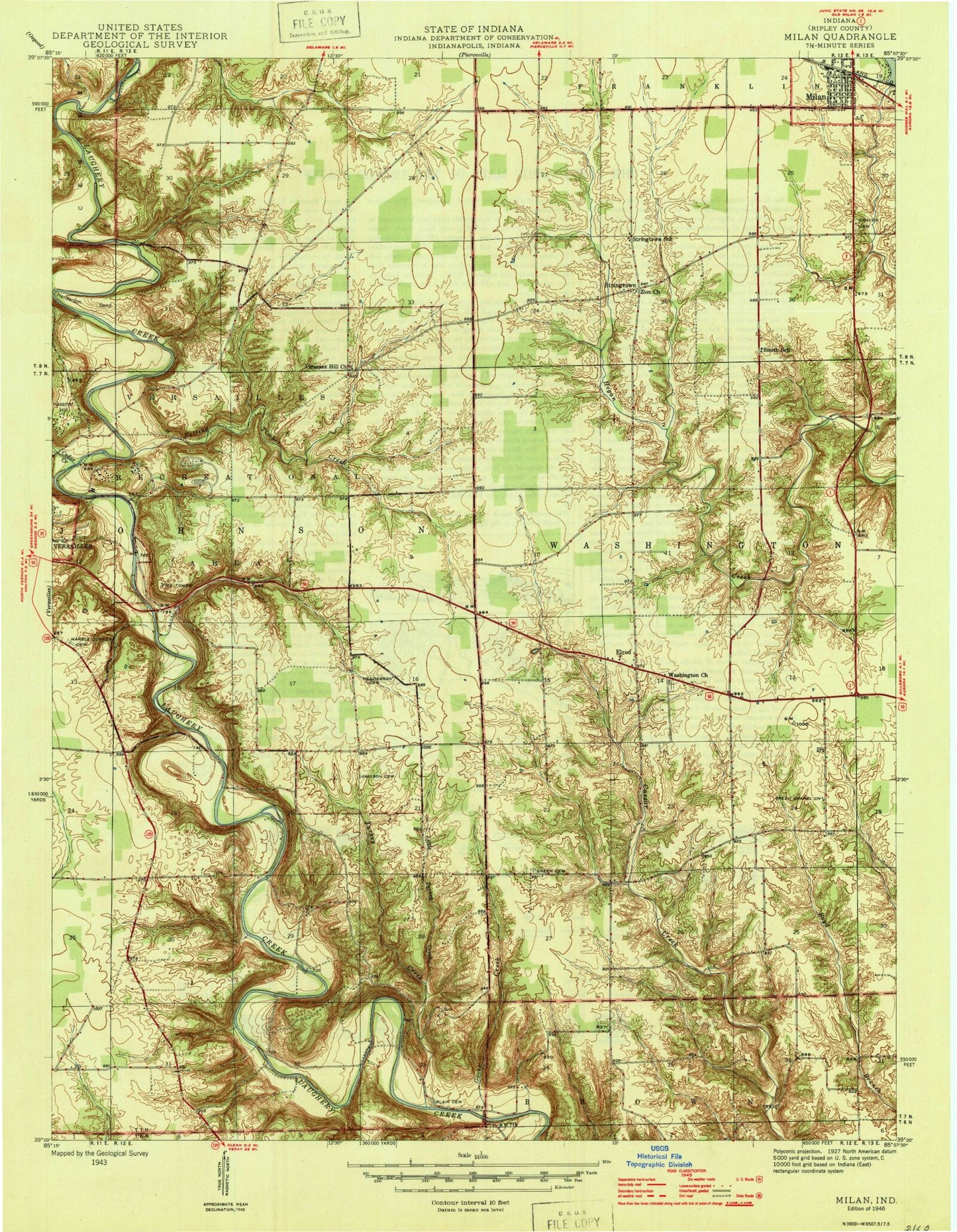
MyTopo
Classic USGS Milan Indiana 7.5'x7.5' Topo Map
Couldn't load pickup availability
Historical USGS topographic quad map of Milan in the state of Indiana. Typical map scale is 1:24,000, but may vary for certain years, if available. Print size: 24" x 27"
This quadrangle is in the following counties: Ripley.
The map contains contour lines, roads, rivers, towns, and lakes. Printed on high-quality waterproof paper with UV fade-resistant inks, and shipped rolled.
Contains the following named places: Bethel Cemetery, Blair Cemetery, Saint Charles Cemetery, Elrod, Falling Timber Creek, Goose Creek, Green Cemetery, Green Chapel, Hassmer Hill, Henderson Bend, Henderson Cemetery, Little Turkey Creek, Marble Corner Cemetery, Milan, Pleasant Hill Church, South Hogan Creek, Stringtown, Turkey Creek, Versailles State Park, Washington Church, Wilson Family Cemetery, South Ripley Junior and Senior High School, Versailles State Park Dam, Versailles Airport (historical), Township of Johnson, Township of Washington, Milan Rescue 30, Milan Police Department, Ripley County Sheriff's Office, Milan Post Office, New Craven Cemetery