MyTopo
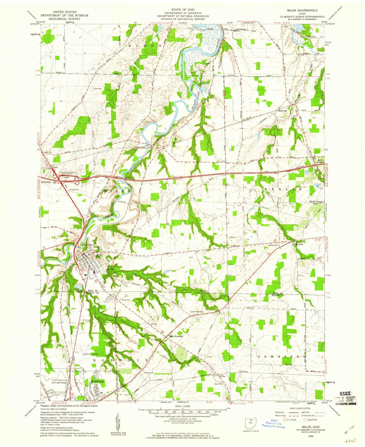
Classic USGS Milan Ohio 7.5'x7.5' Topo Map
Couldn't load pickup availability
Historical USGS topographic quad map of Milan in the state of Ohio. Map scale may vary for some years, but is generally around 1:24,000. Print size is approximately 24" x 27"
This quadrangle is in the following counties: Erie, Huron.
The map contains contour lines, roads, rivers, towns, and lakes. Printed on high-quality waterproof paper with UV fade-resistant inks, and shipped rolled.
Contains the following named places: Avery, Avery Post Office, Berlinville, Berlinville Cemetery, Berlinville Post Office, East Norwalk, East Norwalk Cemetery, East Norwalk Post Office, Edison Memorial United Methodist Church, Edna Roe Newton Memorial Building, Erie County Sanitary Landfill, Firelands Industrial Park, First United Presbyterian Church, Galpin Wildlife Area, Harris Ditch, Homestead Inn Landing Field, Key Estates, Lake Air Ranch, Maplehurst Elementary School, Milan, Milan Cemetery, Milan Church, Milan Elementary School, Milan Friends Church, Milan Historic District, Milan Historical Museum, Milan North Cemetery, Milan Police Department, Milan Post Office, Milan Township Fire Department Station 1, Milan Township Fire Department Station 2, Mitchell Historic District, North Central Emergency Medical Services, North Milan, North Milan Hill, Norwalk Sewage Treatment Plant, O'Dell Cemetery, Ohio State Highway Patrol - Milan Patrol Post, Pages Corners, Rustic Hills Mobile Home Park, Saint Marys Cemetery, Schuster Farms, Scotts Cemetery, Second Methodist Church, Shinrock, Shinrock Post Office, Spears Corners, Sweet Cemetery, The Coupling Reserve, Thomas Edison Birthplace Museum, Township of Milan, Township of Norwalk, Village of Milan, ZIP Code: 44846