
MyTopo
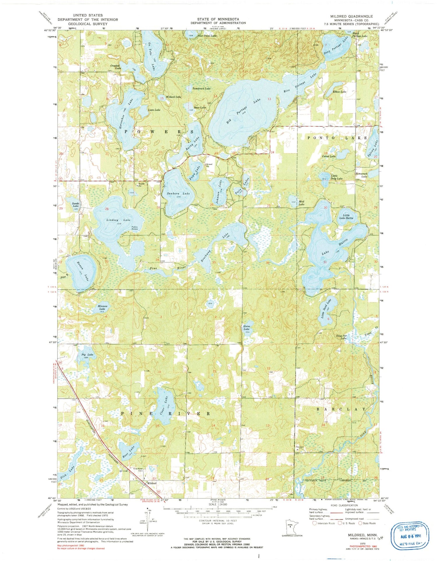
Classic USGS Mildred Minnesota 7.5'x7.5' Topo Map
Couldn't load pickup availability
Historical USGS topographic quad map of Mildred in the state of Minnesota. Map scale may vary for some years, but is generally around 1:24,000. Print size is approximately 24" x 27"
This quadrangle is in the following counties: Cass.
The map contains contour lines, roads, rivers, towns, and lakes. Printed on high-quality waterproof paper with UV fade-resistant inks, and shipped rolled.
Contains the following named places: Bass Lake, Big Portage Lake, Boot Lake, Bowen Lake, Bowen Lake Dam, Brockway Lake, Clear Lake, Corset Lake, Crooked Lake, Deep Portage Lake, Dick Lake, Ding Pot Lake, Elbow Lake, Fawn Lake, Hattie Lake Dam, Horse Lake, Horseshoe Lake, Johnson Lake, Lake Hattie, Lindsey Lake, Lindsey Lake Campgrounds, Little Deep Lake, Little Lake Hattie, Little Sand Lake, Lizzie Creek, Loon Lake, Mildred, Mildred Bible Chapel, Mildred Post Office, Minnow Lake, Mud Lake, Ox Yoke Lake, Pig Lake, Pine River Cemetery, Portage Lake, Portage Lake Dam, Rainy Lake, Rice Portage Lake, Sanborn Lake, Swede Lake, Sylvan Lake, Tamarack Lake, Township of Pine River, Township of Powers, Tuck-A-Way Resort and Campground, Twin Lakes, Willard Lake


