MyTopo
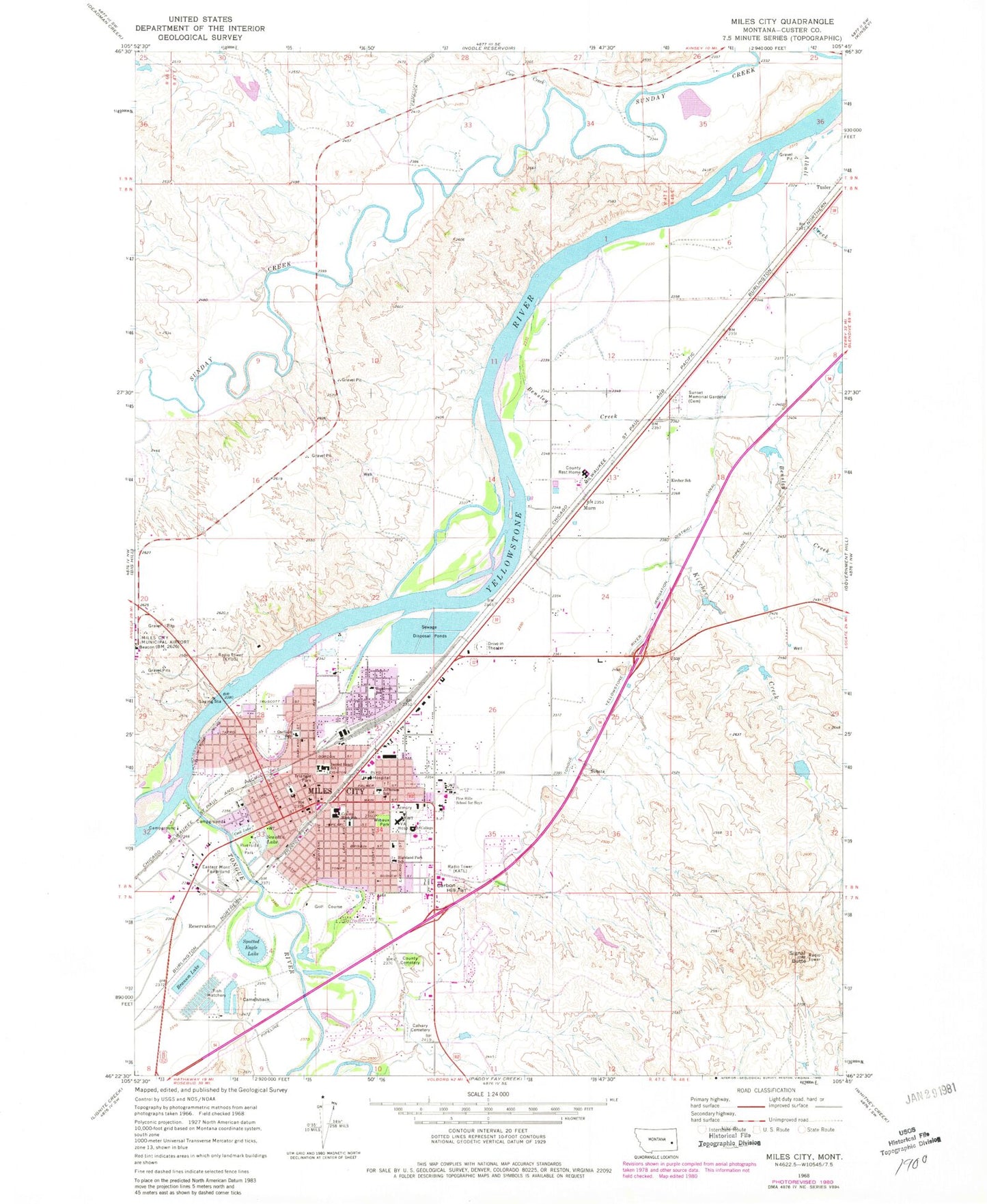
Classic USGS Miles City Montana 7.5'x7.5' Topo Map
Couldn't load pickup availability
Historical USGS topographic quad map of Miles City in the state of Montana. Map scale may vary for some years, but is generally around 1:24,000. Print size is approximately 24" x 27"
This quadrangle is in the following counties: Custer.
The map contains contour lines, roads, rivers, towns, and lakes. Printed on high-quality waterproof paper with UV fade-resistant inks, and shipped rolled.
Contains the following named places: 07N47E04BABA01 Well, 07N47E08AAA_01 Well, 07N47E09BAA_01 Well, 07N47E09BBB_01 Well, 07N47E10ADAA01 Well, 07N47E24BCDD01 Well, 08N47E13AABD01 Well, 08N47E20DBAC01 Well, 08N47E32ACD_01 Well, 09N47E35ABAD01 Well, 09N47E35ADCD01 Well, Alkali Creek, Assembly of God Church, Bender Park, Bensley Creek, Bethel Baptist Church, Big Sky Camp and RV Park, Big Sky Dorm, Branum Lake, Branum Lake Campground and Picnic Area, Branum Lake Dam, Calvary Cemetery, Camelsback, Carbon Hill, Carbon Hill Trailer Court, Centra Gym Complex, Christian and Missionary Alliance of Miles City, Church of Christ, City of Miles City, Cook Lake, Cope Trailer Park, Cow Creek, Custer County Cemetery, Custer County Courthouse, Custer County High School, Custer County Rural Volunteer Fire Company Miles City, Custer County Sheriff's Office, Denton Field, Eastern Montana Cancer Center, Eastern Montana Community Mental Health Center, Eastern Montana Fairground, Emmanuel Episcopal Church, Fellowship Baptist Church, First Baptist Church, First Christian Church, First Lutheran Church, First Presbyterian Church, First United Methodist Church, Friendship Villa Care Center, Garberson Eye Clinic, Garfield School, Glasscock Number 2 Dam, Goodale Number 2 Dam, Grace Bible Church, Green Star Trailer Court, Highland Park Congregational United Church of Christ, Highland Park School, Hogan Number 2 Dam, Holy Rosary Health Center, Jefferson School, Jehovah's Witnesses, KATL-AM (Miles City), KECC-FM (Miles City), Kircher Creek, Kircher Creek Bridge, Kircher School, KYUS-TV (Miles City), Lincoln School, Living Way Fellowship Church, Miles City, Miles City Fire and Rescue, Miles City Fish Hatchery, Miles City KOA Campground, Miles City Plaza Shopping Center, Miles City Police Department, Miles City Post Office, Miles City Public Library, Miles City Sewage Disposal Pond Number 1 Dam, Miles City Sewage Disposal Pond Number 2 Dam, Miles City Sewage Disposal Pond Number 3 Dam, Miles City Town and Country Club, Miles City Vision Clinic, Miles City Wesleyan Church, Miles Community College, Montana Highway Patrol District V Miles City Office, Murn, Peavey Grain Company Elevator, Pine Crest Cemetery, Pine Hills School Cemetery, Pine Hills School for Boys, Pirogue Island, Pirogue Island State Park, Pumping Plant Park, Range Riders Museum, Riverside Park, Roche Jaune Fishing Access Site, Roosevelt School, Sacred Heart Elementary School, Sacred Heart Roman Catholic Church, Scanlan Lake, Seventh Day Adventist Church, Signal Butte, Smiths Trailer Court, Southeastern Montana Research Library, Spotted Eagle Lake, Spotted Eagle Recreation Area, Stanley Chiropractic Center, Sunday Creek Airpark, Sunset Drive-In, Tedesco Park, The Church of Jesus Christ of Latter Day Saints, Tongue and Yellowstone River Irrigation District Canal, Tongue River, Tongue River Bridge, Tongue River Historical Marker, Triangle Park, Trinity Lutheran Church, Tusler, Valley Drive Baptist Church, Valley Drive Mobile Home Park, Veterans Administration Medical Center Chapel, Veterans Affairs Medical Center, Washington Middle School, Westwood Estates, Wibaux Park, Wild Rose Park, Word of Life Fellowship Church, Yellowstone Valley Youth Clinic


