
MyTopo
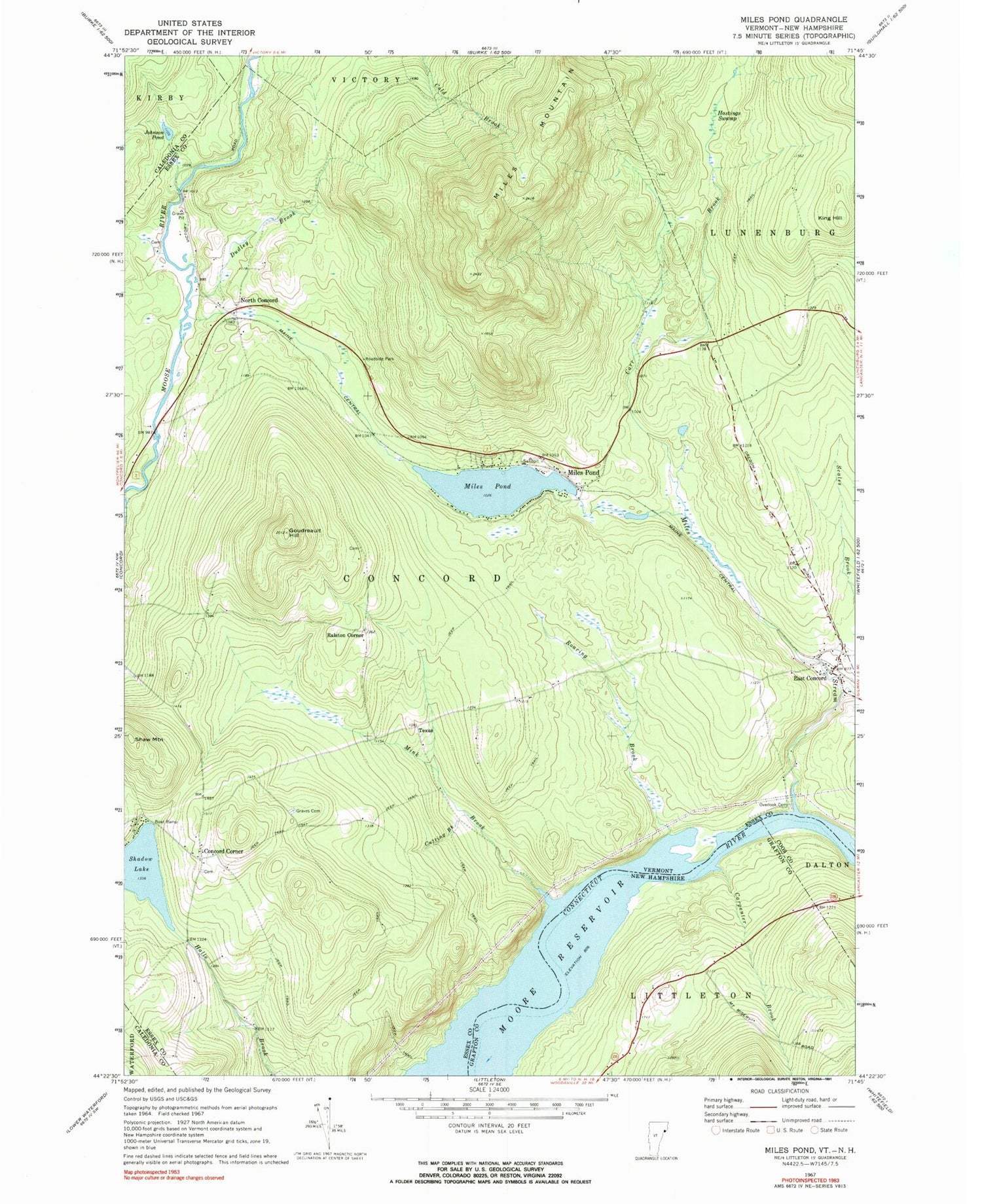
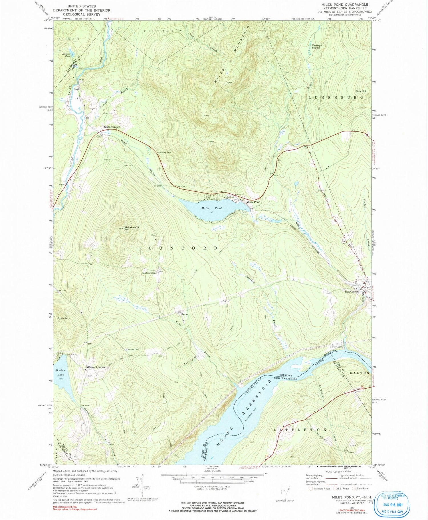
Classic USGS Miles Pond Vermont 7.5'x7.5' Topo Map
Couldn't load pickup availability
Historical USGS topographic quad map of Miles Pond in the states of Vermont, New Hampshire. Typical map scale is 1:24,000, but may vary for certain years, if available. Print size: 24" x 27"
This quadrangle is in the following counties: Caledonia, Coos, Essex, Grafton.
The map contains contour lines, roads, rivers, towns, and lakes. Printed on high-quality waterproof paper with UV fade-resistant inks, and shipped rolled.
Contains the following named places: Carr Brook, Concord Corner, Cutting Brook, Dudley Brook, East Concord, Goudreault Hill, Graves Cemetery, Hastings Swamp, Johnson Pond, King Hill, Miles Mountain, Miles Pond, Miles Pond, Miles Stream, Mink Brook, North Concord, Overlook Cemetery, Ralston Corner, Roaring Brook, Shadow Lake, Shaw Mountain, Texas, Town of Concord, Miles Pond Dam, Brook School (historical), Frye Cemetery, Nichols Hall (historical), North Concord Cemetery, North Concord Post Office, North Concord School (historical), Old Overlook Cemetery, Ralston Corner School (historical), Royalston Corner Cemetery, Samuel Reed Hall Monument, Texas School (historical), Carpenter Brook


