MyTopo
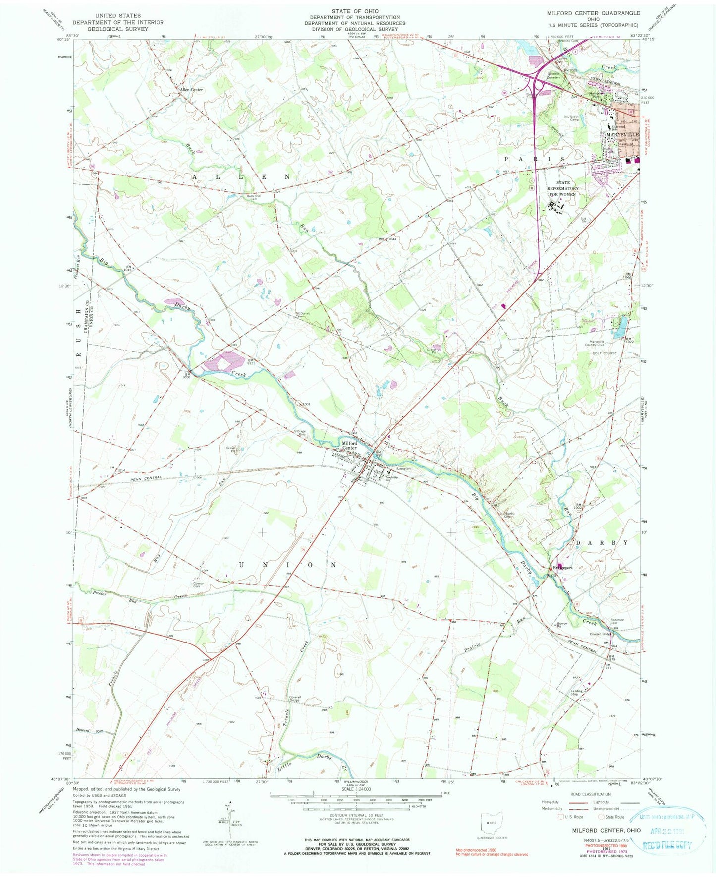
Classic USGS Milford Center Ohio 7.5'x7.5' Topo Map
Couldn't load pickup availability
Historical USGS topographic quad map of Milford Center in the state of Ohio. Map scale may vary for some years, but is generally around 1:24,000. Print size is approximately 24" x 27"
This quadrangle is in the following counties: Champaign, Union.
The map contains contour lines, roads, rivers, towns, and lakes. Printed on high-quality waterproof paper with UV fade-resistant inks, and shipped rolled.
Contains the following named places: Allen Center, Allen Centre Post Office, Allen Township Fire and Rescue Department, Allen Township Hall, Barr Haven Park, Bridgeport, Buck Run, Buck Run Cemetery, Church of Christ, Connor Cemetery, Crane Swamp, Darby Airport, Edgewood Elementary School, Fairbanks High School, Flagstone Golf Course, Green Pastures, Hay Run, Heart of Ohio Fish and Game Association Reservoir, Hickory Run, Howard Run, Hunters Run, Marysville Country Club, Marysville Plaza Shopping Center, Marysville Police Department, McDonald Cemetery, Memorial Park, Milford Center, Milford Center Cemetery, Milford Center Post Office, Milford Center Prairie State Nature Preserve, Milford Center Village Hall, Milford Estates, Oakdale Cemetery, Ohio Reformatory for Women, Ohio Reformatory For Women Correctional Facility, Our Lady of Lourdes Catholic Church, Pleasant Run, Prairie Run, Proctor Run, Ray Lewis Park, Reed Bridge, Robinson Cemetery, Saint Johns Cemetery, Scott Circle Park, Timberview Golf Club, Township of Allen, Township of Union, Treacle Creek, Treacle Creek Bridge, Union Township Fire and Emergency Medical Services Department, Union Township Hall, Village of Milford Center, Wolf School, Woods Cemetery, ZIP Code: 43045