MyTopo
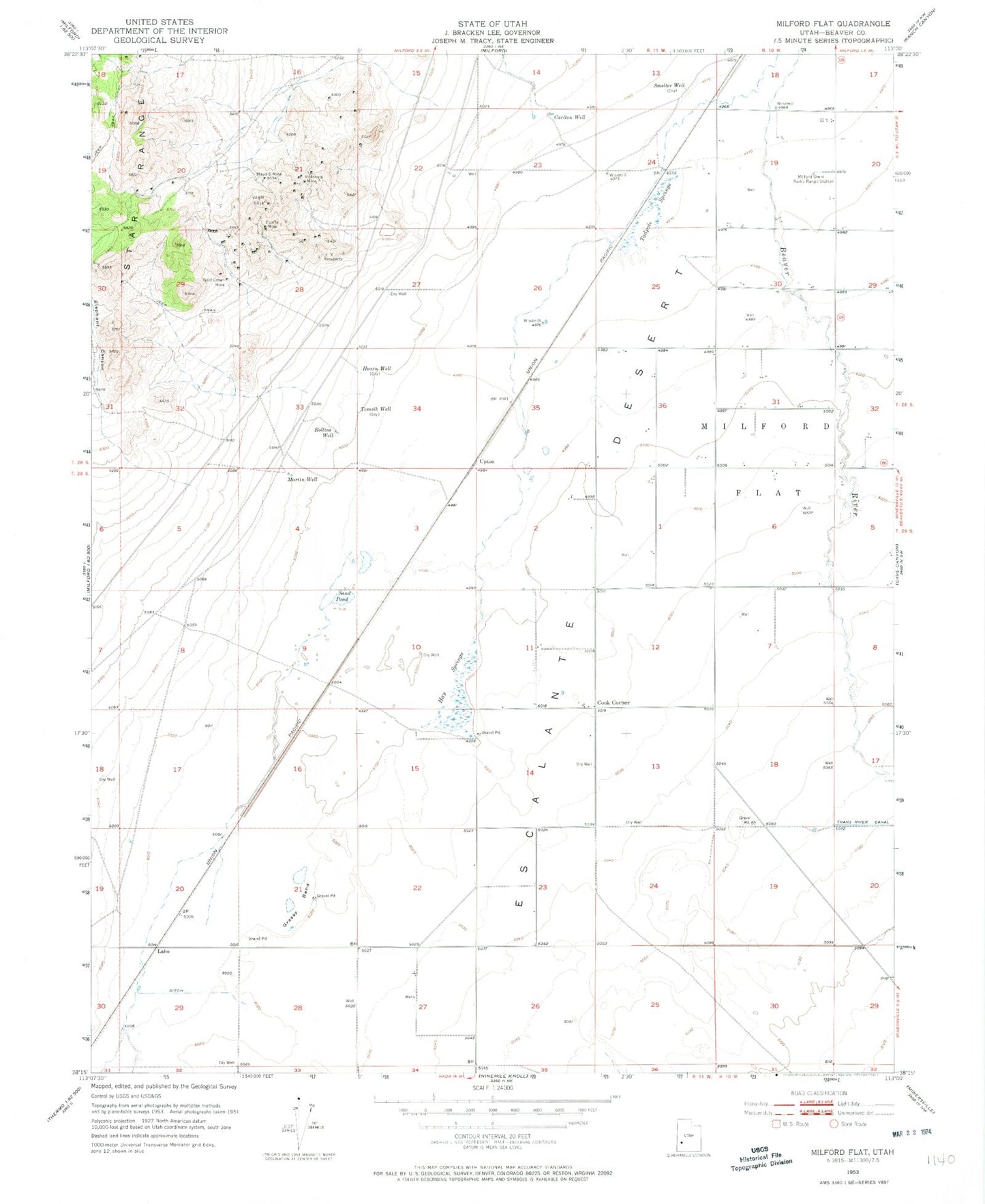
Classic USGS Milford Flat Utah 7.5'x7.5' Topo Map
Couldn't load pickup availability
Historical USGS topographic quad map of Milford Flat in the state of Utah. Map scale may vary for some years, but is generally around 1:24,000. Print size is approximately 24" x 27"
This quadrangle is in the following counties: Beaver.
The map contains contour lines, roads, rivers, towns, and lakes. Printed on high-quality waterproof paper with UV fade-resistant inks, and shipped rolled.
Contains the following named places: Carlton Well, Cook Corner, Elephant Canyon, Estelle Mine, Flying M Ranch Airport, Gold Crown Mine, Grassy Bend, Hay Springs, Hearn Well, Laho, Martin Well, Maud-S Mine, Milford Flat, Mollies Nipple, Rollins Well, Sand Pond, Smelter Well, Tadpole Springs, Tomsik Well, Upton, Vicksburg Mine