MyTopo
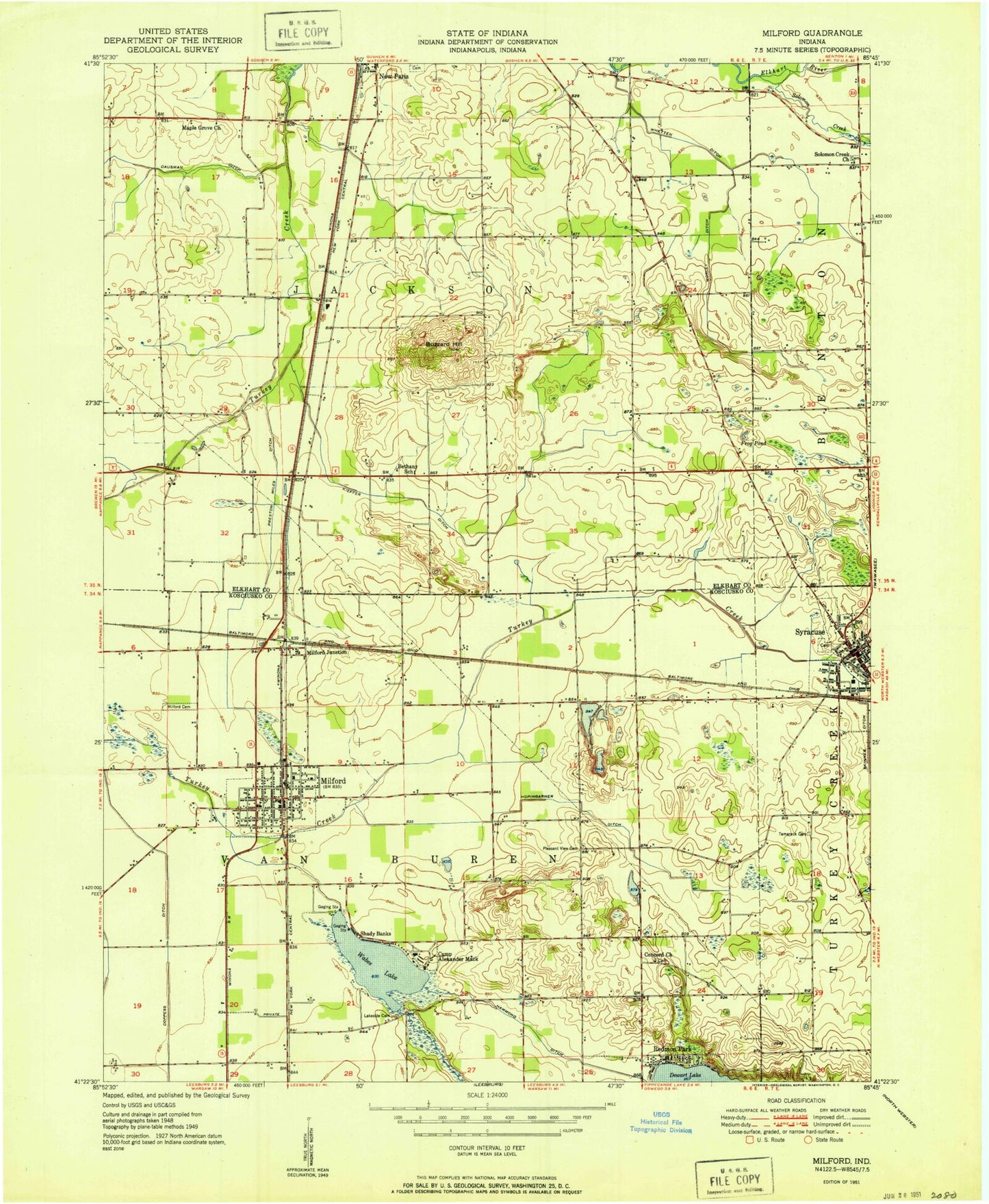
Classic USGS Milford Indiana 7.5'x7.5' Topo Map
Couldn't load pickup availability
Historical USGS topographic quad map of Milford in the state of Indiana. Map scale may vary for some years, but is generally around 1:24,000. Print size is approximately 24" x 27"
This quadrangle is in the following counties: Elkhart, Kosciusko.
The map contains contour lines, roads, rivers, towns, and lakes. Printed on high-quality waterproof paper with UV fade-resistant inks, and shipped rolled.
Contains the following named places: Bethany School, Buzzard Hill, Camp Alexander Mack, Concord Church, Coppes Ditch, Dry Run, Frog Pond, H R Weisser Airport, Hammond Ditch, Hoopingarner Ditch, Jackson Township Emergency Ambulance Service, Kieffer Ditch, Lakeside Cemetery, Maple Grove Church, Matthews Farms, Milford, Milford Cemetery, Milford Elementary School, Milford Junction, Milford Junior High School, Milford Police Department, Milford Post Office, Milford Volunteer Fire Department, Multiple Township Emergency Medical Services - Milford, New Paris Fire Department, New Paris Post Office, Pleasant View Cemetery, Preston Miles Ditch, Redmon Park, Shady Banks, Skinner Ditch, Snider Farms, Solomon Creek Church, Syracuse, Syracuse Elementary School, Syracuse Junior High School, Syracuse Post Office, Tamarack Cemetery, Town of Milford, Township of Jackson, Township of Van Buren, Turkey Creek Fire Territory Station 1, WAKE-AM (Valparaiso), Waubee Lake, Wawasee High School, Whetten Ditch, Worley Ditch, Zimmerman Gravel Pit, ZIP Codes: 46542, 46553