
MyTopo
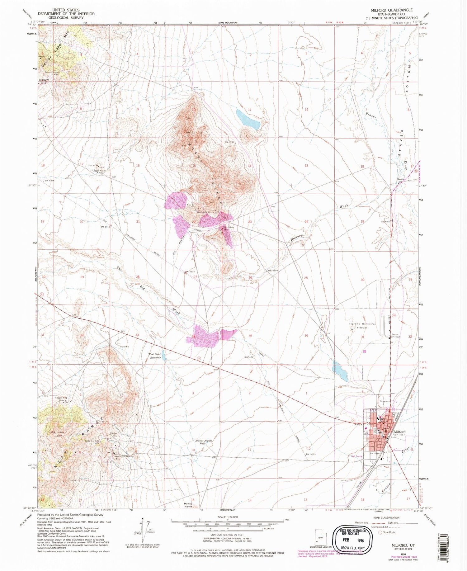
Classic USGS Milford Utah 7.5'x7.5' Topo Map
Couldn't load pickup availability
Historical USGS topographic quad map of Milford in the state of Utah. Map scale may vary for some years, but is generally around 1:24,000. Print size is approximately 24" x 27"
This quadrangle is in the following counties: Beaver.
The map contains contour lines, roads, rivers, towns, and lakes. Printed on high-quality waterproof paper with UV fade-resistant inks, and shipped rolled.
Contains the following named places: Beaver County Fire District - Milford, Beaver County Sheriff's Office Milford, Beaver-Harrison Mine, Big Wash Dam, Big Wash Reservoir, City of Milford, Copper King Mine, Copper Ranch Mine, First Baptist Church, Harrington-Hickory Mine, Hickory Wash, Little May Lilly Mine, Lower Big Wash Dam, Lower Big Wash Reservoir, Milford, Milford Catholic Church, Milford City Cemetery, Milford Community Methodist Church, Milford Elementary School, Milford High School, Milford Municipal Airport/Ben and Judy Briscoe Field, Milford Post Office, Milford Valley Memorial Hospital, Mollies Nipple Well, Montreal Mine, Old Hickory Mine, Rebel Mine, Rocky Range, The Big Wash, The Church of Jesus Christ of Latter Day Saints, West Point Reservoir


