MyTopo
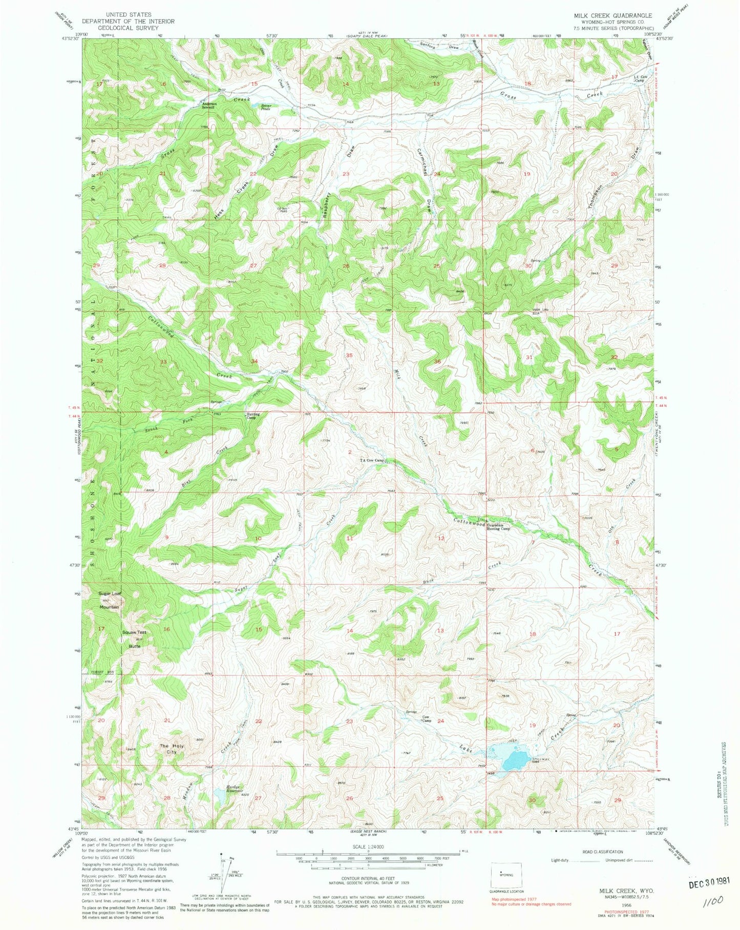
Classic USGS Milk Creek Wyoming 7.5'x7.5' Topo Map
Couldn't load pickup availability
Historical USGS topographic quad map of Milk Creek in the state of Wyoming. Map scale may vary for some years, but is generally around 1:24,000. Print size is approximately 24" x 27"
This quadrangle is in the following counties: Hot Springs.
The map contains contour lines, roads, rivers, towns, and lakes. Printed on high-quality waterproof paper with UV fade-resistant inks, and shipped rolled.
Contains the following named places: Anderson Sawmill, Blue Creek, Buck Creek, Carmichael Draw, Dvarishkis Hunting Camp, Egbert Draw, Hardys Reservoir, Hess Creek Draw, L U Cow Camp, Lake Creek Dam, Lake Creek Reservoir, Milk Creek, Ota Creek, Otto Creek, Raspberry Draw, Roach Creek, Sanford Draw, South Fork Cottonwood Creek, Squaw Teat Butte, Sugar Loaf Creek, Sugar Loaf Mountain, T A Cow Camp, The Holy City, Thompson Draw