MyTopo
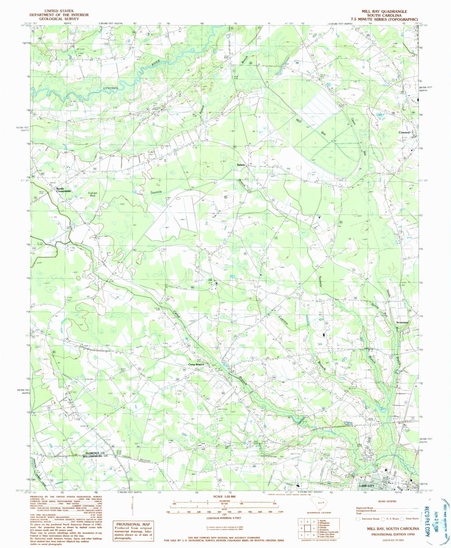
Classic USGS Mill Bay South Carolina 7.5'x7.5' Topo Map
Couldn't load pickup availability
Historical USGS topographic quad map of Mill Bay in the state of South Carolina. Map scale may vary for some years, but is generally around 1:24,000. Print size is approximately 24" x 27"
This quadrangle is in the following counties: Florence, Williamsburg.
The map contains contour lines, roads, rivers, towns, and lakes. Printed on high-quality waterproof paper with UV fade-resistant inks, and shipped rolled.
Contains the following named places: Beulah Church, Byrds Crossroads, Calvary Baptist Church, Camp Branch, Camp Branch Cemetery, Camp Branch Church of God of Prophecy, Camp Branch Oris Free Will Baptist Church, Camp Branch Pentecostal Holiness Church, Carolina Academy, Community Church, Coward Church of God, Cypress Branch, Cypress Grove School, Freewill Holiness Church, Glendale School, Godley Morris Business Center, Grace Free Will Baptist Church, Hickson Grove School, Indigo Bay, J C Lynch Elementary School, J Paul Trulock Elementary School, Kelley Corners, Lake City Community Hospital, Lake City Elementary School, Lake City Fire Department, Lake City High School, Lake City Municipal Complex, Lake City Police Department, Lake City Post Office, Lake City Shopping Center, Lake City Vocational Center, Lee Tabernacle, Lifeline Regional Ambulance, Lower Florence County Hospital, Matthews Tabernacle, McClam School, Mill Bay, Mount Seal Church, New Zion Church, Olanta Lookout Tower, Open Bay, Pleasant Grove Church, Saint John Holiness Church, Saint John School, Saint Paul Church, Saint Peter Church, Salem, Salem Church, Salem School, Sandy Run, South Lynches Fire Department Station 3, Spring Run Branch, Trifalia School, Twomile Branch, West Church, WWFN-FM (Lake City), ZIP Code: 29591