MyTopo
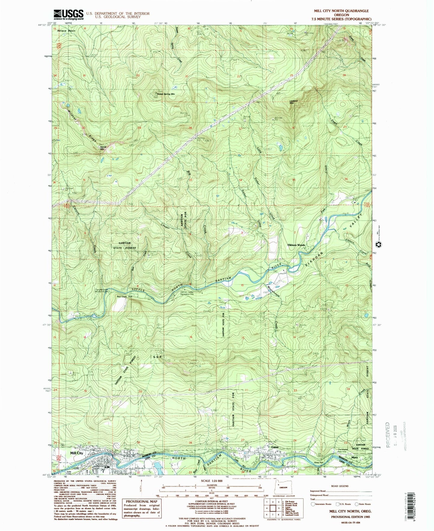
Classic USGS Mill City North Oregon 7.5'x7.5' Topo Map
Couldn't load pickup availability
Historical USGS topographic quad map of Mill City North in the state of Oregon. Typical map scale is 1:24,000, but may vary for certain years, if available. Print size: 24" x 27"
This quadrangle is in the following counties: Linn, Marion.
The map contains contour lines, roads, rivers, towns, and lakes. Printed on high-quality waterproof paper with UV fade-resistant inks, and shipped rolled.
Contains the following named places: Big Creek, Canyon Creek, Cougar Creek, Gates, Little Sinker Creek, Lookout Mountain, Mill City, Moorehouse Creek, Sweet Spring Mountain, Wildcat Ridge, Minto Creek, Anderson Creek, Chamberlain Creek, Bear Creek, Homestead Creek, Turnidge Creek, House Mountain, The Maples Safety Rest Area, Buck Creek, Elkhorn Creek, Elkhorn Valley, Mad Creek, Rock Creek, Doodle Creek, Kimmel Park, Minto County Park, Elkhorn Woods Park, Camp Cascade, Burbank Creek, Elkhorn Woods, Fish Creek, Minto (historical), Sinker Creek, Pierce Creek, Wonder Creek, Packsaddle Creek, Rock Creek Post Office (historical), Gates Post Office, Cascade Operating Company (historical), Homer (historical), Livesay (historical), Schroeder (historical), Bear Creek County Park, City of Gates, City of Mill City, Mill City Elementary School, Sanitam Junior - Senior High School, Gates Rural Fire Protection District, Mill City Fire Department, Stayton Rural Fire Protection District Elkhorn Station, Mill City Sewage System, Gates Park and Ride, Gates City Hall, Gates Public Works Department Office, Mill City Town Hall, Mill City Library, Mill City Municipal Court, Mill City Public Works Department Office, 7th Street City Boat Launch, Kimmel City Park Boat Ramp, Linn County Sheriff's Office Mill City Substation


