MyTopo
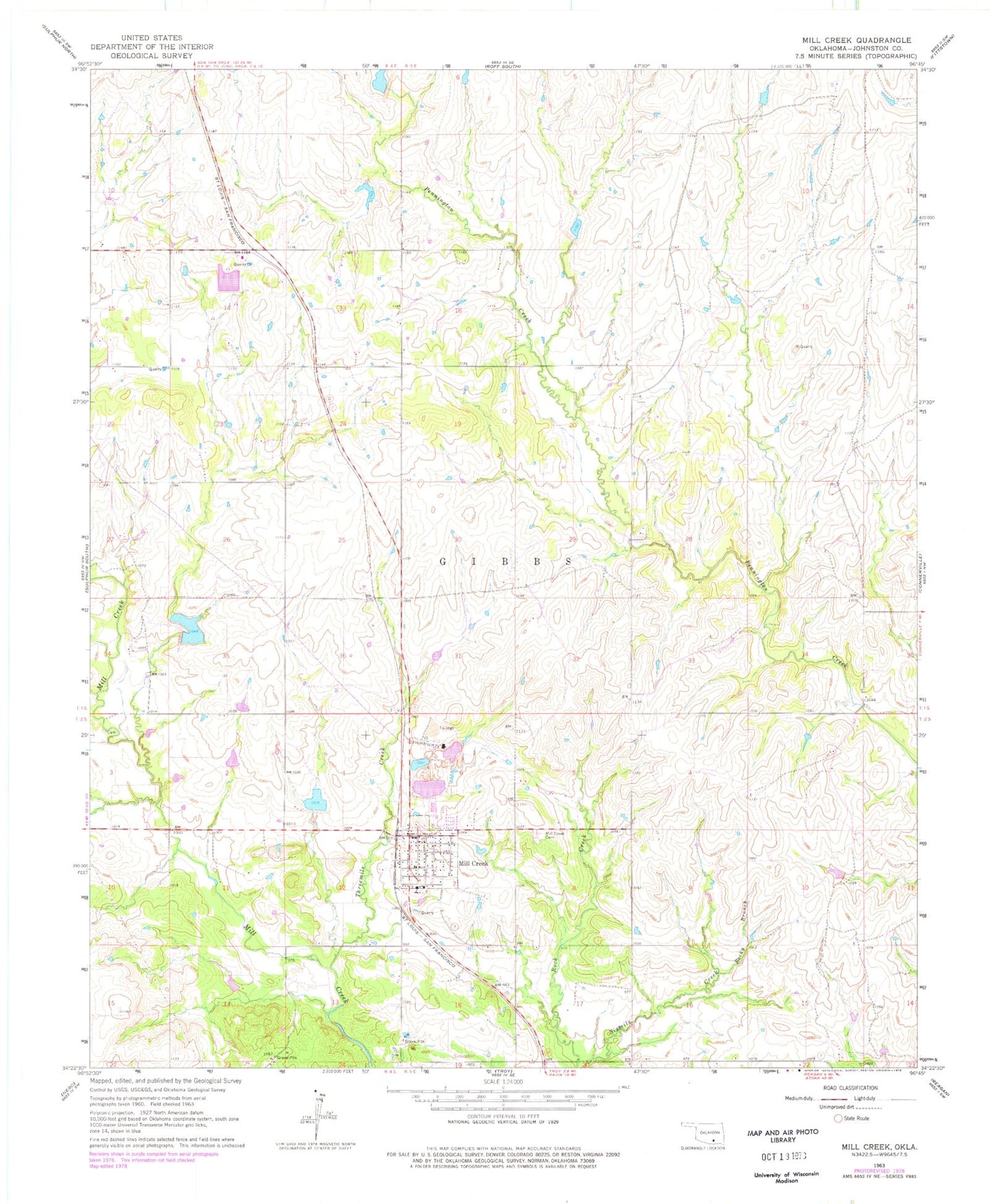
Classic USGS Mill Creek Oklahoma 7.5'x7.5' Topo Map
Couldn't load pickup availability
Historical USGS topographic quad map of Mill Creek in the state of Oklahoma. Map scale may vary for some years, but is generally around 1:24,000. Print size is approximately 24" x 27"
This quadrangle is in the following counties: Johnston.
The map contains contour lines, roads, rivers, towns, and lakes. Printed on high-quality waterproof paper with UV fade-resistant inks, and shipped rolled.
Contains the following named places: Alberson and Lewis Cemetery, Mill Creek, Mill Creek Cemetery, Mill Creek Elementary School, Mill Creek Fire Department, Mill Creek High School, Mill Creek Post Office, Mill Creek Watershed Site 11 Dam, Mill Creek Watershed Site 11 Reservoir, Mill Creek Watershed Site 12 Dam, Mill Creek Watershed Site 12 Reservoir, Mill Creek Watershed Site 15 Dam, Mill Creek Watershed Site 15 Reservoir, Mill Creek Watershed Site 17 Dam, Mill Creek Watershed Site 17 Reservoir, Mill Creek Watershed Site 18 Dam, Mill Creek Watershed Site 18 Reservoir, Pennington Creek Site 1 Dam, Pennington Creek Site 1 Reservoir, Pennington Creek Site 2 Dam, Pennington Creek Site 2 Reservoir, Pennington Creek Site 3 Dam, Rocky Branch, Threemile Creek, Town of Mill Creek, Township of Gibbs, ZIP Code: 74856