MyTopo
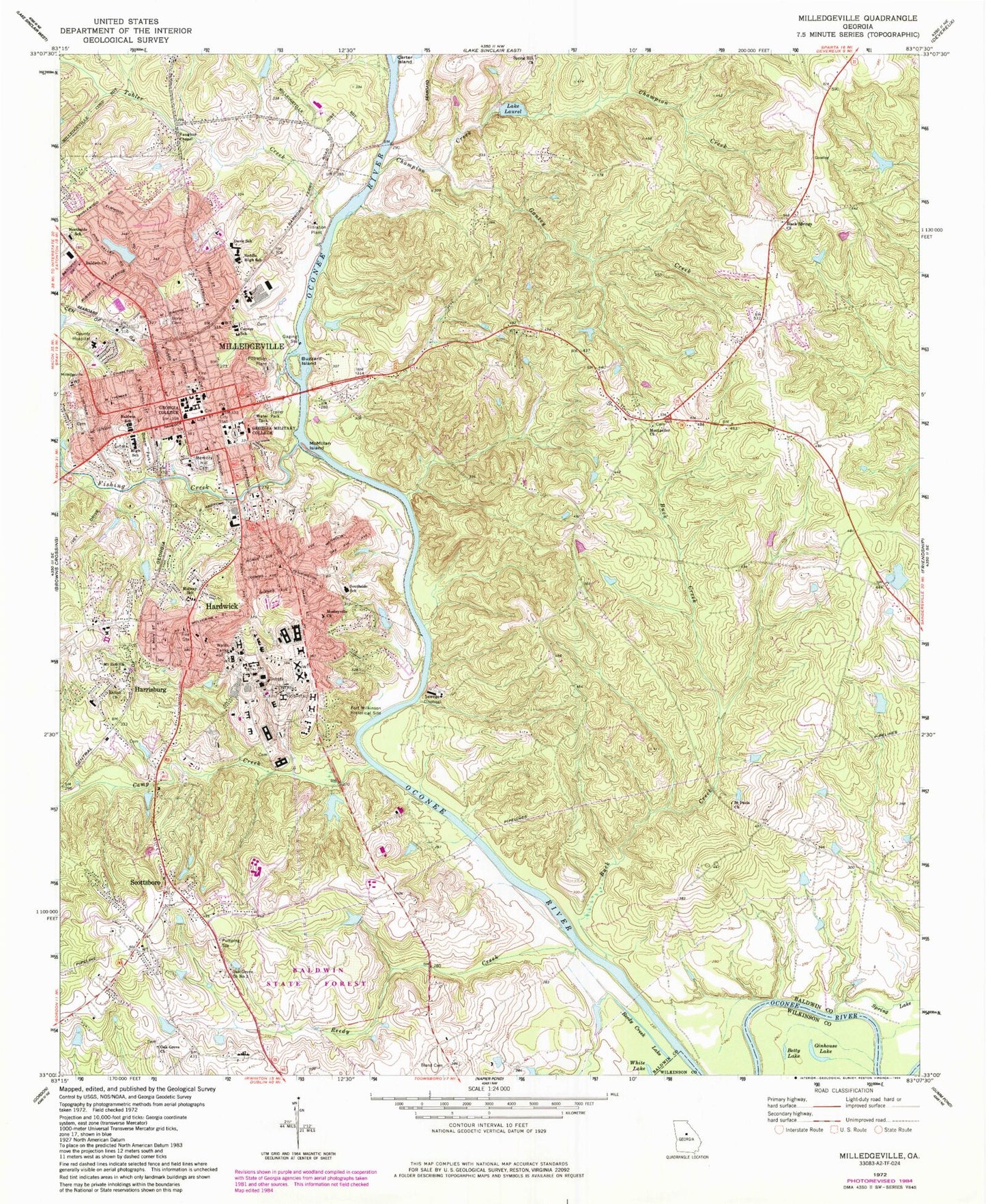
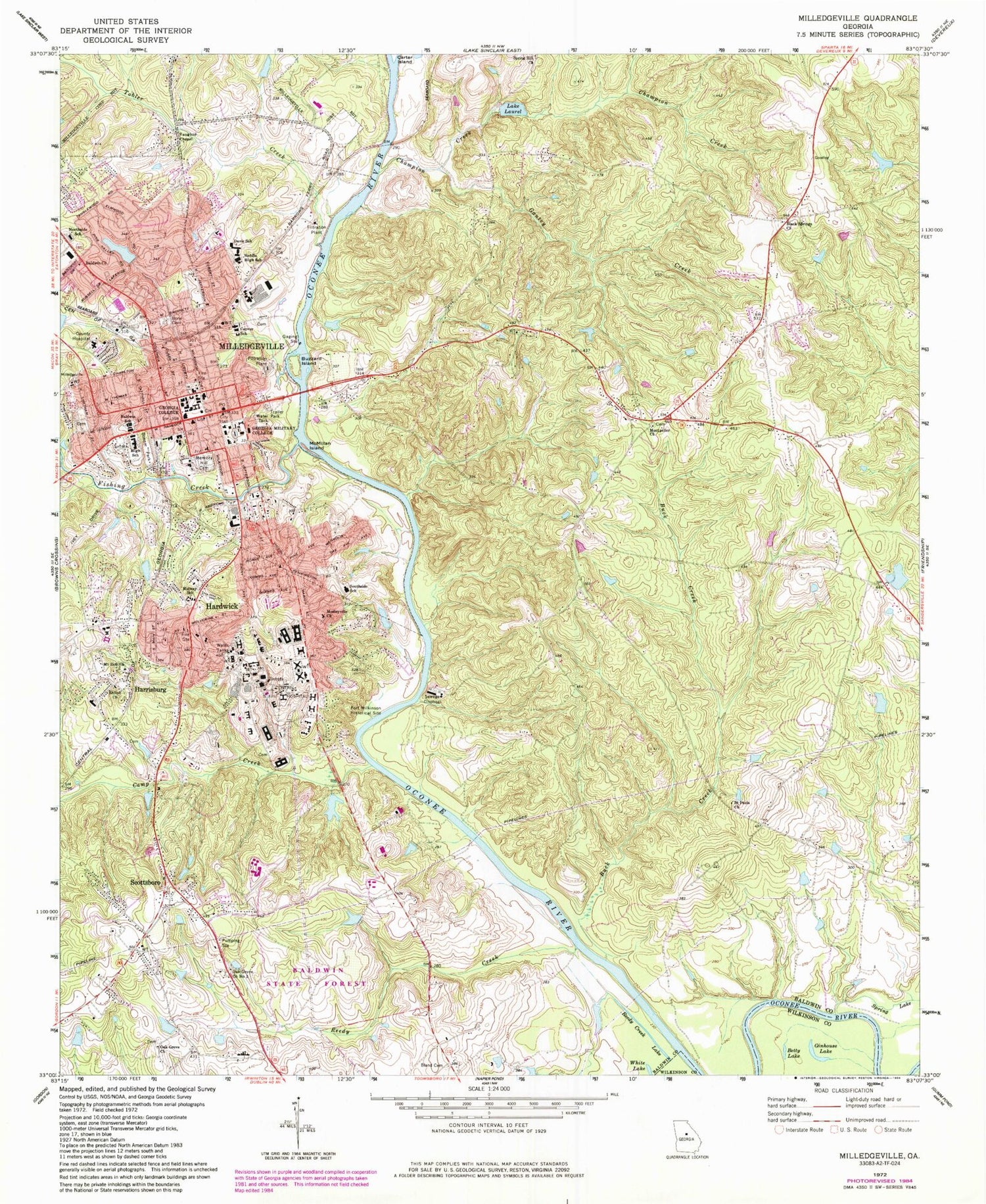
Classic USGS Milledgeville Georgia 7.5'x7.5' Topo Map
Couldn't load pickup availability
Historical USGS topographic quad map of Milledgeville in the state of Georgia. Typical map scale is 1:24,000, but may vary for certain years, if available. Print size: 24" x 27"
This quadrangle is in the following counties: Baldwin, Wilkinson.
The map contains contour lines, roads, rivers, towns, and lakes. Printed on high-quality waterproof paper with UV fade-resistant inks, and shipped rolled.
Contains the following named places: Baldwin Church, Betty Lake, Bland Cemetery, Bone Cemetery, Buck Creek, Buzzard Island, McMillan Island, Gantry Creek, Ginhouse Lake, Lake Laurel, Memory Hill Cemetery, Midway Elementary School, Montpelier Church, Mosleyville Church, Mount Zion Church, Northside School, Oak Grove Methodist Cemetery, Reedy Creek, Reedy Creek Lake, Saint Pauls Church, Shiloh Church, Southside School, Spring Hill Church, Vaughns Church, Hardwick, Harrisburg, Milledgeville, Asylum Station (historical), Carling (historical), Clark Chapel (historical), Oak Grove Methodist Church, Oconee Siding (historical), Powell Lake (historical), The Colony, Tucker Ferry (historical), Walker Chapel (historical), Carrington Woods Lake Dam, Milledgeville City Lake, Lake Laurel Dam, Patrick Lake Dam, Patrick Lake, Hospital Lake Number Two Dam, Hospital Lake Number Two, Youth Development Center Dam, Willoughby Lake Dam, Willoughby Lake, Fountain Lake Dam, Fountain Lake, Ivey Lake Dam, Ivey Lake, McDade Lake Dam, McDade Lake, Simpsons Lake Dam, Simpsons Lake, Grimes Pond Dam, Grimes Pond, Georgia Lake Dam Number Nine, Georgia Lake Number Nine, Oak Grove Church Number 2, Allen Hospital, Baldwin County, Baldwin County Courthouse, Oconee Regional Medical Center, Baldwin County Jail, Black Spring, Bible Church, The Church of Jesus Christ of Latter Day Saints, El Bethel Baptist Church, First Baptist Church, First Methodist Church, First Presbyterian Church, Flippers Chapel African Methodist Episcopal Church, Fort Wilkinson (historical), Georgia State Penitentiary (historical), Governors Square (historical), Greenpasture Church, Hardwick Baptist Church, Hardwick Christian Church, Hardwick Methodist Church, Hardwick Progressive Primitive Baptist Church, Harrisburg School, Ina Dillard Russell Library, John Arnold Cemetery, Lees Chapel, Marion Ennis Health Center (historical), Marvin Parks Memorial Hospital, Mary Vinson Memorial Library, Milledgeville City Hall, Milledgeville Historic District, Milledgeville Post Office, Miller Gymnasium, Montpelier, Northside Baptist Church, Old Governors Mansion, Georgia Old State Capitol, Peabody Practice School, Penitentiary Square (historical), Russell Auditorium, Saint Stephens Episcopal Church, Scott Hospital (historical), State House Square, Town and Country Shopping Center, Trinity Christian Methodist Episcopal Church, Union Baptist Church, Wesley Chapel African Methodist Episcopal Church (historical), Central State Hospital Heliport, WKGQ-AM (Milledgeville), WXGC-FM (Milledgeville), WLRR-FM (Milledgeville), Baldwin School, Black Springs Baptist Church, Boddie Middle School, Camp Creek, Carver School, Central State Hospital, Champion Creek, Davis School, Fishing Creek, Georgia College and State University, Georgia Military College, Scottsboro, Tobler Creek, Averills Ferry (historical), McKinzies Ferry (historical), Oconee Old Town (historical), Rock Landing, Toms Shoals, East Baldwin Division, Black Springs Baptist Churchyard, Georgia Veterans Memorial Cemetery Milledgeville, Montpelier Methodist Churchyard, Mount Olive Churchyard, West View Cemetery, Hardwick Census Designated Place, City of Milledgeville, Faith Christian Academy, Milledgeville Fire Department Station 1, Milledgeville Fire Department Station 2, Baldwin County Fire and Rescue Department Station 1 Headquarters, Baldwin County Fire and Rescue Department Station 5, Baldwin County Fire and Rescue Department Station 2, Milledgeville Police Department, Georgia College and State University Police, Baldwin State Prison, Hardwick Post Office


