MyTopo
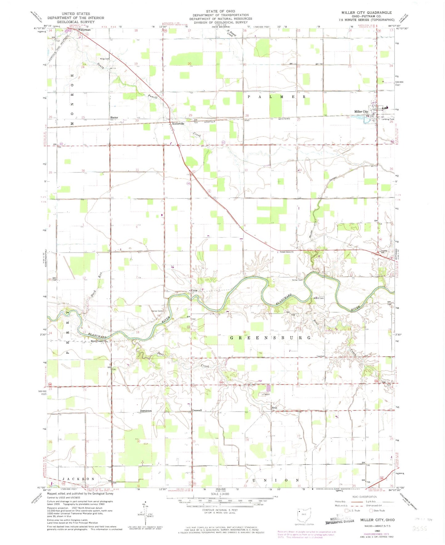
Classic USGS Miller City Ohio 7.5'x7.5' Topo Map
Couldn't load pickup availability
Historical USGS topographic quad map of Miller City in the state of Ohio. Map scale may vary for some years, but is generally around 1:24,000. Print size is approximately 24" x 27"
This quadrangle is in the following counties: Putnam.
The map contains contour lines, roads, rivers, towns, and lakes. Printed on high-quality waterproof paper with UV fade-resistant inks, and shipped rolled.
Contains the following named places: Avis, Bear Creek, Center School, Country Acres Golf Course, Croswell, Cuba, Deer Creek, Dornington Post Office, Dorninton, Duck Run, Forest Grove Church, Hector, Hector Post Office, Kieferville, Kieferville Cemetery, Kieferville Post Office, Miller City, Miller City Cutoff, Miller City Post Office, Miller City Volunteer Fire Department, Miller Elementary School, Miller High School, Mount Pleasant Church, Myers Cemetery, Myers Corners, Putnam County, Saint Isadores Catholic Church, Saint Isadores Cemetery, Saint Nicholas Catholic Church, Saint Nicholas Cemetery, Township of Greensburg, Township of Palmer, Varner Cemetery, Verhoff Airport, Village of Miller City, Wing Cemetery, Wisterman, Wisterman Post Office, ZIP Code: 45864