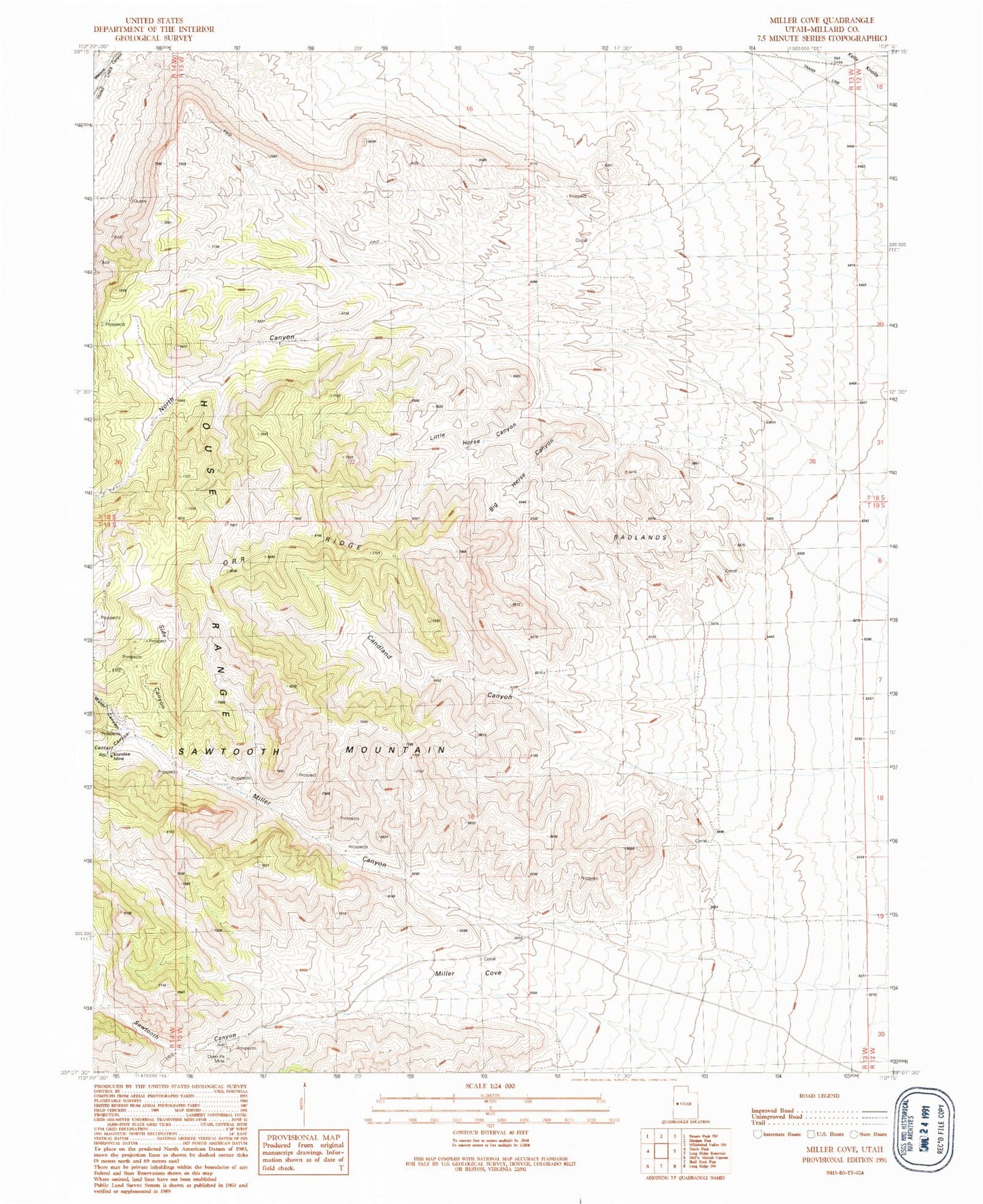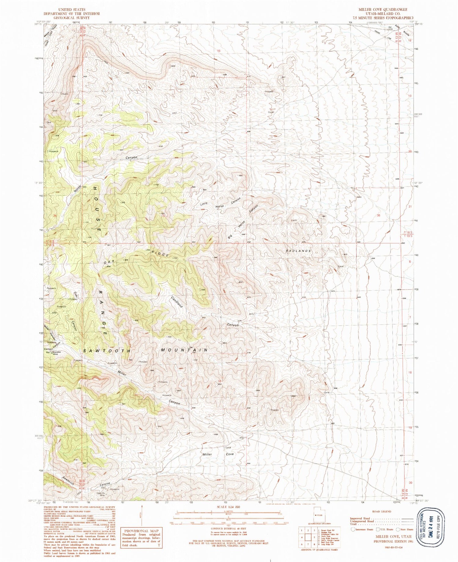
MyTopo
Classic USGS Miller Cove Utah 7.5'x7.5' Topo Map
Regular price
$16.95
Regular price
Sale price
$16.95
Unit price
per
Couldn't load pickup availability
Historical USGS topographic quad map of Miller Cove in the state of Utah. Map scale may vary for some years, but is generally around 1:24,000. Print size is approximately 24" x 27"
This quadrangle is in the following counties: Millard.
The map contains contour lines, roads, rivers, towns, and lakes. Printed on high-quality waterproof paper with UV fade-resistant inks, and shipped rolled.
Contains the following named places: Amasa Valley, Badlands, Big Horse Canyon, Candland Canyon, Contact Canyon, Klondike Mine, Little Horse Canyon, Miller Canyon, Miller Cove, North Canyon, Orr Ridge, Sawtooth Canyon, Side Canyon, Water Canyon