MyTopo
Classic USGS Miller Creek SW Montana 7.5'x7.5' Topo Map
Regular price
$16.95
Regular price
Sale price
$16.95
Unit price
per
Couldn't load pickup availability
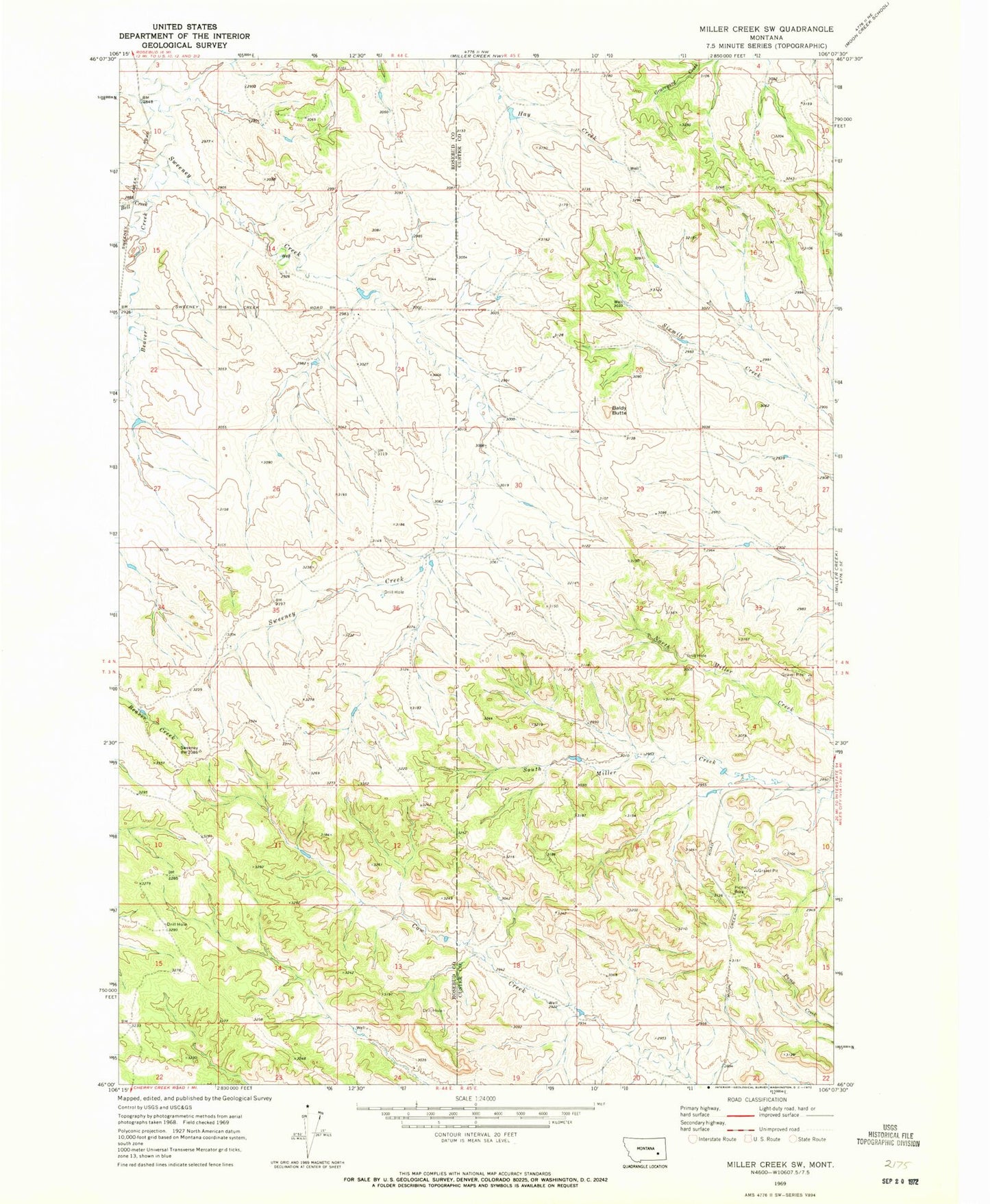
Historical USGS topographic quad map of Miller Creek SW in the state of Montana. Map scale may vary for some years, but is generally around 1:24,000. Print size is approximately 24" x 27"
This quadrangle is in the following counties: Custer, Rosebud.
The map contains contour lines, roads, rivers, towns, and lakes. Printed on high-quality waterproof paper with UV fade-resistant inks, and shipped rolled.
Contains the following named places: 03N44E01CACA01 Well, 03N44E02DBAA01 Well, 03N44E24ACAC01 Well, 03N44E24ACAC02 Well, 03N44E24ACAC03 Well, 03N44E24BBAA01 Well, 04N44E23ADCC01 Well, 04N44E24BADA01 Well, 04N44E24BBAB01 Well, 04N44E36AABA01 Well, Baldy Butte, Bell Creek, Douglas School