MyTopo
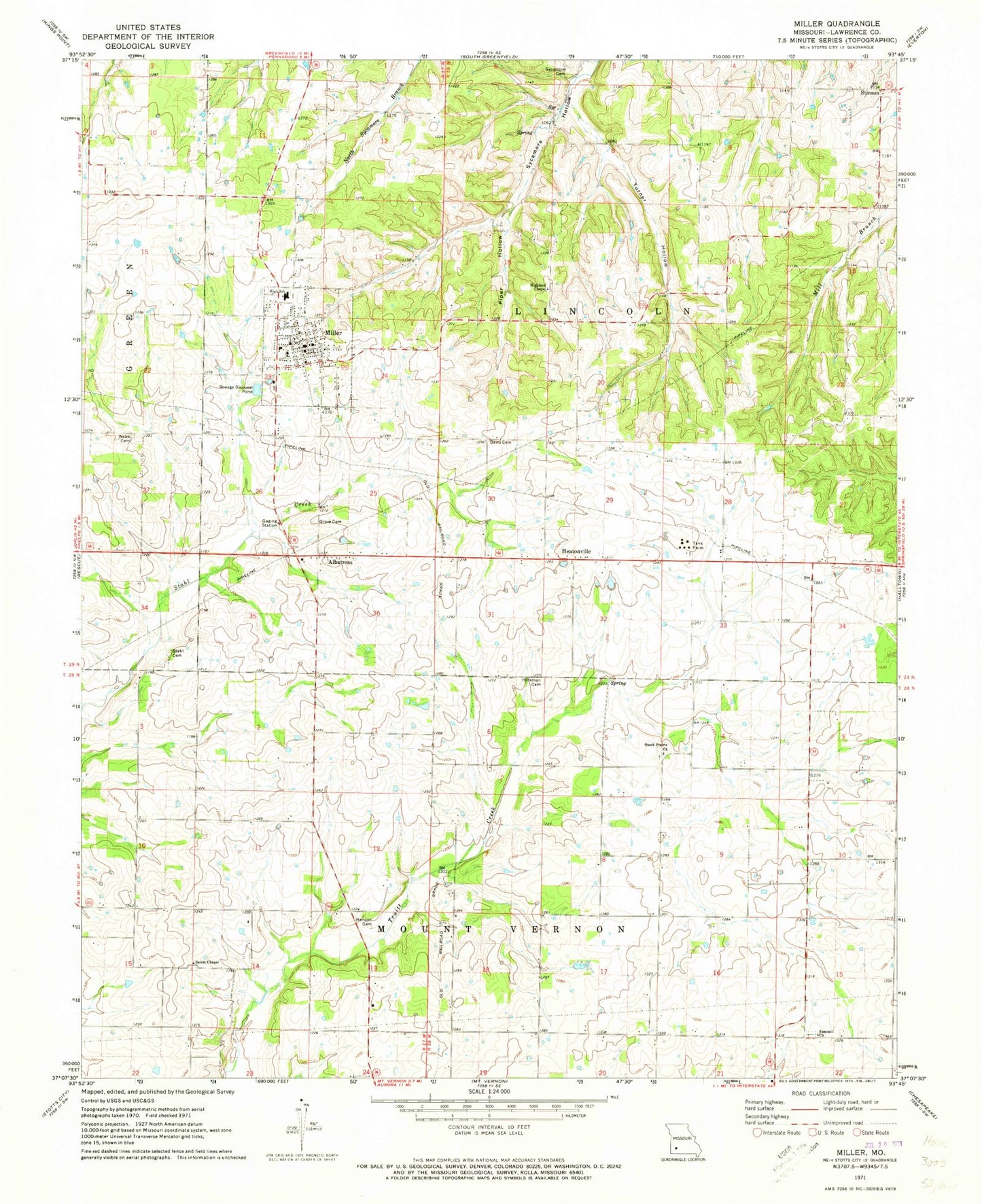
Classic USGS Miller Missouri 7.5'x7.5' Topo Map
Couldn't load pickup availability
Historical USGS topographic quad map of Miller in the state of Missouri. Map scale may vary for some years, but is generally around 1:24,000. Print size is approximately 24" x 27"
This quadrangle is in the following counties: Lawrence.
The map contains contour lines, roads, rivers, towns, and lakes. Printed on high-quality waterproof paper with UV fade-resistant inks, and shipped rolled.
Contains the following named places: Albatross, Call, Center School, Central Elementary School, City of Miller, Davis Cemetery, Fairplay School, Grove Cemetery, Heatonville, Heatonville School, Henson Cemetery, Hickman Cemetery, Highland Chapel, Liberty School, Miller, Miller Fire and Rescue, Miller High School, Miller Post Office, Miller Rural Fire Department, Ozark Prairie Cemetery, Ozark Prairie Church, Piper Hollow, Pleasant View School, Salem Cemetery, Salem Chapel, Shiloh School, South Sycamore School, Stahl Cemetery, Stinson, Stinson School, Summit Church, Sycamore Cemetery, Township of Lincoln, Turner Hollow, Webb Cemetery, ZIP Code: 65707