MyTopo
Classic USGS Millersburg SW Missouri 7.5'x7.5' Topo Map
Couldn't load pickup availability
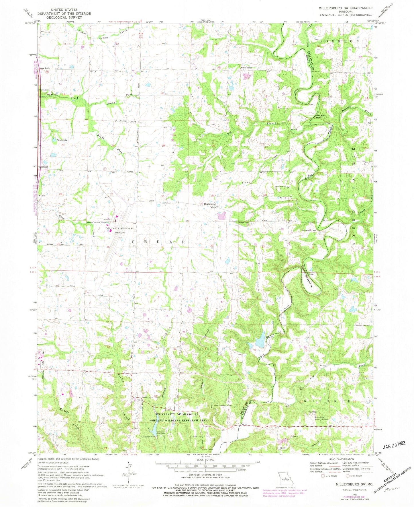
Historical USGS topographic quad map of Millersburg SW in the state of Missouri. Typical map scale is 1:24,000, but may vary for certain years, if available. Print size: 24" x 27"
This quadrangle is in the following counties: Boone, Callaway.
The map contains contour lines, roads, rivers, towns, and lakes. Printed on high-quality waterproof paper with UV fade-resistant inks, and shipped rolled.
Contains the following named places: Barger Cemetery, Barnes Chapel, Bass Lake, Big Branch, Devils Backbone, Dry Fork, Englewood, Johnson Cemetery, Mill Site Bluff, Millers Creek, North Fork Turkey Creek, Oak Chapel, Owl Creek, Smith Creek, South Fork Turkey Creek, Stump Creek, University of Missouri Ashland Wildlife Research Area, Duncan School (historical), Duley Mill Bridge, Cedar Creek Hiking Trail, Millers, Pine Ridge Picnic Grounds, Laboratory Dam, Curry Lake, Columbia Regional Airport, Barnes School (historical), Ellis School (historical), Englewood School (historical), Ginlet, Summerville (historical), Windmiller Dam Number 1, Eugene Windmiller Lake, Ashland Lake, Ginn Lake Dam, Ginn Lake, Peterson Lake Dam, Peterson Lake, Windmiller Dam Number 2, Doctor Windmiller Dam, Doctor Windmiller Reservoir, City of Ashland, Southern Boone County Fire Protection District Station 19, Mid Missouri P and DF Post Office