MyTopo
Classic USGS Millersburg Indiana 7.5'x7.5' Topo Map
Couldn't load pickup availability
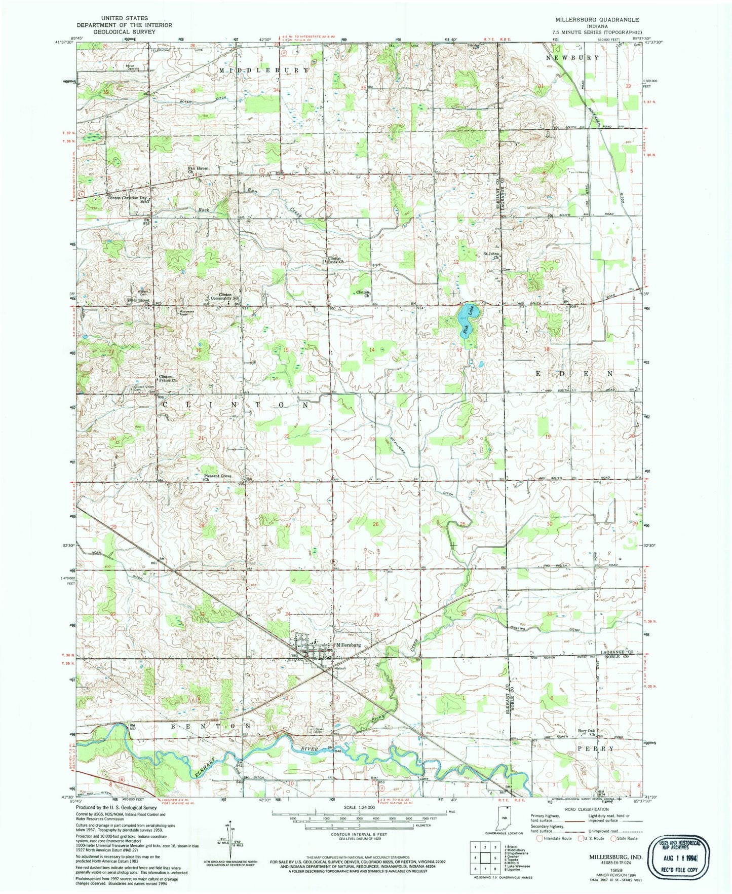
Historical USGS topographic quad map of Millersburg in the state of Indiana. Map scale may vary for some years, but is generally around 1:24,000. Print size is approximately 24" x 27"
This quadrangle is in the following counties: Elkhart, LaGrange, Noble.
The map contains contour lines, roads, rivers, towns, and lakes. Printed on high-quality waterproof paper with UV fade-resistant inks, and shipped rolled.
Contains the following named places: Brown Cemetery, Burr Oak Church, Clinton Brick Church, Clinton Christian Day School, Clinton Church, Clinton Community School, Clinton Frame Church, Clinton Township Fire Department, Clinton Union Cemetery, Dry Run Ditch, Eldridge Cemetery, Fair Haven Church, Fish Lake, Ladon Farms, Loyal Acres, Maplebranch Farm, McAllister Ditch, Miller Cemetery, Miller Farms, Millersburg, Millersburg Elementary School, Millersburg Post Office, Nisley Cemetery, Phillips Ditch, Pleasant Grove Church, Rowe-Eden Ditch, Saint Johns Church, Silver Street Church, Stony Creek, Town of Millersburg, Township of Clinton, ZIP Code: 46543