MyTopo
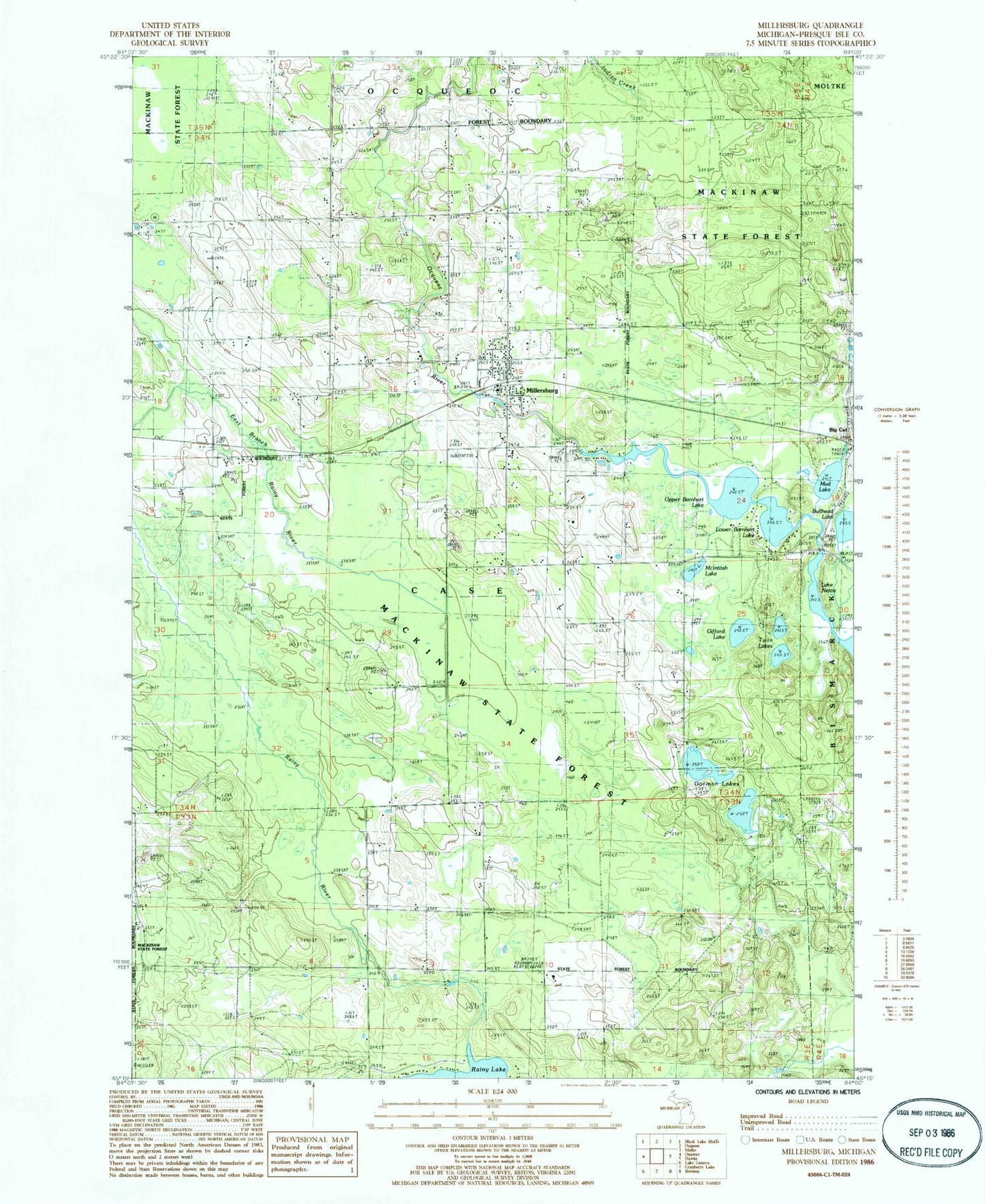
Classic USGS Millersburg Michigan 7.5'x7.5' Topo Map
Couldn't load pickup availability
Historical USGS topographic quad map of Millersburg in the state of Michigan. Map scale may vary for some years, but is generally around 1:24,000. Print size is approximately 24" x 27"
This quadrangle is in the following counties: Presque Isle.
The map contains contour lines, roads, rivers, towns, and lakes. Printed on high-quality waterproof paper with UV fade-resistant inks, and shipped rolled.
Contains the following named places: Bullhead Lake, Case Township Fire Department, Gifford Lake, Gorman Lakes, Lower Barnhart Lake, McIntosh Lake, Millersburg, Millersburg Elementary School, Millersburg Post Office, Millersburg Station, Millersburg United Methodist Church, Mud Lake, Ocqueoc Baptist Church, Presque Isle County Fairgrounds, Providence Post Office, Riverside Cemetery, Township of Case, Twin Lakes, Upper Barnhart Lake, Village of Millersburg