MyTopo
Classic USGS Millersburg Missouri 7.5'x7.5' Topo Map
Couldn't load pickup availability
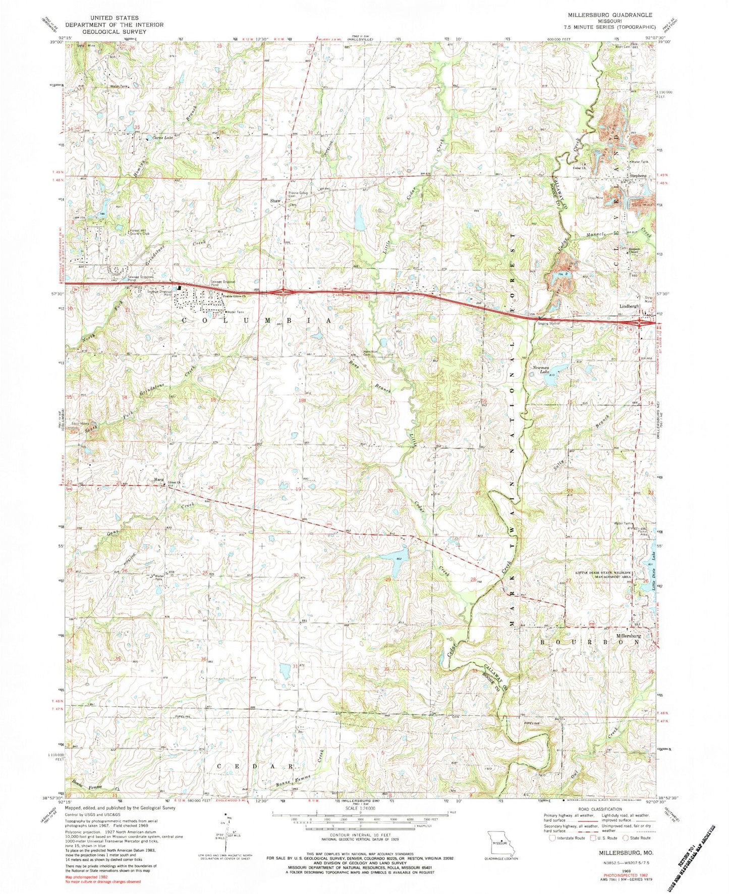
Historical USGS topographic quad map of Millersburg in the state of Missouri. Map scale may vary for some years, but is generally around 1:24,000. Print size is approximately 24" x 27"
This quadrangle is in the following counties: Boone, Callaway.
The map contains contour lines, roads, rivers, towns, and lakes. Printed on high-quality waterproof paper with UV fade-resistant inks, and shipped rolled.
Contains the following named places: Allen Cemetery, Bone Branch, Boone County Fire Protection District Station 1, Boonesborough, Carter School, Cedar Church, Cedar Creek Airport, Cheng Lake Dam, Corns Lake, Daly Dam, Gillaspy School, Hamilton Cemetery, Harg, Jacobs School, KOPN-FM (Columbia), Lake Chateau Dam, Lake Lavista, Lake Lavista Dam, Lake of the Woods Recreation Area, Landhuis Lake, Landhuis Lake Dam, Lindbergh, Little Cedar Creek, Manacle Chapel, Manacle Creek, McGuire School, Millersburg Fire Protection District, Millersburg School, Newman Lake, Newman Lake Number 2 Dam, North Callaway Fire Protection District Station 4, Number 153 Reservoir, Olivet Church, Prairie Grove Cemetery, Prairie Grove Church, Robnett School, Sally Branch, Shaw, Simpson Cemetery, Simpson Chapel, Stephens, Stephens School, Stephens Store, Township of Columbia, Troy Newman Lake 1, Truitt School, Turkey Farm Lake Dam, Turner School, Welch Lake Dam, ZIP Code: 65201