MyTopo
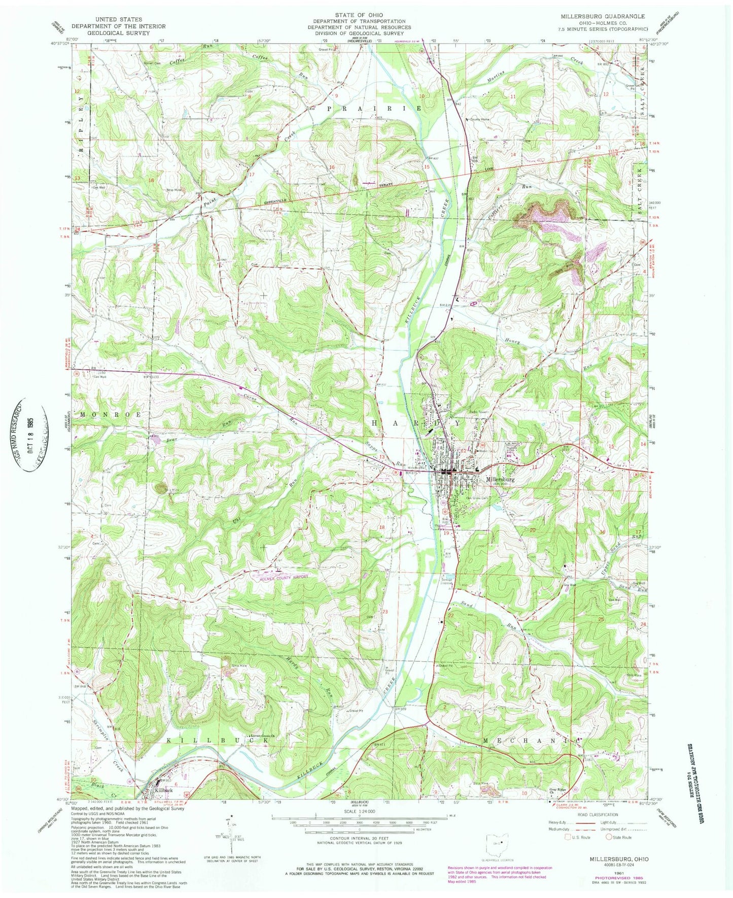
Classic USGS Millersburg Ohio 7.5'x7.5' Topo Map
Couldn't load pickup availability
Historical USGS topographic quad map of Millersburg in the state of Ohio. Map scale may vary for some years, but is generally around 1:24,000. Print size is approximately 24" x 27"
This quadrangle is in the following counties: Holmes.
The map contains contour lines, roads, rivers, towns, and lakes. Printed on high-quality waterproof paper with UV fade-resistant inks, and shipped rolled.
Contains the following named places: Bear Run, Briar Hill Airport, Briar Hill Golf Course, Christy Chapel Cemetery, Church of Christ, Clover Patch, Clover Patch Dairy, Coffee Run, Colliers Run, Corns Run, First Presbyterian Church, Gambles School, Gindlesberger Cemetery, Gorrell Cemetery, Grade, Grade Post Office, Gray Ridge Church, Gray Ridge School, Hammond School, Hardy Junction, Hardy Run, Hayes School, Holmes County, Holmes County Airport, Holmes County Courthouse, Holmes County District Public Library, Holmes County Home, Holmes County Landfill, Holmes County Law Library, Holmes County Sheriff's Office, Holmes Fire District 1, Honey Run, Honey Run School, Huston, Lauther School, Locust Grove Church, Martins Creek, Millersburg, Millersburg City Hall, Millersburg Elementary School, Millersburg High School, Millersburg Historic District, Millersburg Police Department, Millersburg Post Office, Millersburg United Methodist Church, Millersburg Waterworks, Monroe Lutheran Cemetery, Oak Grove Cemetery, Oak Ridge School, Paint Creek, Pomerene Hospital, Saint Johns Evangelical Church, Saint Peters Roman Catholic Church, Sand Run, Sand Run Hill, Sand Run School, Sapps Run, Shrimplin Cemetery, Shrimplin Creek, Township of Hardy, Trinity Lutheran Church, Uhl Cemetery, Uhl Run, Union School, Upper Honey Run School, Upper Sand Run, Village of Millersburg