MyTopo
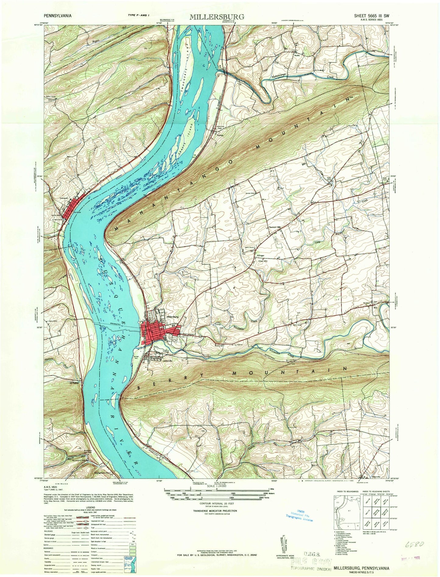
Classic USGS Millersburg Pennsylvania 7.5'x7.5' Topo Map
Couldn't load pickup availability
Historical USGS topographic quad map of Millersburg in the state of Pennsylvania. Map scale may vary for some years, but is generally around 1:24,000. Print size is approximately 24" x 27"
This quadrangle is in the following counties: Dauphin, Juniata, Northumberland, Perry.
The map contains contour lines, roads, rivers, towns, and lakes. Printed on high-quality waterproof paper with UV fade-resistant inks, and shipped rolled.
Contains the following named places: Armstrong Valley Bible Church, Bargers Run, Barners Church, Barners School, Borough of Liverpool, Borough of Millersburg, Boyers Run, Bucks Run, Bucks Valley, Cloverly Acres, Crafts Island, Ebenezer Church, Ebenezer Evangelical United Brethren Church Cemetery, Fisherville, Free Grace Brethren in Christ Church Cemetery, Free Grace Church, Grace Church, Hartmens School, Hunters Run, Hunters Valley, Jacobs Church, Kaercher Creek Dam, Killinger, Lenkerville, Lenkerville Census Designated Place, Little Wiconisco Creek, Liverpool, Liverpool Post Office, Liverpool Volunteer Fire Company Station 5, Mahantango Creek, Malta, Markunas Dam, Messiah Lutheran Cemetery, Millersburg, Millersburg Area Ambulance Station 20, Millersburg Borough Police Department, Millersburg Fire Company Station 20, Millersburg Post Office, Mount Patrick, Oak Hill Cemetery, Pa-478 Reservoir, Paxton, Pleasant Hills, Reservoir Heights, Rickard Memorial Cemetery, Riegles Church, Rife, Saint Davids Church, Saint Davids Reformed Church Cemetery, Saint Lukes Church, Salem Church, Salem Lutheran Cemetery, Shippens Run, State Game Lands Number 258, Susquehanna Water Gaps, Sweigarts Island, Township of Upper Paxton, West Lykens Valley Cemetery, Wiconisco Creek, Zion Church, Zion Lutheran Church Cemetery, ZIP Code: 17061


